
July 30, 2023
Back to the Owens Valley
My quest to hike all 50 US state high points involves making a lot of excuses. Basically, you need an excuse to visit odd corners of all 50 states. And perhaps the best attitude to facilitate these excuses are truisms like “there’s no time like the present” and, even simpler, “why not?”
For the Silver State, it turns out, I had a pretty great excuse. Something called an ‘atmospheric river’ had blessed the West Coast with biblical levels of snowfall this past winter. As a result, Mammoth Ski Area would pull off a rare August close date. I had never been skiing in August. Or July for that matter. If I showed up at the end of July I could check off both calendar months.
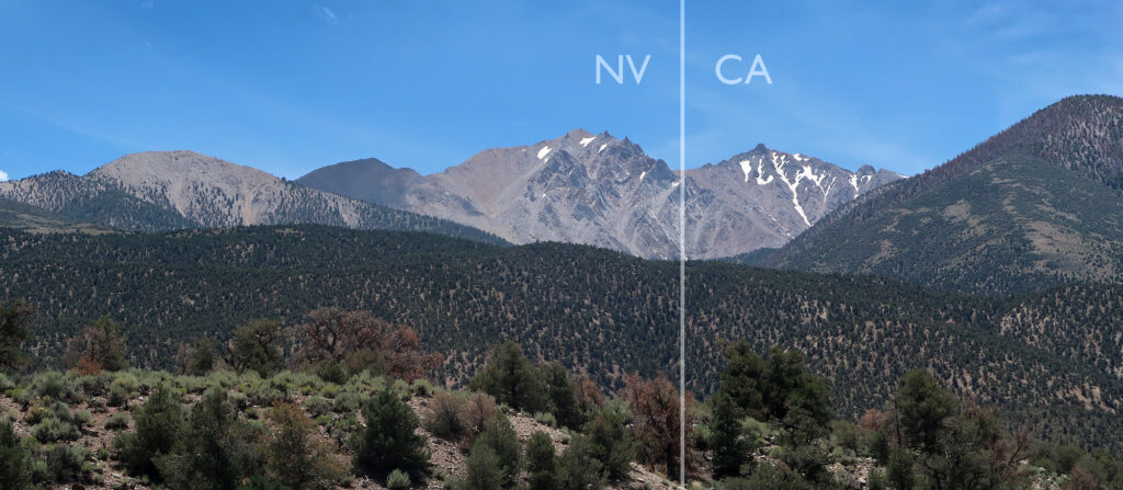
As luck would have it, Mammoth Lakes sits a mere 37 miles, as the crow flies, from Nevada’s highest point: Boundary Peak. They sit across from each other at the northern end of California’s massive and nearly deserted Owens Valley. Two birds ranges, one stone.
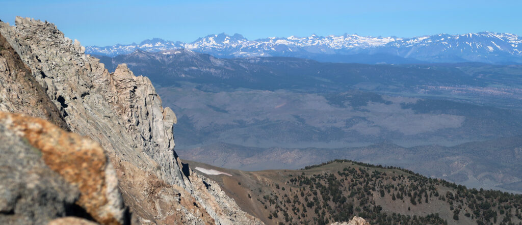
In fact, two towering state high points sit on opposite sides of the Owens Valley. To the west, and south, Mount Whitney rises amidst the jagged walls of the Eastern Sierra Nevada, above the dusty town of Lone Pine. Boundary Peak sits in the White Mountains, to the East. White Mountain Peak rises above 14,000′ but sits squarely within California. Boundary Peak, as the name implies, sits just over the state line in Nevada, the northernmost 13er in the range.
Rough roads in the middle of nowhere
And so on the last Sunday of July, I found myself leaving a comfortable, heavily discounted ski condo in Mammoth Lakes sometime before 4 a.m. I began the “Benton Crossing”, a fully deserted road across the Valley. Trundling along in a rented Jeep Wrangler, I prayed to the deer gods for safe passage.
Long after cell phone signals had disappeared, I arrived at the dirt road up to the col below Boundary Peak. This road was notorious, and for good reason. It grew worse and worse as I ascended. This was my first time in a wrangler, and I prayed it wouldn’t be too stiff a course in 4-low. Luckily I arrived at the trailhead unscathed.
I met a father-daughter duo at the trailhead. It was the man’s 70th birthday. They had rented a fun-looking ATV to get up there. I’d run into no more than six people that day. It’s hard to convey how empty large portions of Nevada (and Eastern California) can feel.
Sunrise among the bristlecones
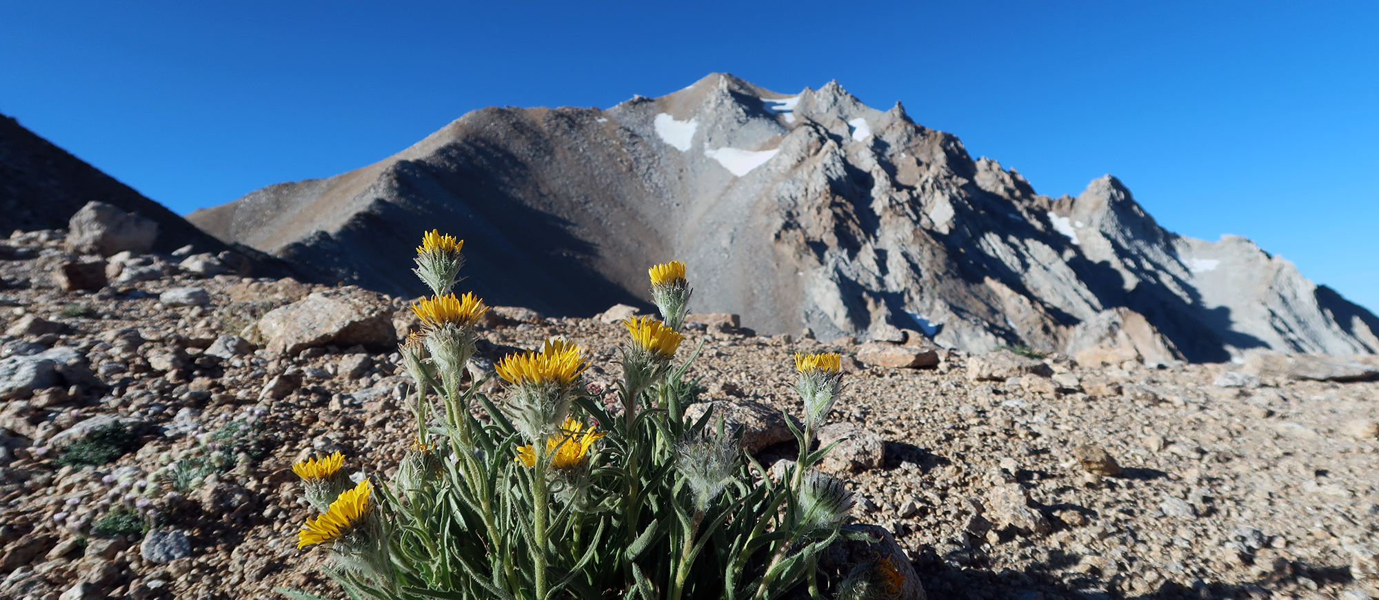
A reddish pink glow had just begun on the distant horizon as I left the col. A dusty trail made wide switchbacks up the steep lower slopes of the ridge. This hike features precisely zero shade. Around noon, you’d be lucky to wander off-trail and fine a scraggly tree thick enough to provide cover. But trees there were: the famous bristlecone pines of the White Mountains.
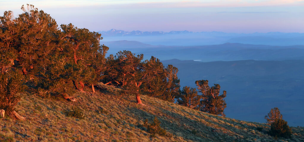
Bristlecone pines of varying species thrive at high altitudes in small patches of habitat throughout the West. The Great Basin bristlecones boast being among the oldest living organisms on the planet. Further south in the White Mountains, near White Mountain Peak, sits the Methusla Grove. An undisclosed tree therein ranks as the world’s oldest “non-clonal” tree of verified age—nearly 5,000 years young.
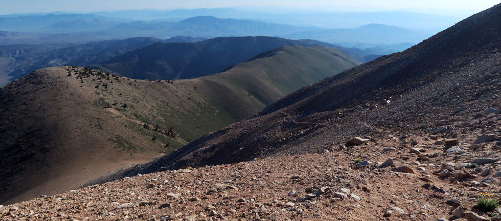
The trail began around 9,800′. Over the first mile, it rises roughly 1000 feet via moderately steep switchbacks. Then you reach a broad, flat ridgeline with gentle hiking for the next 1.5 miles. It’s here that the summit of Boundary Peak rises above the scrubby grasslands. And from such a distance, it looks intimidatingly steep.
Wild, wild horses
You never know what you may find when you trudge off into the wilds in search of a state high point. In this case, it was sweeping views, endless wildflowers, and a band of wild horses.
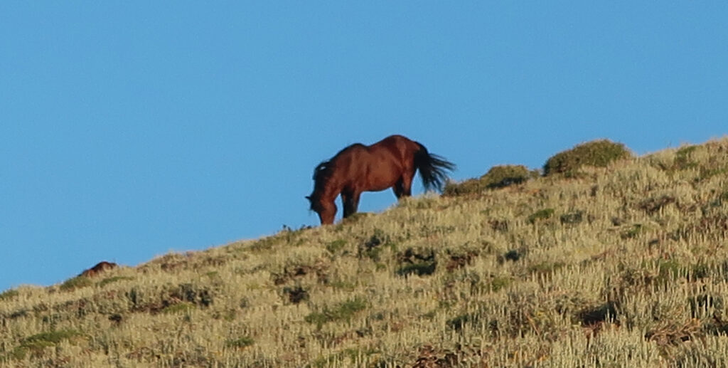
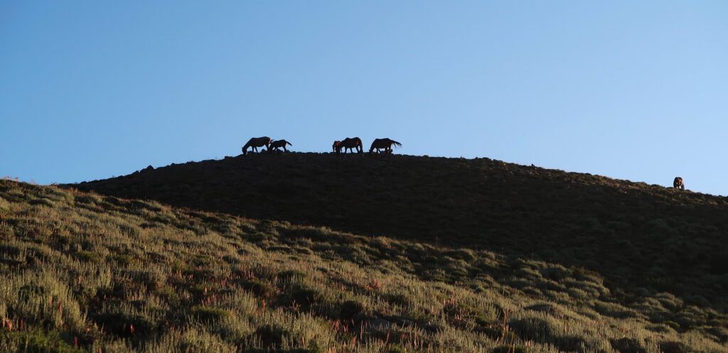
I know nothing about wild horses. But horses are huge, scare easily, and can easily take me down if they have the mind to. I decided to keep a wide distance. Luckily, on the way out, they were decently far from the trail. I don’t have any impressive, detailed photos sadly. Your options for that kind of shot involve hauling around a giant zoom lens or getting dangerously close to wildlife.
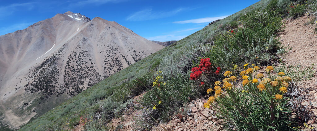
The trail meandered on, drawing closer and closer to the steep, dusty pitches of the summit. But for now, I enjoyed an incredibly green “spring” landscape. The White Mountains had way less snow than the Sierra Nevada. But clearly, the wildflowers and sagebrush were doing just fine for now.
Up to Boundary Peak
I reached the very distinct transition to steep hiking. The trail to Boundary Peak is “Class II”, meaning you never need to employ hands or scrambling. But it can still get uncomfortably steep at times. Boundary Peak featured my least favorite kind of terrain: loose, steep dirt. Luckily after the weekend prior, I was a bit of an expert on the subject.
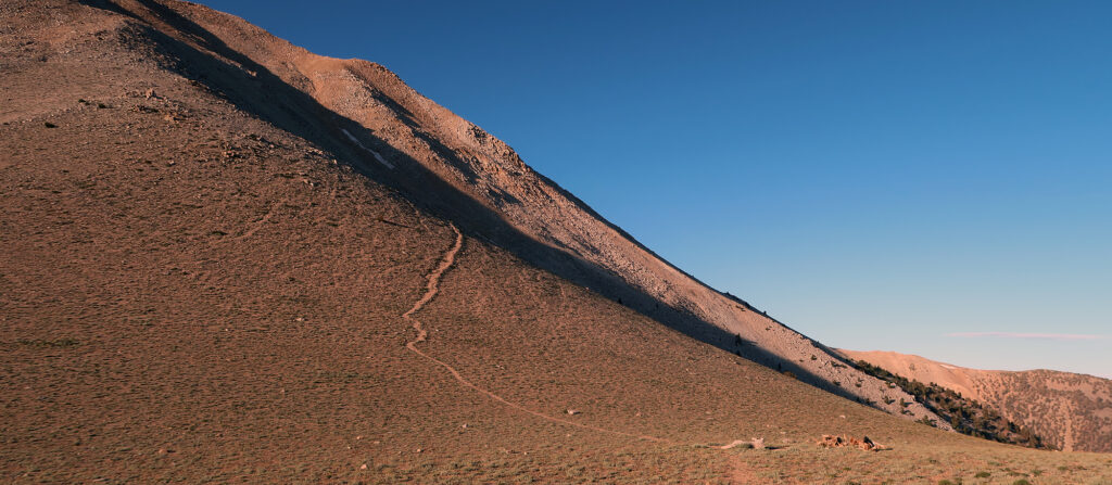
Over the next 1.5 miles, I’d gain over 2000 vertical feet in fits and starts. The trail never got uncomfortably steep. But it traversed across some nerve-wracking slopes. If you haven’t done a class II alpine hike in the west, this mountain could be a rude awakening.
Highest Point vs Highest Peak
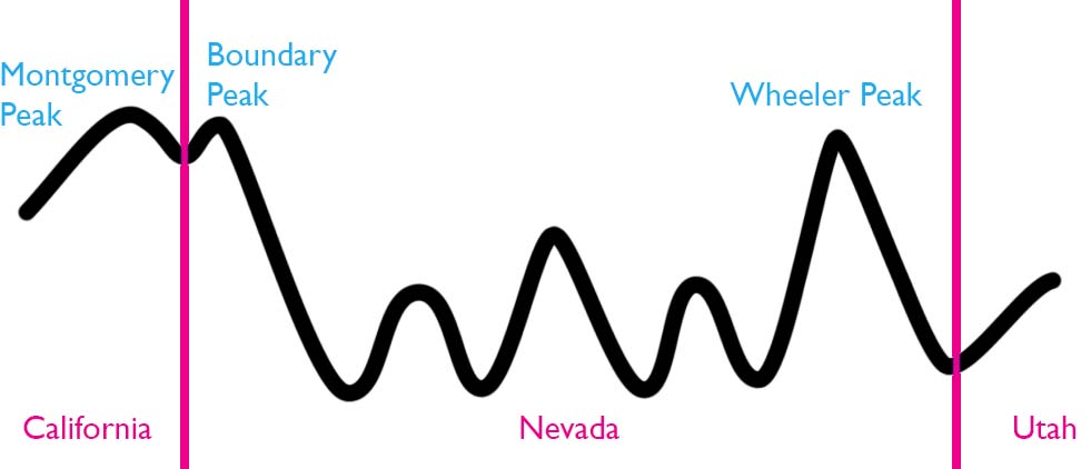
According to some geography snobs, Boundary Peak is not Nevada’s highest summit. There’s a different 13er in the Silver State, home to its own grove of Bristlecone pines, that takes that distinction. Clear across the state, near the Utah Border, Wheeler Peak rises proudly at the center of Great Basin National Park. And that, according to some, is Nevada’s highest peak.
So why was I hiking 232 miles west of Wheeler Peak, risking death by hoof impalement? Well, Boundary Peak is the indisputable highest point in Nevada. It rises about 80 feet higher than Wheeler Peak. But it also happens to sit just below the summit of nearby Montgomery Peak, just half a mile away, over the California border.

The disqualification from “highest mountain” comes from its prominence. Boundary Peak rises just 250 feet above the col between itself and Montgomery Peak. This is less than the 300-foot prominence many use to qualify a mountain as a true, separate peak.
Interestingly, Boundary Peak is a slightly more complicated example of what’s going on with Connecticut’s high point. Connecticut’s highest point sits exactly on the border of Massachusetts, on the side of a taller mountain in the latter state. Some other lower peak in Connecticut counts as the highest mountain. Numerous state high points sit exceptionally close to the border with other states. And numerous state high points are not mountains (e.g. Kansas, Rhode Island, Ohio).
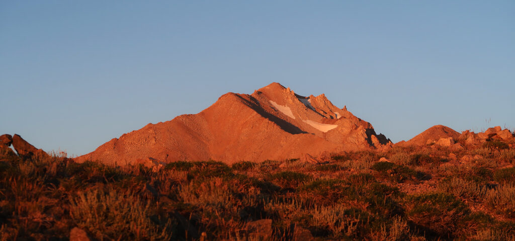
Boundary Peak
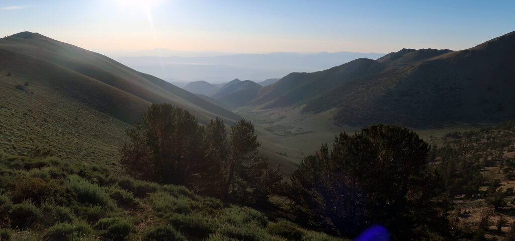
Geography arcana notwithstanding, I slowly ascended towards the definitely-highest point in Nevada. And the views were predictably spectacular. Mountains and valleys sprawled in all directions. Nothing articulates the vastness of the mountain west quite like standing atop a peak in middle-of-nowhere Nevada.
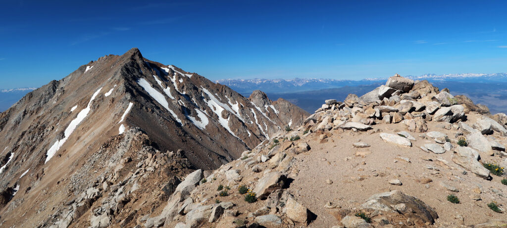
A metal box held a summit registry, which I signed. These are hit-or-miss on state high points. I ran into a pair of local hikers atop the summit. My second encounter of the day. After some chatting and some snacks, I began the descent.
Back down to Earth
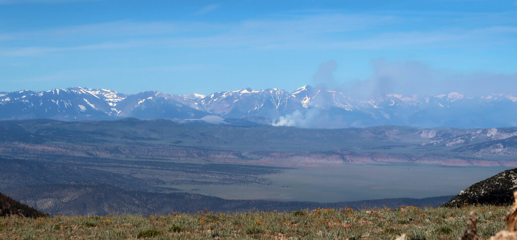
The steep descent to the ridge remained uneventful. Far in the distance, I could see small wildfires near Mono Lake. I reached the col and began walking along the fla green ridge.
The wild horses had drifted onto the trail. I decided to drop about 200-300 feet below the trail and bushwack through the sagebrush. This was easy going, since the vegetation was low and sparse.
Soon enough I was back at the jeep, ready to trundle down the rough and dusty road. Then it was a long deserted drive back across the Valley to the bustling town of Mammoth. Nevada’s high point was in the books.