
July 17, 2023
The Approach
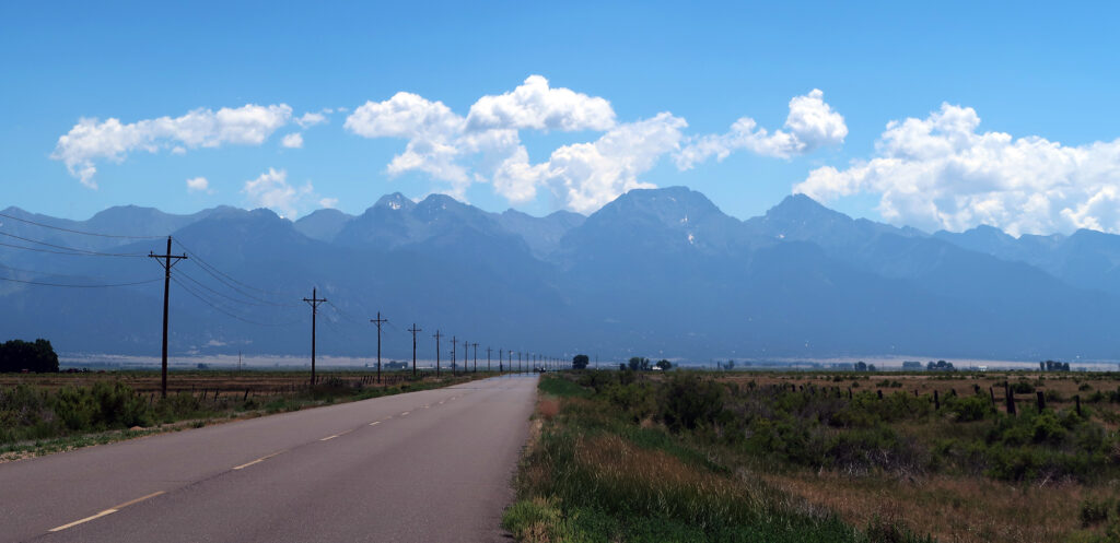
I sped through the hot and dusty high desert of the San Luis Valley. Ahead of me, hot air off the pavement warped the jagged, hazy peaks of the Sangre de Cristo mountains. Summer had come out in full force in the Colorado Rockies.
I drove through the tiny, … quirky … town of Crestone, and up the dusty hillside towards the trailhead. My tires skidded and spun as they negotiated the sandy dirt road. The trailhead sat just a few miles away from Great Sand Dunes National Park, and you could definitely tell from the soil.
Finally, I arrived at the trailhead. I doused myself in bug spray even before leaving the car. Then I hopped out and made quick work of gearing up and getting going. Recent hiker status updates had told of intense mosquito activity. And sure enough, I saw and heard them buzzing about as I got ready.
The Approach to Willow Lake
Fourteeners in the stunning Sangre de Cristo mountain range do not come cheap. The trailheads sit low, and the approach routes climb high and deep into the narrow valleys amongst the peaks. From the trailhead below 9,000′ to the summit, Kit Carson requires a round trip distance of 15 miles and over 6000 vertical feet. Most folks, myself included, opt to turn this into an overnight.
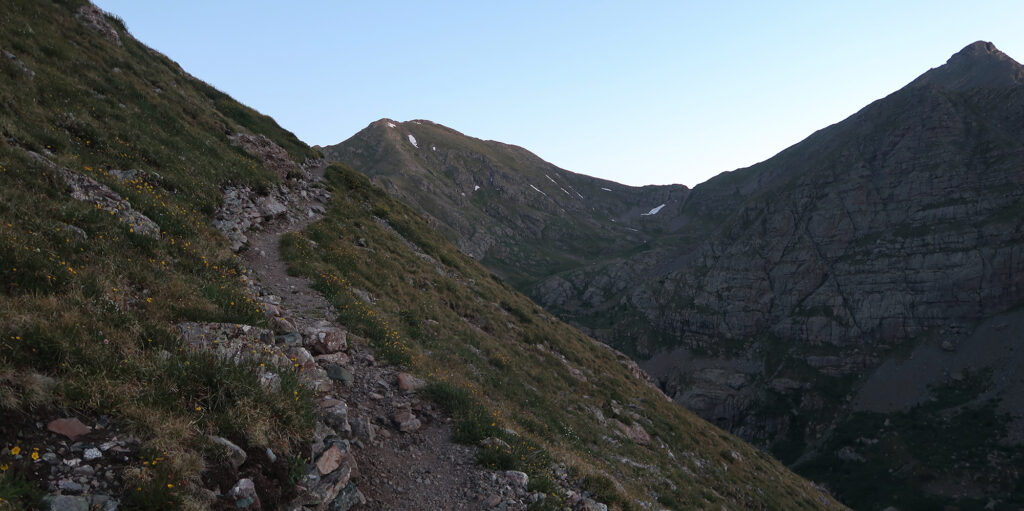
And so I set off with a 35-pound pack, carrying all the necessary gear to camp out at Willow Lake, nearly 5 miles into the wilderness, and 3000 vertical feet above the trailhead. I trudged slowly up the steep switchbacks, with increasingly expansive views of the broad and flat San Luis Valley. Just the Colorado portion of this valley is, apparently, larger than the state of Delaware. The route ascended about a third of the way along the outermost slopes of the range, before disappearing into the mountains.
Sand, sagebrush, and junipers gave way to taller evergreens. I started around 9 am, which meant the sun still sat relatively low in the sky and behind the hills. But the air had already begun to heat up in earnest.
Camp at Willow Lake
The upper half of the trail moved deeper into the Sangres. It passed a narrow, verdant valley, and then climbed steep stone steps back towards the lake.
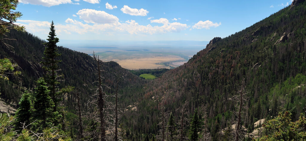
Even as the approach pushed deeper into the mountains, the San Luis Valley never disappeared. Instead, the green slopes of the range grew higher and tighter, as if a curtain was slowly being drawn on the flatlands. Related, cell phone service never disappeared.
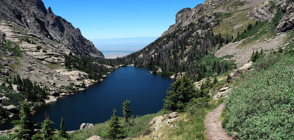
Finally, I arrived at Willow Lake, where ample campsites remained. I carefully chose a dry and well-drained area with decent shade. A heat wave had settled over the Western US, and even at 11,500′ in the Rockies, the sun felt brutal.
After applying a second, liberal coating of picaridin, I set up camp. Then I headed up to the lake itself to dry off all the sweat from the effort. A broad, flat rock provided the perfect spot for sunning and lazing about by the lake. It also provided excellent views down-valley. Best of all, an afternoon downdraft provided a steady breeze and threw the mosquitos off my scent.
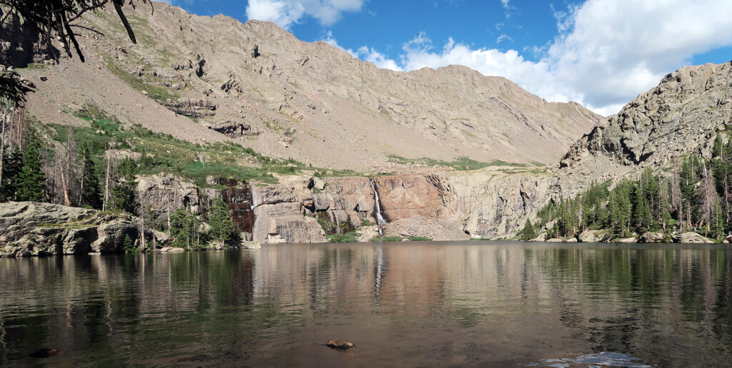
Willow Lake was stunning. Opposite my spot, a tall waterfall dropped into the alpine waters. Puffy white clouds had formed that afternoon but threatened no precipitation nor electrical shenanigans. The straight, narrow valley out to the trailhead pointed due west. And us campers enjoyed a seemingly endless sunset.
A pre-dawn start for Kit Carson Peak
Some friends I had joined up with on Snowmass would also be hiking Kit Carson this weekend. As with that summit, I planned to start well ahead of them, knowing they’d probably catch up to me on the high ridge—I hike slow.
I was among the first to start the next morning. I donned a headlamp and made my way around the lake in darkness. At some point I got off the trail, way too close to the lake shore. Then I found myself bushwacking through dense willows, scrambling up talus to regain the proper route. This left me annoyingly sweaty for such an early, cold hour. I had only brought one liter of water, and could not afford to work up such a sweat. It was a long way to Kit Carson Peak. And then a long way back.
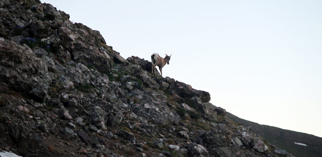
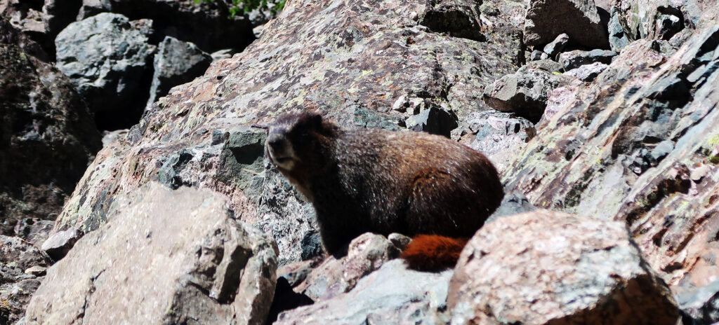
One other solo hiker passed me before we began up the steep slopes of Challenger Point. He had summited Challenger before and said he had spotted a mountain lion in this area. So I spent the dawn hours peering nervously at any rock outcropping above me. Cats are, of course, quite crepuscular. Fortunately, the only macro-fauna I spotted were some goats.
Alpenglow and lingering snow
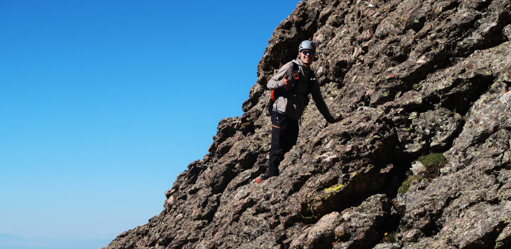
A well-built trail took me over halfway up the slopes of Challenger. And then it came to an end. I hugged a nearby rock rib and ascended a ‘fun’ melange of slippery scree, grassy ledges, and larger talus. The grassy ledges reminded me of some easier sections of Crestone Needle. They were mostly dry, and I felt comfortable despite the ever-increasing slope angle.
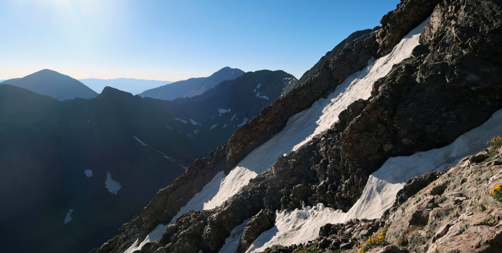
Unfortunately, the safety of the rock rib ended as deep, lingering snowpack covered the upper route. I negotiated my way to the left, and towards the “crux” of this ‘difficult class II’ ascent. By now a half dozen fellow hikers were above and below me. We improvised. None of us were really on any kind of formal route. Once or twice we had to traverse across steep snow. Luckily it was frozen and had flat footprints.
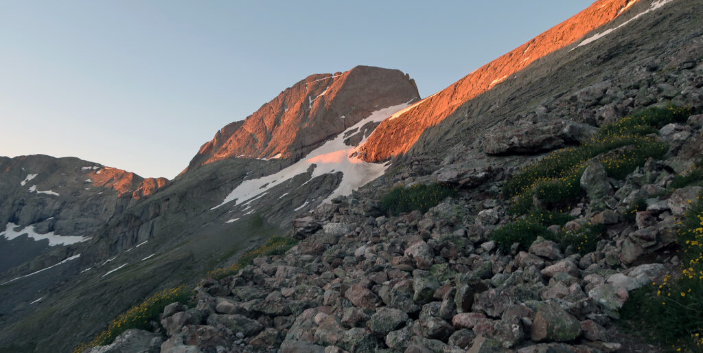
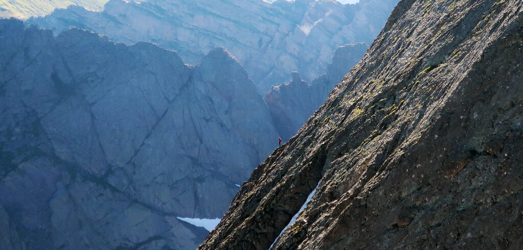
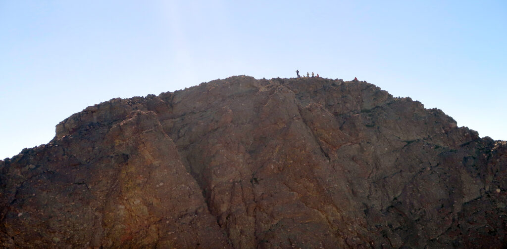
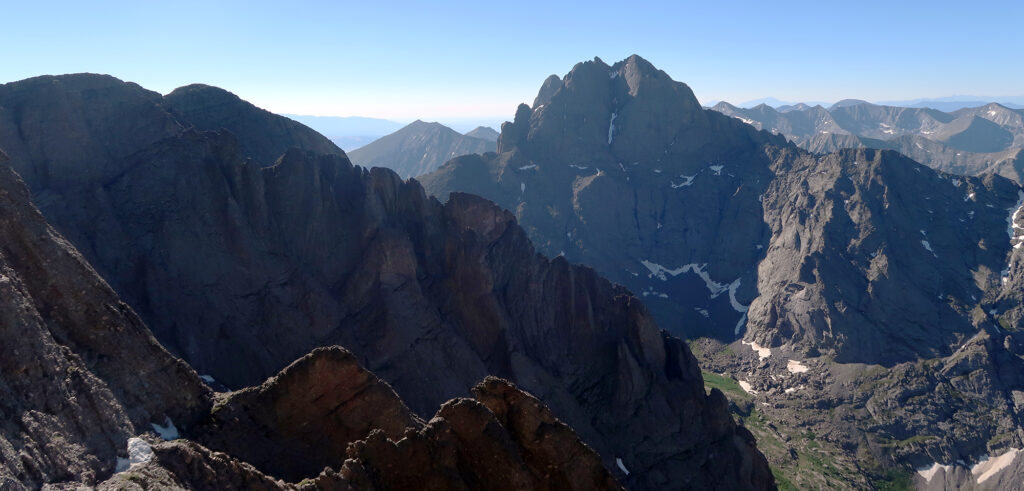
The golden morning sun lit up the upper reaches of the Crestones. Kit Carson Peak in particular looked stunning, its distinctive profile highlighted in orange light. This area of the Sangres really packs a scenic punch. I was surrounded by dramatic rock faces. Across the way, I saw tiny specks of fellow climbers inching their way up Kit Carson by a far more adventurous, Class IV route.
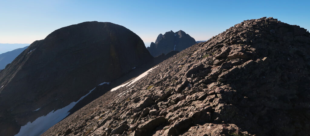
Challenger Point
Challenger Point may or may not be a “real” fourteener peak. Its prominence ranks somewhere between 280 and 320 feet, straddling the magical 300′ mark of “real” peaks. The summit gained its name in 1987, a year after the disastrous explosion of the Space Shuttle Challenger. A thirteener sub-peak on Kit Carson’s opposite shoulder gained the name Columbia Point sometime after that more recent incident.
14ers.com ranks Challenger Point as a “Difficult Class II” ascent. It ranks Kit Carson Peak as “easy class III”. Personally, I found Challenger way more nerve-wracking. You scramble up nice, solid “crestone conglomerate” on Kit Carson. On Challenger, you face some loose steep dirt, which is my least favorite kind of ascent.
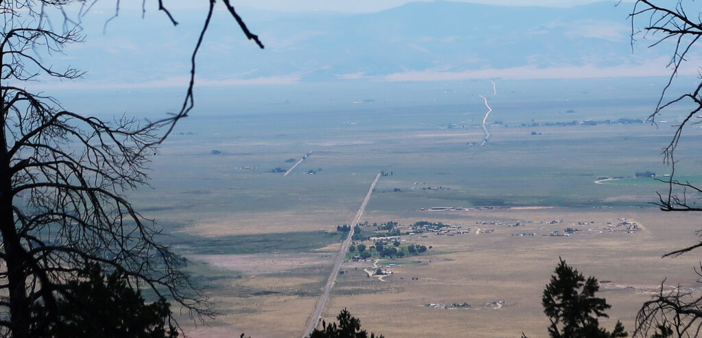
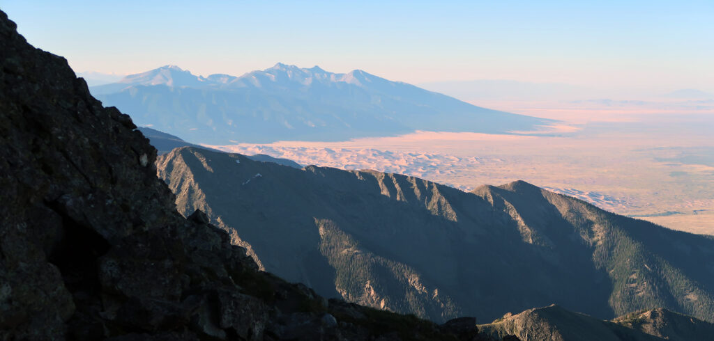
At any rate, I soon gained the high ridge. For the first time since camp, I could once again see the San Luis Valley. Great Sand Dunes National Park stretched out to the southwest. Morning sun cast long shadows amongst the dunes.
I rested atop my first summit of the day. And then I ate some snacks and drank a third of my water. I was beginning to realize I had skimped on water. A long day still lay ahead of me. After summiting Kit Carson, I would need to ascend back over Challenger. Then I would descend back to camp. Then I’d pack out all my gear to the trailhead far below.
Kit Carson Avenue
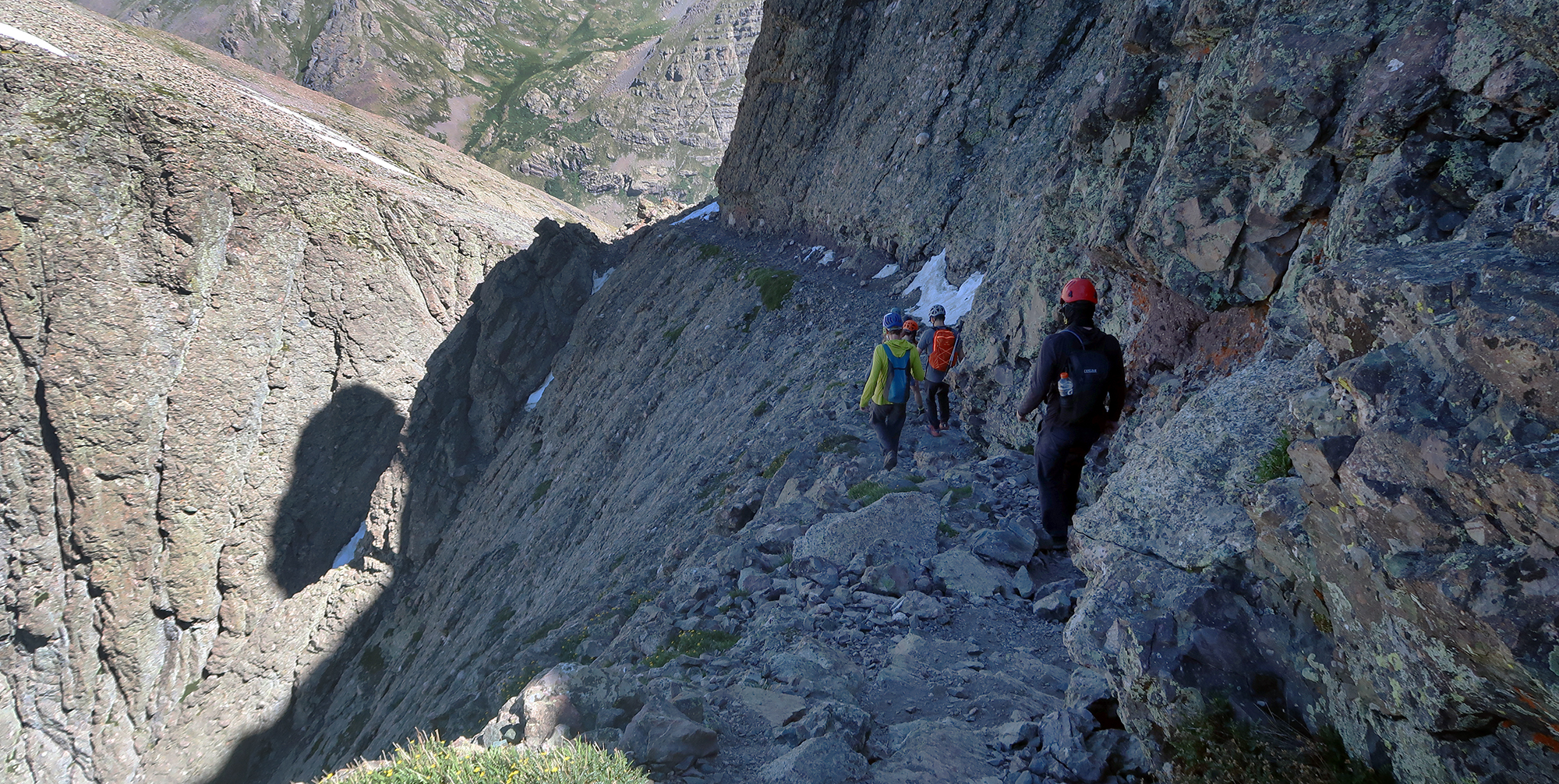
At this point, pretty much everyone summitting that day (via the standard route) had arrived on Challenger Point. We’d move more or less as a group from here. A mellow descent over talus brought us down to the col and the start of “Kit Carson Avenue”. The name makes obvious sense once you see it. It’s as if the gods carved a perfectly safe, ramped sidewalk up an otherwise sheer cliff face. It looked impressive, but not scary. Pure fun.
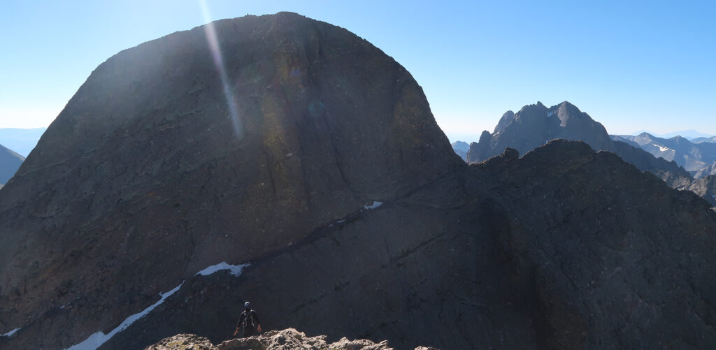
After ascending the avenue, the route continued on a similar ledge down the backside. This led to a steep rocky gulley to the summit. From here I could see tiny hikers atop Columbia Point. They had probably started their day at South Colony Lakes, approached from the opposite side of the narrow Sangres.
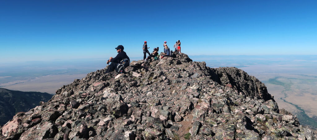
Kit Carson Peak
We ascended the gulleys. Some folks, like me, kept to its loose center, up a series of obvious switchbacks. Others chose steeper solid rock pitches. The way was obvious: straight up. I stuck close to a pair of guys who, like me, started very early and moved a bit slow. One of them seemed kind of out of his depth. I coached him through a few of the stickier spots. Eventually, we summited.
Kit Carson was a famous frontiersman of the early 1800s. Kids bought novels recounting his adventures in America’s wild, wild west. He led Union soldiers into battles in the southwest during the Civil War. Much of his later life was spent in the San Luis Valley. He died near his eponymous peak at Fort Lyon. Today you can visit his grave about an hour south in Taos, NM.
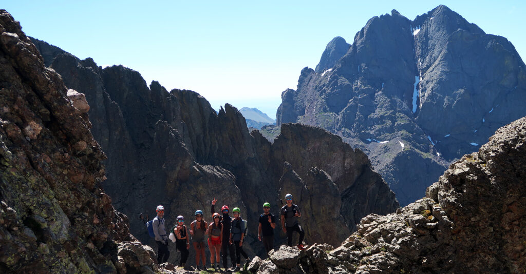
I relaxed atop KC’s Peak for a good time. The tiny speck climbers crawling up its steep, eastern ridge arrived on top around the same time as the rest of us. And so a summit party of sorts ensued. It was warm and sunny, even at 14,000′. A true summer stunner.
The Descent
Soon everyone began doing it all in reverse. Except for the crazy ridge climbers, who would instead join us down the standard route. Something I’ve noticed about these more technical scrambles: pretty much everyone on the mountain forms a bit of a social bond. This isn’t some giant congo line up Grays and Torreys. There’s only one or two dozen climbers on these peaks. And everyone is some mixture of nervous and excited.
As we made our way back to Challenger Point, I asked a friend of mine if we could stick somewhat close on the steep descent. Luckily, he agreed. The way down actually wasn’t as terrible as I had been anticipating. Whatever route we were following seemed more legit and less slippery than how I had ascended. The worst moment involved a snow crossing—now slushy and slippery. But eventually, we were all back on the ‘good trail’.

Mistakes were made
We got back to the lake and I filtered lots of water. It was hot. I was a bit dehydrated. And the sun was omnipresent. I got back to camp and began packing up. And things went very slowly. I alternated between packing up camp and chatting with folks waiting for slower friends.
I guzzled water and stuffed down some Clif bars. But something felt off. I sort of knew I should be adding Nuun tablets to my water. I needed salt and sugar. Not just H20. But they down somewhere at the bottom of my bear bag. And I felt super lazy. Beyond that, the Clif bars did not go down easy. I felt slightly sick.
Then I began the long descent to the trailhead. It was hot and I felt exhausted. I broke a personal rule, putting on headphones and listening to an audiobook to distract myself.
The hike out seemed to take forever. Finally, I caved, dropped my pack, and sat in a tiny patch of shade. I stared blankly. Then I began projectile vomiting.
Dumb Luck
As fate would have it, four hikers came along at basically the same instant. Not an unlikey occurrence. But soon I learned they were volunteers from Custer County Search and Rescue, out for a team hike on the opposite side of the range from their home county. A very unlikely—and lucky—occurrence.
They offered me Pedialyte, alcohol wipes, and ginger chews. It turns out that sniffing pure alcohol helps with nausea. They gave me a wet bandana for the back of my neck as well. Then they very kindly accompanied me to the trailhead. I felt incredibly grateful.
When we arrived at the cars, the stern matriarch of the team asked me to summarize what went wrong. A big factor we identified was lack of food. I didn’t pack a sandwich for the summit or eat a big breakfast. Just a lot of energy bars and smaller snacks. Skimping on water for the summit push was obviously a big one. I also decided that a cotton bandana was a critical piece of gear I was missing. Sometimes in the backcountry, you want soaking wet clothing sticking to your skin, slowly evaporating and lowering your body temperature. Cotton saves!
All that said, it was an incredible weekend in the Sangre de Cristo range. I cranked the A/C and drove to somewhat nearby Salida. There I would slowly reintroduce my stomach to solids, and enjoy an unplanned hotel stay. Kit Carson Peak kicked my butt, but luckily only enough to teach me some important lessons.