
June 24, 2023
A Bluebird Weekend
I left Denver at the crack of dawn, to beat the weekend I-70 traffic. I sped through the Eisenhower tunnel as the Sun rose above the rugged peaks of the Continental Divide. Ahead I saw only clear blue skies. We had been blessed with a perfect weather window.
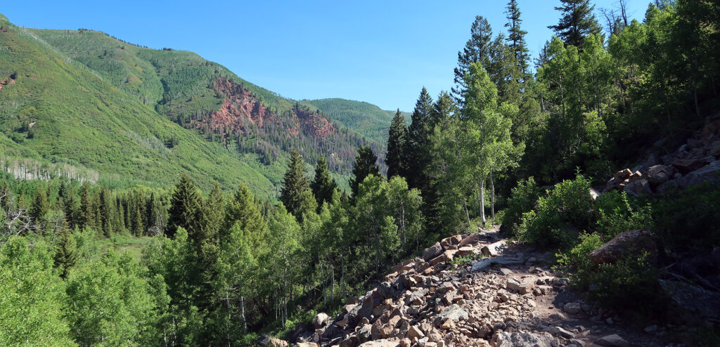
A couple hours later, I reached Glenwood Springs and turned south, into the Roaring Fork Valley. This rarefied corner of the Rockies always seems a bit more verdant than most of Colorado. But after a blockbuster winter and spring of endless snowfall, it seemed downright lush. The sun poked through the leaves of enormous hardwoods planted alongside the road.
My target that weekend: Snowmass Mountain.
The Other Snowmass
“Snowmass” may refer to a mountain, a peak, a lake, a creek, a fake village, a real hamlet, and a ski resort. And none of these things are the same as the other. But they all take their name from the fourteener mountain.
Aspen Ski Co. built Snowmass Ski Resort in the late 1960s. From the start, it was designed as a massive, purpose-built destination resort—a direct response to nearby Vail, which opened five years prior. In fact, the founders of Vail had considered building a resort in the current location of Snowmass. When the time came to name the resort, Aspen settled on “Snowmass”, probably given its obvious marketing potential. But the namesake mountain sits several miles away from the resort and is rarely if ever visible from the ski slopes.
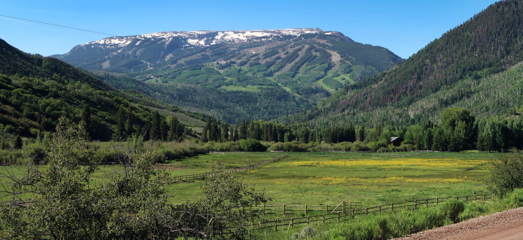
The trailhead for Snowmass Mountain begins less than a mile from one of the resort’s lowest-elevation chairlifts, appropriately named ‘Campground’. And the drive-in, along the bucolic Snowmass Creek Road, passes right beneath its slopes.
Hiking in
Finally, I reached a small dirt parking lot, next to the gate for a private ranch. I snagged one of the last parking spots and geared up. I’d be packing heavy for this adventure.
Snowmass ranks as perhaps the most remote Colorado 14er, with a whopping 22-mile “standard route” to its summit and back. Only one peak sports a longer standard route—Pikes Peak. But Pikes has a paved roadway to its summit so that hardly counts.
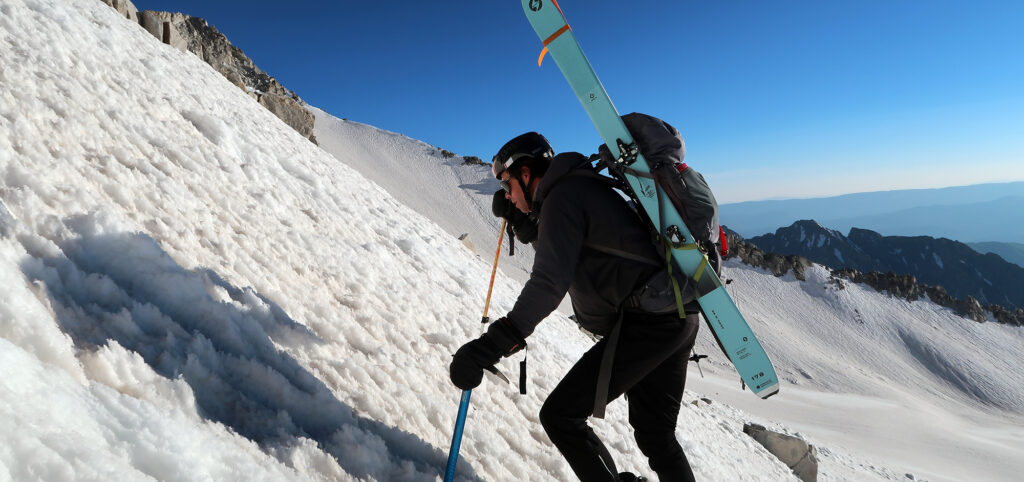
I packed for a full-on backpacking adventure. I’d tramp 9 miles to the remote Snowmass Lake. There I’d set up camp, alongside other aspiring summiteers. And in the wee hours of Sunday morning, we’d inch our way up the steep slopes of the rugged fourteener.
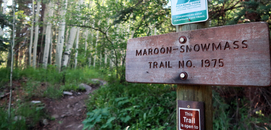
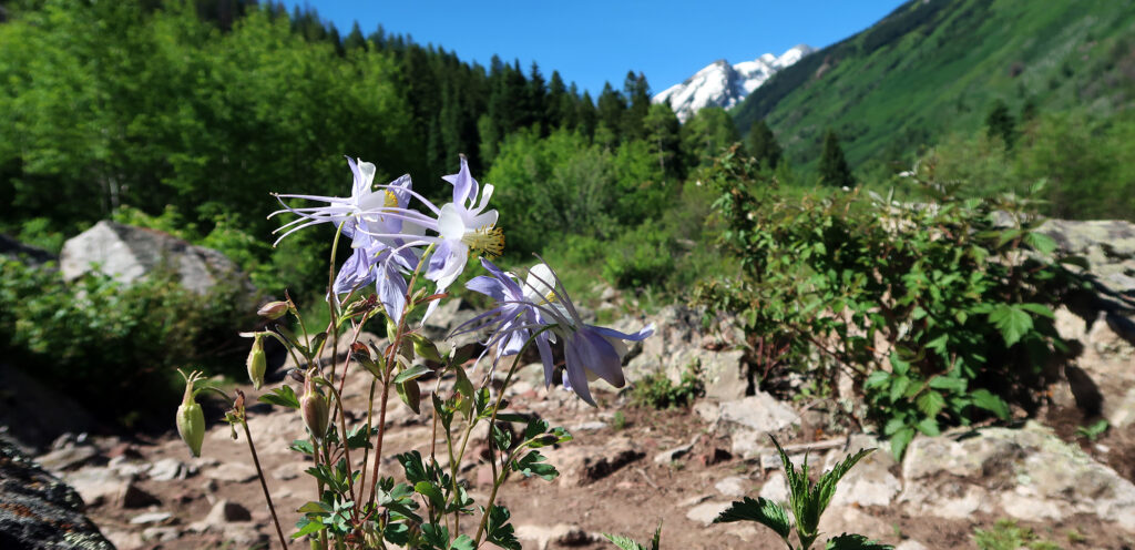
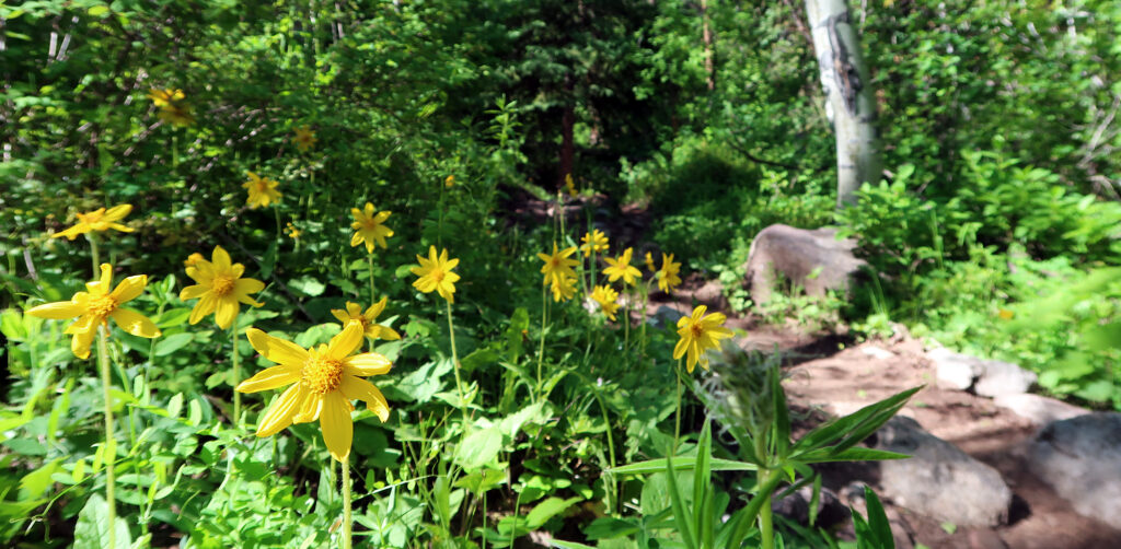
Not long into the hike, I crossed from private property into the Maroon Bells-Snowmass Wilderness area. Down there, around 8000′, I didn’t see an ounce of snow. Fully leafed trees lined the valley walls in all directions. But soon enough, as I made my way into the backcountry, snow-capped summits poked out above the nearby ridgelines.
Fording Snowmass Creek
I passed a half dozen other hiking parties. About half of them were coming back from their own Snowmass adventure. The other half were folks who began that morning and got turned around at the infamous “log float”. That was the first big obstacle looming in my mind.
Snowmass Creek ripped and roared beside the trail. Ample spring snowmelt had supersized its white, frothy rapids. I grew more and more nervous about the log crossing. What if I get carried away?
To my relief, the crossing occurred in a wide, flat, marshy area. The Creek was effectively a muddy, shallow lake at this point. There was no chance I’d be swept away.
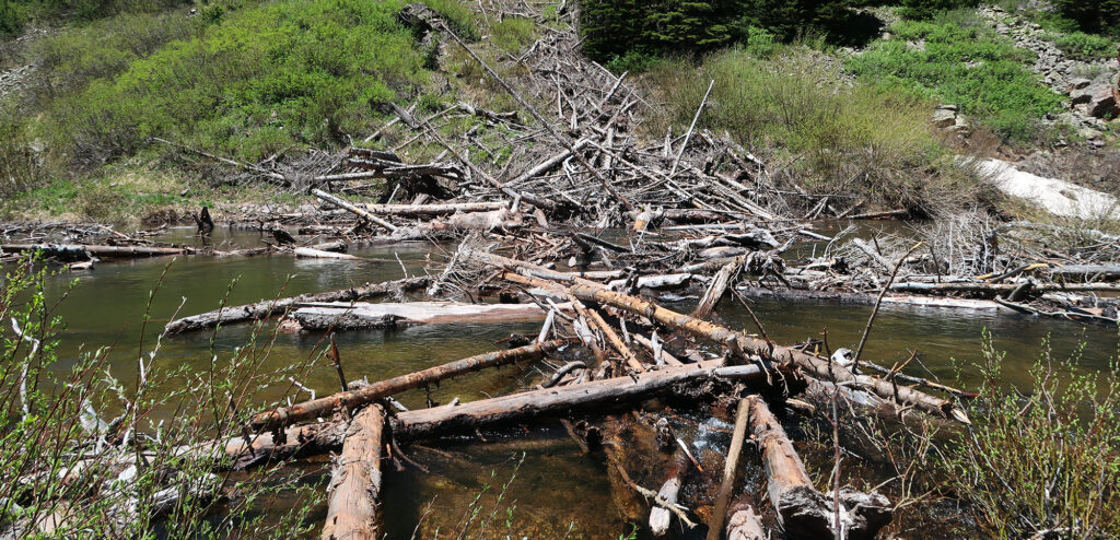
Nonetheless, I found the crossing nerve-wracking. One wrong move might mean a soaking-wet hiking boot. And if it failed to dry by sundown, that would probably scuttle a summit attempt.
I took a deep breath and began to cross. This involved a combination of hands-on scrambling and some balance-beam action. Some of the logs were sturdy and well-secured. Others bobbed up and down as you placed your weight on them. I learned quickly to test the logs before committing. I had one trekking pole which I extended to full length. That helped a lot.
Onward, to Snowmass Lake
Back on solid trail, I breathed a huge sigh of relief. My boots would remain dry as a bone for summit day.
My verdict? It’s totally doable for anyone who belongs on a high-altitude rock scramble. You just need to take your time. As with many situations in the outdoors, different people come away from these adventures with wildly different perceptions of the risk and skill involved. You just need to see for yourself and, as always, be prepared to turn around.
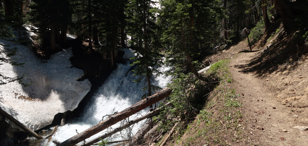
The trail continued on for a few miles. It switchbacked up a steep slope into pine forest. That’s when the snowpack began. At first, the snow appeared in small patches here and there. But the last half mile mostly involved walking on packed snow.
And just like that, I reached the lake. I celebrated with my favorite trail lunch: an everything bagel with peanut butter and bananas. It was around 1 pm now.
I surveyed the tight cluster of campsites near the lake. They all sat on a single, large patch of dry dirt, beneath some pine trees. Only a handful of tents were set up yet, and I had my pick of choice spots. I was relatively early.
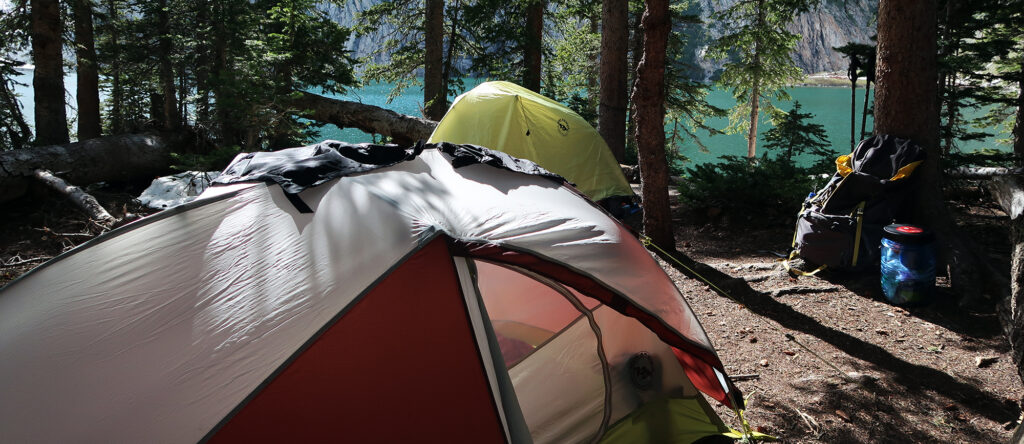
I always worry about getting bored in the many hours between a mid-afternoon arrival and sundown. But this never seems to present a problem. I pull off my hiking boots and switch to flip-flops. I let everything I wear dry in the sun. There are dozens of camp chores, from filtering water to inflating a sleeping pad. I work diligently but it still takes hours. I make sure to down a couple of liters of fluid with electrolytes. Which means more filtering.
Comparing Notes
But most importantly, I make the rounds, checking in with the other folks arriving to summit the next day. Snowmass is a Class III peak. And for more technical summits I deem it important to know who’s on the mountain. I learn when they plan to start, and what opinions they have about the route. We chat about the weather and the necessary equipment. It’s also just a great way to get to know your fellow hikers.
Later in the afternoon a large-ish group arrived and I heard bleeping walkie-talkies. I had a hunch these were some friends-of-friends I was told would be summiting that weekend. Sure enough, we confirmed the mutual connection, and they invited me to join them on the summit push. I hesitated because they looked in way better shape than I was. But I mentioned I’d be starting a solid 45 minutes earlier and would hopefully meet up with them around the high ridgeline.
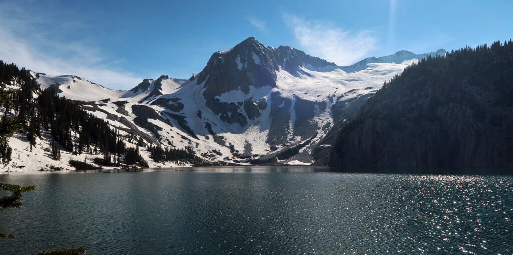
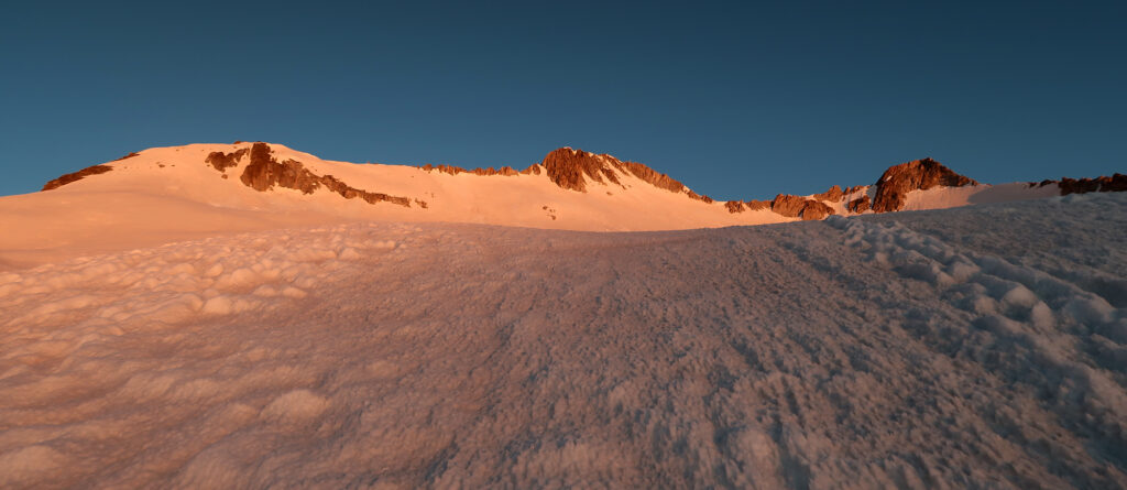
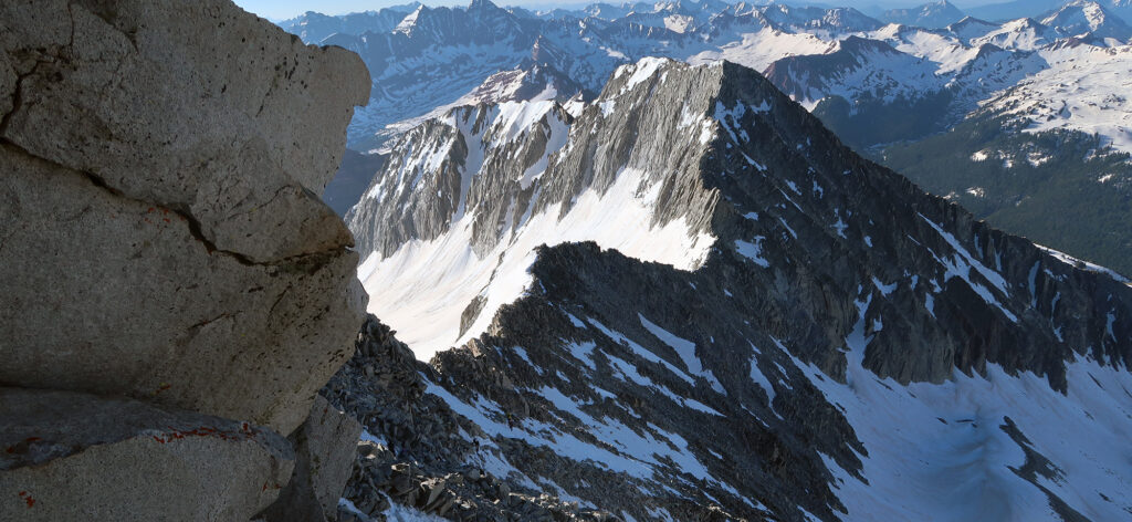
Eventually, it was dinner time. I boiled water and rehydrated a marginally enjoyable veggie mac and cheese. I sat by the lake, in the last bits of sunlight. Snowmass Peak loomed large over the lake. Confusingly this was not Snowmass Mountain. The real McCoy lay to the right, much further back from the lake beyond a massive snowfield (a snow–mass).
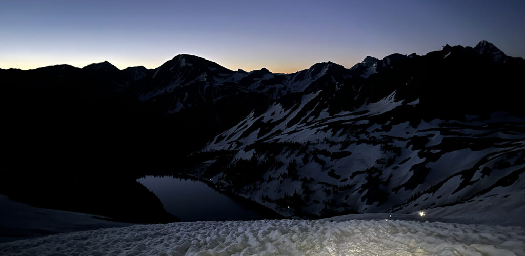
An Alpine Start
My phone alarm went off at 2 a.m. But in truth I spent most of the night half awake. Sleeping at 11K feet on a tiny, squeaky sleeping pad is … challenging. Around midnight I got up to pee and wandered onto some snow patches away from the tents. My flip-flops sunk a good 10 inches into the still-soft snow. This made me nervous. I was counting on the snow to re-freeze overnight.
Around 2:30 a.m., I crossed the creek and began around the lake. I was the first to leave camp that morning. Luckily I had scouted out the early route in broad daylight the afternoon prior. To my relief, much of the snow had re-frozen, in spite of an ambient air temperature 10+ degrees above freezing. Snowpack can radiate low-wavelength energy basically into space on clear, still nights. The re-freeze seemed most effective beyond tree cover.
It was slow going around the lake. Evidence of a bootpack came and went. I wore crampons, as the steep icy banks dropped straight towards the water. Eventually, I reached the gulley, as a couple of other groups caught up to me.
Up the gulley and onto the ‘snowmass’
The “gulley” presents the first big challenge of summit day on Snowmass. It’s pretty damn steep. Staring at it from across the lake the day before, it basically looked vertical. I knew (or hoped) that was just poor depth perception at work. But regardless: gulley, steep.
Here the deep spring snowpack proved more a blessing than a curse. The loose steep dirt and scree remained buried beneath firm snow. And so I could march straight up the gulley and let my crampons sink satisfyingly into the pack. On particularly steep pitches I would sink my ice axe’s pick into the snow as well. This was the closest I got to legit “mountaineering” since summiting Rainier a few years prior.
Glancing back towards the lake, I saw the dots of headlamps stretching back towards camp. There were perhaps only 30 of us on the mountain that day. And at this point we were quite spread out.
Pushing Higher
It took me nearly five hours to reach the high ridgeline. And I’m not sure why. It’s roughly 3000 vertical feet. On a ‘standard trail, I could do that in three hours. I think circumventing the lake added a solid 45 minutes. Beyond that, I guess it’s just really steep and slow.
Above the gulley, however, things mellowed out for most of the way up the snowmass. It’s choose your own adventure on this middle stretch. The snowfield undulates, steeper here. and shallower there. But for the most part, my ice axe had been demoted from MVP gear to awkwardly short trekking pole.
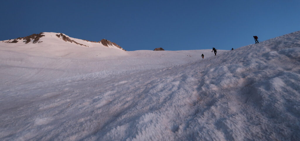
The world grew brighter as I pushed higher. The goal was to get off the snowfield before direct sunlight began turning it into slush. Pushing higher on firm snow would remain both safer and more efficient.
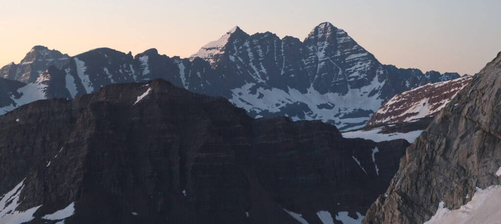
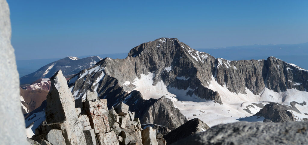
About halfway up, I caught sight of a familiar pair of peaks from a novel angle: the Maroon Bells. From Snowmass, you could see how set back South Maroon sat from its twin. A separation not at all well-appreciated from Maroon Lake or Aspen Highlands.
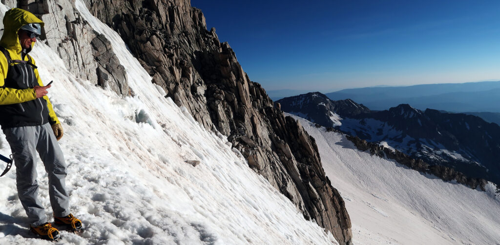
The Headwall
I reached the steep headwall below the ridge around 7 a.m. By now the various hiking parties had sort of compressed into a single loose cohort. Sure enough, the friends-of-friends I met the night before were pretty fast. And so we all trudged up the headwall together.
We had all opted for a steeper “direct route” to Snowmass’ ridgeline. This direct route probably shrunk the ridge scramble by a factor of three. The cost was steep snow. As a skier of 30 years with a non-negligible amount of crampon experience, I don’t mind steep snow. So in my opinion this tradeoff was a no-brainer. But your mileage may vary. When. the snow melts out, my understanding is most people take the non-direct “standard” route. Steep scree is no bueno.
The last 30 feet or so really ramped up the steep factor. Luckily the route was devoid of a cornice. But the angle towards the top easily exceeded 50 degrees. Another great reason to start crazy early: reduced risk of wet slides.
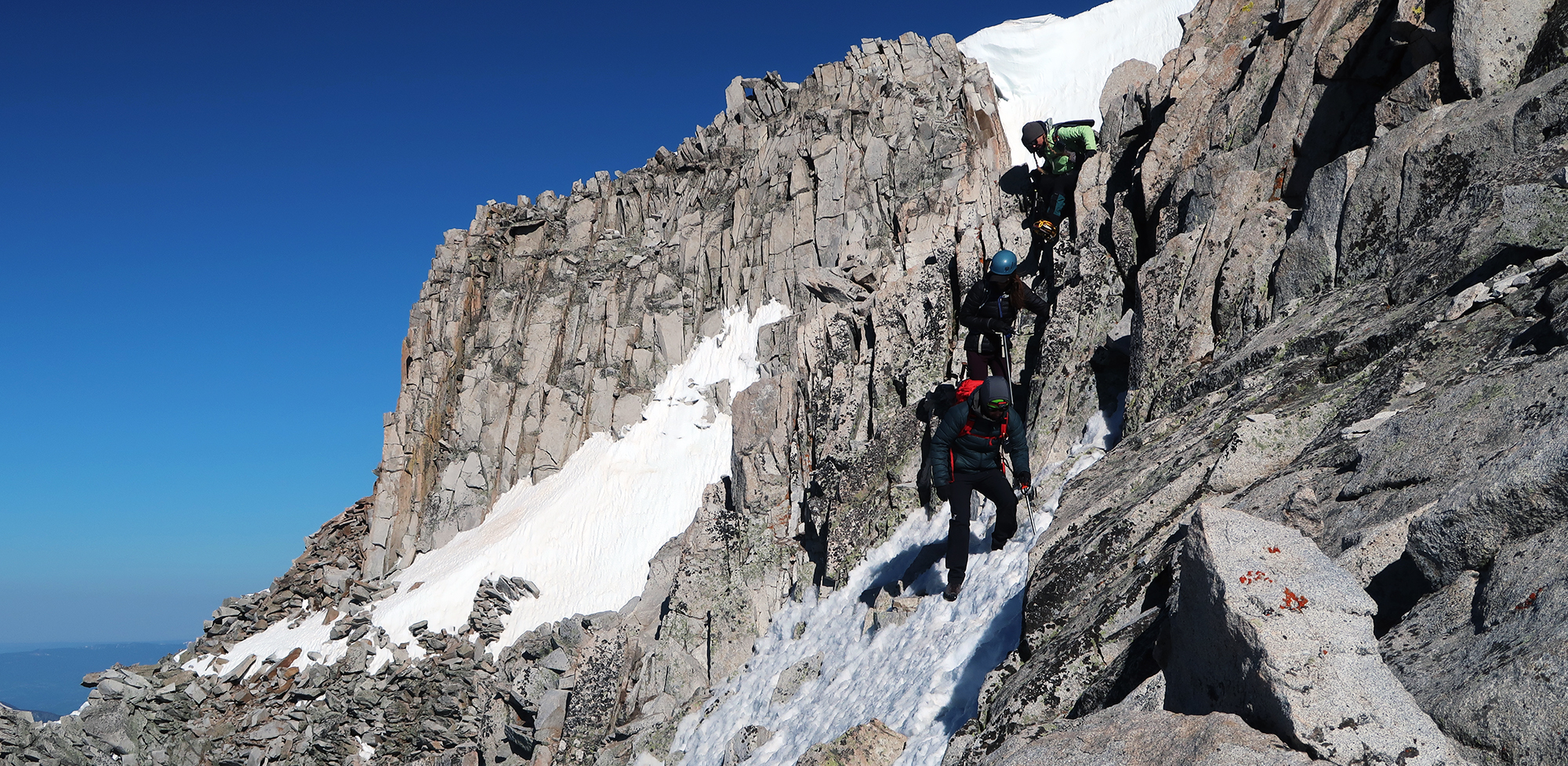
Scrambling along the ridge
Long backpacking approach. Check. American Ninja Warrior log float. Check. Pitch black lake hike. Check. Steep-ass gulley. Check. Endless snowfield. Check. The final boss of the video game? High ridge scramble.
The Rocky Mountains have a well-earned reputation for being loose and steep. Looking for solid granite masterpieces? Try Yosemite. Rocks in Colorado have a non-commital relationship to the mountains upon which they reside. And the Elk Mountains, surrounding Aspen, provide perhaps the most notorious example. In light of this, it’s unsurprising Elk Mountain summits dominate the list of deadliest 14ers in the state.
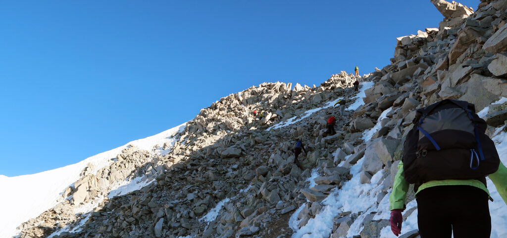
All that said, I want to claim the Snowmass scrambling (at least the short bit I did, via the direct route) was not that bad. A bit less loose than the Deadly Bells. And harrowing exposure limited to a few brief stretches. Of course, the snow didn’t help. The consensus opinion was crampons were more trouble than they were worth on this stretch. But there were moments I desperately wished they were back on my feet.
We had a bit of a traffic jam on this stretch. A hiker in front of me got a bit hesitant on a steep snow section. I noticed she was holding her ice axe along the shaft—not at all the “ready position” for a successful self-arrest. I calmly showed her how I was holding mine: palm at the top of the shaft, thumb, and fingers on opposite sides, with the sharp pick end pointing behind me. Another hiker was struggling a bit in ski boots, now without the aid of crampons. Utterly terrifying, in my opinion.
Snowmass Mountain
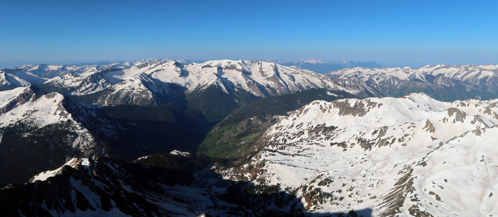
But in short order, we all reached the summit. And the views were stunning. Blue skies, sunshine, and snowcapped red-rock peaks. Far below we saw deep, green valleys—the Rocky Mountains at their finest.
We had a small party going atop Snowmass’s tiny summit. Ample sunshine and surprisingly low winds left it warm and pleasant. Out came the snacks and salty drink mixes.
With a glance, I followed the high ridgeline northward a couple of miles to an even taller and more rugged summit: Capitol Peak. Capitol has gained a reputation as the most difficult (and perhaps dangerous) of the Colorado 14ers. As a result, a majority of climbers save it for last. I knew in a year or two, I’d be making my own summit attempt, scooching not-so-gracefully across its infamous Knife’s Edge.
The Unwinding
Summiting a difficult peak hardly affords sighs of relief—a fact George Mallory may or may not know better than any of us. And the descent definitely kept my nerves high. And so as soon as someone suggested starting down, I sprang up to join them.
I kept the crampons off for the scramble. While they’d let me breathe easy on the steep snow, I had no idea how well I could scramble on bare rock with 2″ steel tines sticking out from my toes. It was slow going again. Someone in front of us didn’t have an ice axe. Of all the sketchy crap I’d seen that weekend, that took the cake.

A moment later we were back at the headwall of the direct route. Now my breathing did improve quite a bit. Here everyone elected to slowly down-climb this steepest section. We donned our crampons and turned around to face back towards the mountain. This felt a bit like climbing down a ladder.
Glissade Time
Glissade is a fancy French word for butt sliding. Butt sliding is a perfectly acceptable mountaineering technique for descending steep-ish snow. And the undulating snowfield between the ridge and the gulley provided over 1000 vertical feet of prime butt sliding. There are two big rules to safe glissading: use an ice axe, and lose the crampons.
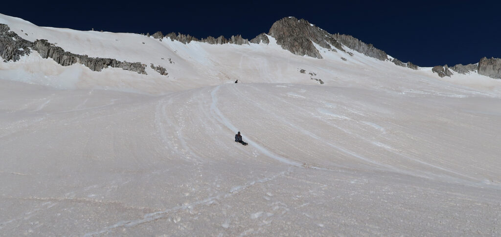
It took us perhaps 30 minutes to butt-slide the vertical equivalent of the Empire State Building. That is a LOT of spring snowpack rushing past your keister. And boy oh boy, did that hurt. Yes, it was fun. But also painful on the derriere. A couple of folks brought trash bags to protect their pants. But within two or three slides, those were shredded to pieces.
I’m told donning Goretex rain pants can help reduce wear on your pants (and potentially the pain). I happen to own a pair of $200 Goretex rain pants. But to be honest, I’m not in love with the idea of running them across a mile of frozen sandpaper at high speeds.
Back to civilization
Next, it was back down the gulley. This seemed way steeper in broad daylight. It was narrow and rocky enough that no one felt comfortable glissading the top. About halfway down, the more adventurous among us resumed butt-sliding. I moved over onto nearby talus.
I reached the lake again around 11 a.m. Not too shabby! The sun baked down as everyone broke camp. I refilled my water bottles with cold, filtered lake water. I was in no rush to begin the 9-mile trek out.
But begin it I must. I went slowly, really feeling the 35 lbs on my back. I stopped periodically to cool down. A trio of young women from the Front Range passed me. Then a couple from Aspen. We’d spend the next few hours “leap-frogging” each other. Boy, it felt hot. The guy from Aspen put a slash through his bare thigh with a tine of his crampons. He went increasingly slowly. I’ve been told to always wear gaiters with crampons.
Eventually, I fell into a stride with another summiteer. We chatted all things outdoorsy, which really helped the time pass. Around 4 pm… or 5 pm… or some embarassingly long time later, we reached the car park. I sat for a while in glorious air conditioning. Snowmass was in the books.