June 10, 2023
The Crags Campground
I arrived at the Crags Campground trailhead around 3:45 am. It was June—when hikers are blessed with the longest days of the year. But even still it was pitch black.
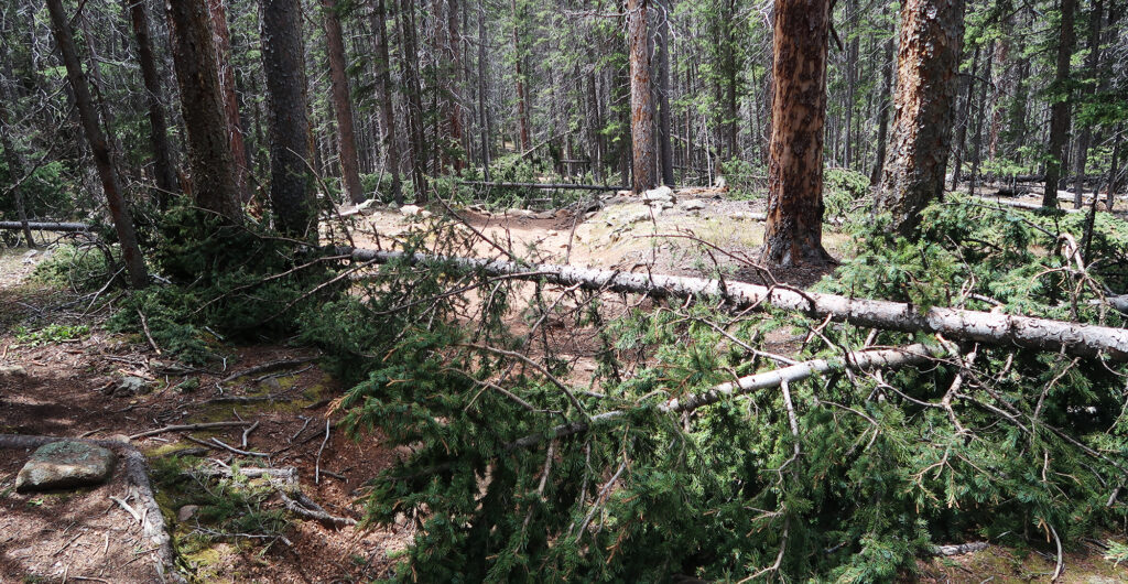
I hit the trail around 4 am. The first three miles rose through pine forest at a gentle pitch. But copious amounts of blowdown still meant slow going. I wanted to summit and get back below treeline before the predicted afternoon thunderstorms rolled in. And so I tried to keep a deliberate pace. I had a big day ahead of me, at least for the early season. And this was the “short route.”
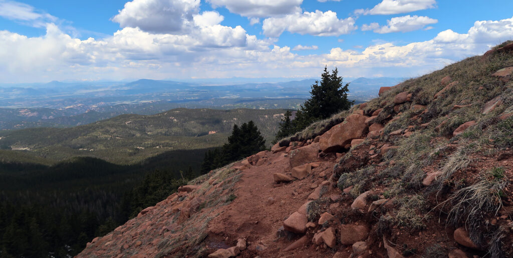
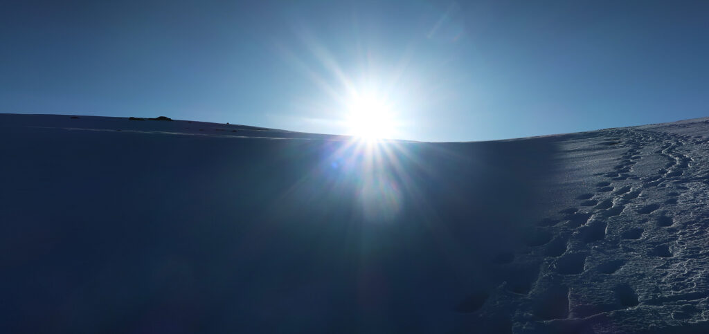
Around 11.5K feet (1500′ into my climb) three things began to happen. The earliest dawn light began to illuminate the surrounds beyond the Pikes Peak massif. The trees began to thin out. And patches of snow began to appear along the trail. Ahead in the distance, I saw the snowy upper reaches of the massif.
The Crags Approach: The Short Route to Pikes
The “Crags” trail approaches Pikes Peak from the west. And it’s a well-marked, quality, Class-II trail with minimal dangers and ample views. But it is not the “standard route”.
The standard route up Pikes is the “Barr Trail”, perhaps the oldest well-marked trail up a Colorado 14er. And the Barr Trail is a beast. It rises a knee-destroying 7,200 vertical feet from Manitou Springs to the summit. Round trip distance? 22 miles. It is the longest and tallest standard route up any Colorado 14er.
And I was having none of that, thankyouverymuch.
The Crags approach is a solid effort, after which you can confidently say you’ve hiked Pikes Peak. It rises a respectable 4.5K vertical feet. And it runs a very respectable 14 miles. Even several of the mighty Sawatch 14ers involve less effort. There was no reserving space in an A-Frame at “Barr Camp”. No finagling legal parking in Manitou Springs.
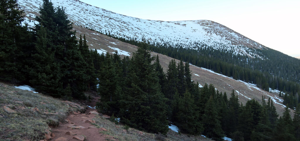
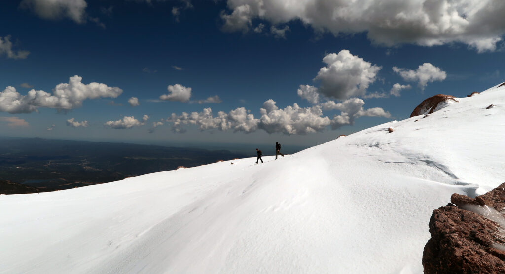
I reached the treeline, where the serious snow began. I brought both snowshoes and microspikes but would use neither on the ascent. Instead, the snow had frozen solid overnight, allowing easy passage. I chugged along, up the steep slope, towards the “Devil’s Playground”.
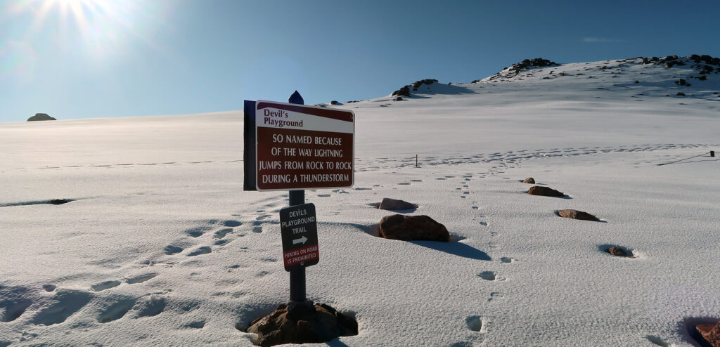
The Devil’s Playground
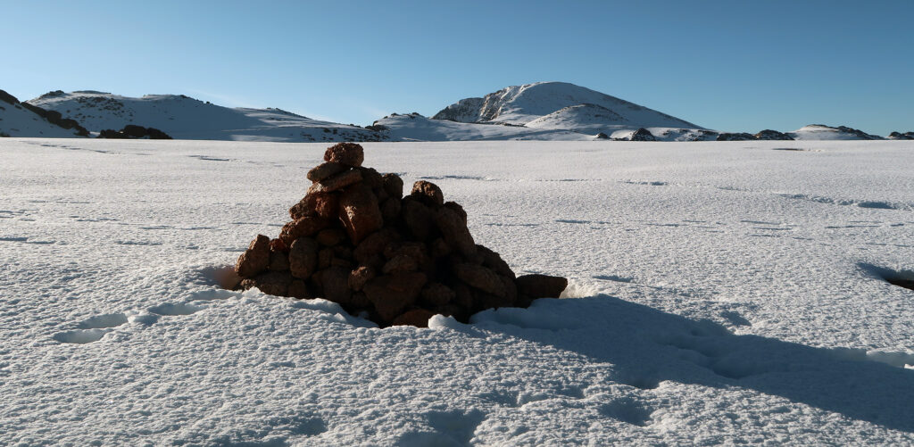
Around 12,750′ the trail reaches a broad flat area that stretches a couple of miles towards the summit. Here the Crags approach parallels the paved roadway to Pikes’ summit. But for the first mile or two, the road is mostly hidden behind rock outcroppings and folds in the landscape.
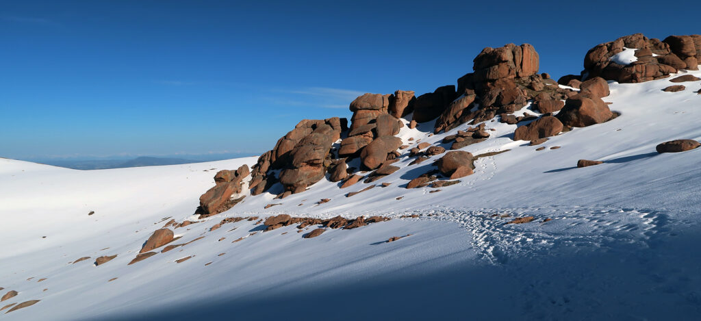
I now had direct sunlight, but the snow would remain entirely frozen over for a couple more hours. This meant I could walk with minimal effort along this beautiful upper stretch. I passed through breaks in pink rock bands of Pikes Peak granite.
Soon I reached a crossing of the auto road. Here I also saw a sign explaining the Devil’s Playground. It takes its name from the way lightning “dances” about the massif during storms. This was a not-so-subtle reminder to GET OFF the peak before said lightning arrived.
You may ask why I chose to hike Pikes Peak on a day with “weather” in the forecast. Well, for starters, this is summer in Colorado. And there are months when storms seem to form over the Rockies pretty much every afternoon. The trick is just to start early. And second, this is Pikes Peak—the only fourteener with a public cafeteria at the summit. If things turned for the worse, I had two safety havens: the summit and treeline. But mostly, I was confident I could be down off the massif by early afternoon.
Pikes Peak or Bust!
There are many ways to the summit of Pikes Peak. I’ve already mentioned two hiking routes: the Barr Trail and the Crags Campground approach. But for the less sweat-inclined, there are two far more leisurely approaches. First, you can drive your car all the way to the summit via the memorial highway. Pikes is actually one of two fourteeners with a paved road to the summit (Mount Blue Sky being the second).
The Crags Trail parallels the auto road for a mile or two. They diverge about 1000 vertical feet below the summit. Here the road snakes off around the corner and the hiking trail plows straight ahead, up the slope. This setup is … less than ideal … but hardly ruins the views or the high alpine vibe. And by my luck, very few cars seemed interested in gunning up Pikes at 7 am on a Saturday in early June.
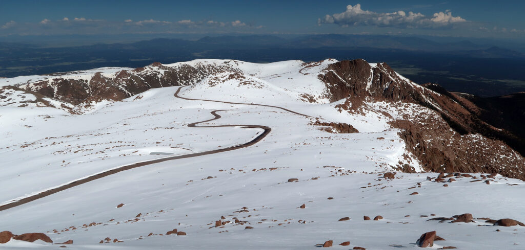
Shockingly, this road remains open year-round. You can, under reasonable weather conditions, drive to the summit of Pikes Peak in January! Pretty neat.
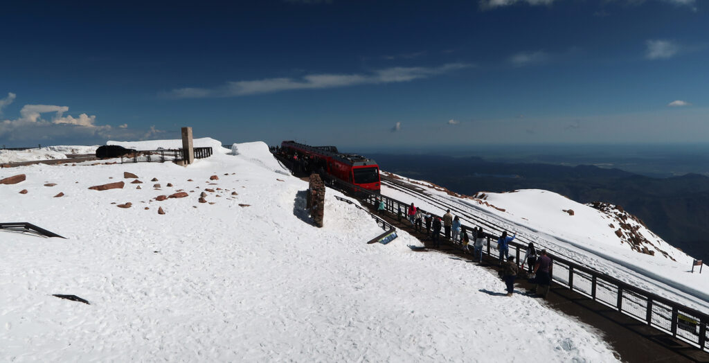
The second low-effort way to visit the summit ranks as my favorite: the Cog Railway. The Cog travels up from Manitou Springs (at times roughly parallel to the Barr Trail), rising over 7000 vertical feet along the way. It’s the world’s highest Cog Railway and one of just two in the United States (the other being the original cog railway on Mount Washington).
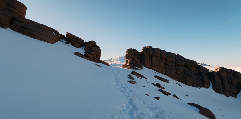
I came to the final steep push to the summit. The Crags trail is not to be underestimated. After an initial push to 12,750 feet, you bumble along atop the massif for a couple of miles. There are some ups and downs. You gain perhaps 300 vertical feet along the way. That leaves a roughly 1000-vertical foot “stinger” for the bitter end. I huffed and puffed up this last steep pitch. This was my first new 14er of the season.
America’s Mountain
With two hiking trails, a roadway, and a fancy railroad, you may be wondering: why do so many people want to summit Pikes Peak? What is so special about this 14er that people around the country—and the world—seem vaguely familiar with the name?
It’s not the highest peak in the state (it’s actually around the 30th highest). And it’s definitely not the most beautiful. That said, it is a very tall mountain. Maybe the “tallest” in Colorado, depending on how you define these things.
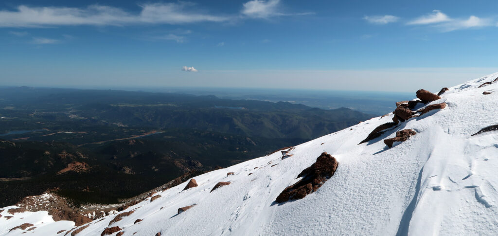
Pikes rises directly up from the flat open plains of Eastern Colorado. It’s one of just three “ultra-prominent” peaks in the state. It lords over the city of Colorado Springs, but you can see it, on a clear day, from 150 miles away. No peak East of Pikes in the USA rises anywhere near as high.

It is the definition of “purple mountain majesty above the fruited plains”. That’s a line, of course, from America the Beautiful. The song’s author, Katharine Lee Bates, was inspired to write it after standing atop the summit of Pikes. This mountain is not just referenced in the song, it is the very reason for the song’s existence.
Pikes has inspired entrepreneurs, gold prospectors, and competitive automobile racers. Multiple people have even felt inspired to push a peanut up its slopes. It takes its name from Zebulon Pike, an explorer sent out by Thomas Jefferson to explore the new Louisiana Territory and a contemporary of Lewis and Clark.
Pikes Peak Summit House
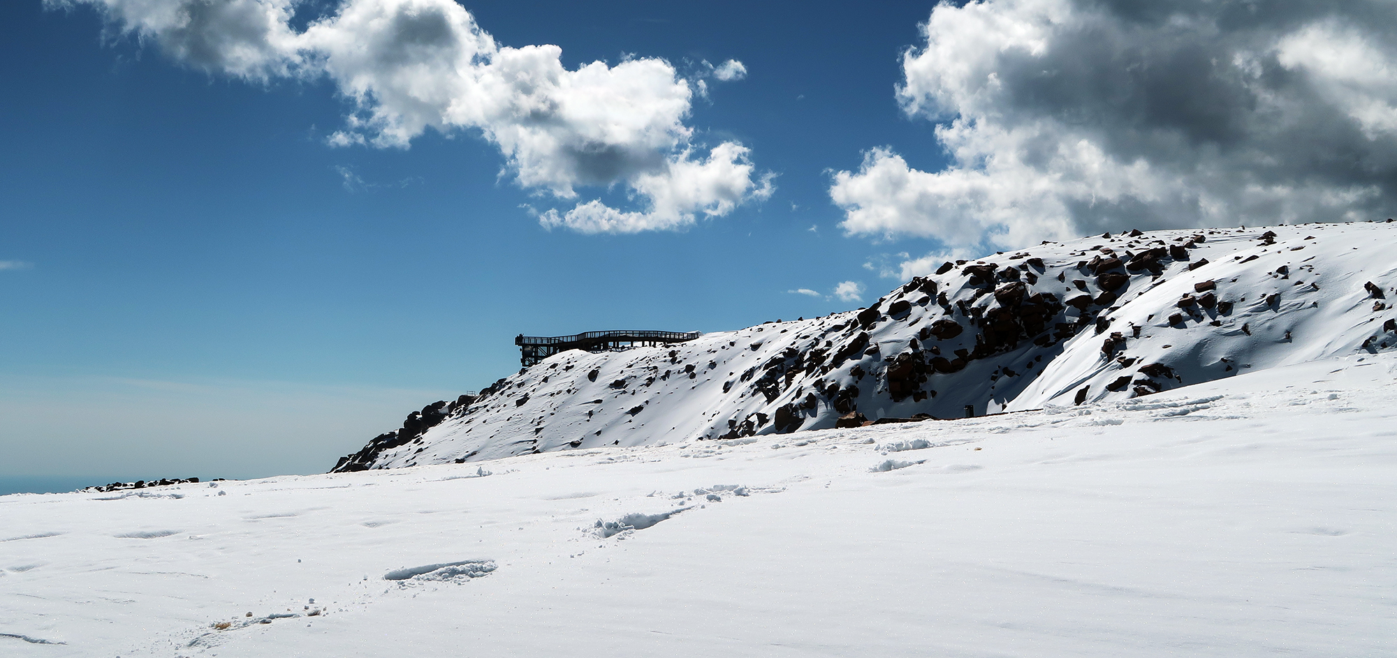
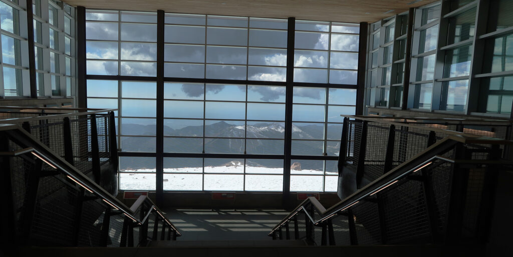
In short order, I had arrived at the summit. I walked across parking lots towards the Summit House. As mentioned earlier, Pikes is the only 14er with a cafeteria on its summit. And I fully intended to put that fact to good use!
A newly-built visitors center opened just a couple of years earlier. It features a massive glass atrium that fully showcases the views to the East.
I made a b-line for the cafeteria. A new batch of cog railway riders had begun to disembark.
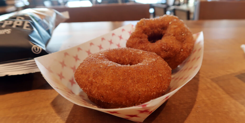
No visit to Pikes is complete, apparently, without sampling the summit donuts. Rumor has it they deflate if brought back down to Manitou Springs. Given the thin air and low pressure up here, the story seems plausible. I’ve also been told the new visitor center was constructed around the massive donut-making machine.
After some donuts and crunchy potato chips, I re-filled my water bottle and strapped up to head back down the mountain. The last thing I wanted was to get stranded at the summit in a thunderstorm. The museum next door didn’t seem that interesting.
Flotation, Flotation, Flotation
For the journey back down the mountain, I would strap on my snowshoes. For the steeper sections, this meant better traction. But more importantly, it meant flotation. The Sun had been out for a few hours now, and the deep snowpack I had to cross had begun to bake.
Be forewarned: a spring 14er hike requires flotation. Otherwise, prepare to “posthole”. That’s when every other step you take involves sinking a foot or two into slush. Even with my snowshoes, the steps felt laborious. I sank a couple of inches into the snow with every step.
I crossed paths with some skiers, out and about for some June backcountry turns. I saw a few other happy parties on snowshoes. And I passed by some very disgruntled-looking folks on foot, sinking deep into the snow.
After what seemed like forever, I was back in the transition zone. The snow abated and trees reappeared. I pulled off the snowshoes and began a hot midday hike back to the campground. All those knocked-over trees seemed twice as painful in reverse. But I just kept telling myself: this was good conditioning for the summer. And also that Pikes Peak was not a bust.