September 17, 2023
Rough Roads
I trundled along in the pre-dawn darkness, up the four-mile road along Nellie Creek. The objective: Uncompahgre Peak.
My trusted Subaru had delivered me faithfully to the trailheads for Handies, Wetterhorn, and numerous other fourteeners. But for this approach, I opted to rent a jeep in nearby Lake City. Shortly after pulling off the gentle approach road of the Alpine Loop, I realized the rental was money well spent.
The jeep splashed across running creeks. It sputtered up steep switchbacks. I inched carefully over large rocks and slabs. There were no “oh crap” moments per se—for that, try the approach to Blanca. But the road definitely seemed beyond the reach of your standard 4WD station wagon.
I kept the car in “four high” throughout the climb. Mostly because I had never tried “four low” before. That would come on the descent. As the road began to level off and the miles ticked by, my confidence (and enjoyment) grew. The whole time I had the theme song from Jurassic Park stuck in my head.
This was a “treat yo self” kind of approach. I have trudged up many a jeep road on foot, en route to a fourteener. Doing so can transform a peak like Antero from a quick jaunt above 13K feet into a mile of vertical and many miles of hiking. On Uncompahgre, starting at the 2WD trailhead adds “only” 2000 vertical feet to the ascent. But it was the tail end of the season. And Lake City is sort of the capital of off-roading. And so the upgrade felt sensible enough.
Uncompahgre Peak: The Top of the San Juans
Around dawn, I reached the “upper trailhead”. It was empty, perhaps unsurprisingly. Peak season was over in the San Juans. Lake City had celebrated its last hurrah with a Wine and Music Festival the day prior. The hotels in town were discounted. The meandering byways felt sparsely driven. And so I’d only run into perhaps a half dozen other hikers that day.
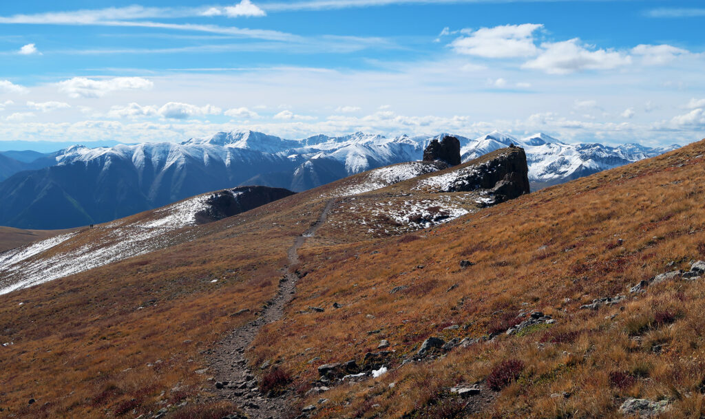
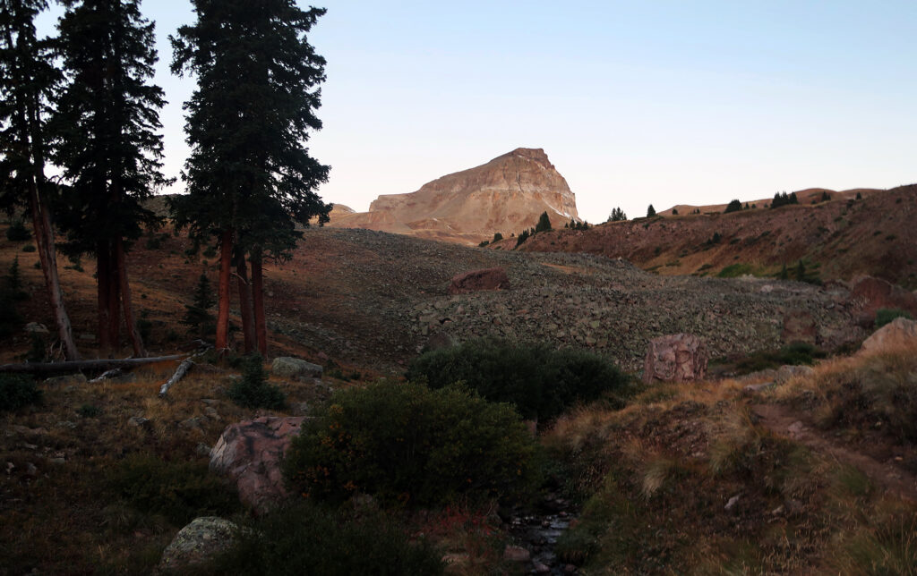
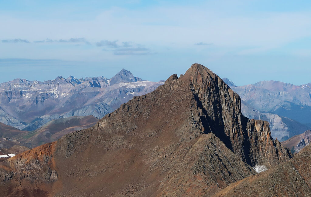
Right off the bat, Uncompahgre Peak’s distinctive profile loomed large over the landscape. Uncompahgre ranks first among San Juan summits, making it the sixth tallest peak in the entire Rocky Mountains. And in terms of shape, it stands out as a charismatic chieftain, in a corner of the state with many charismatic summits.
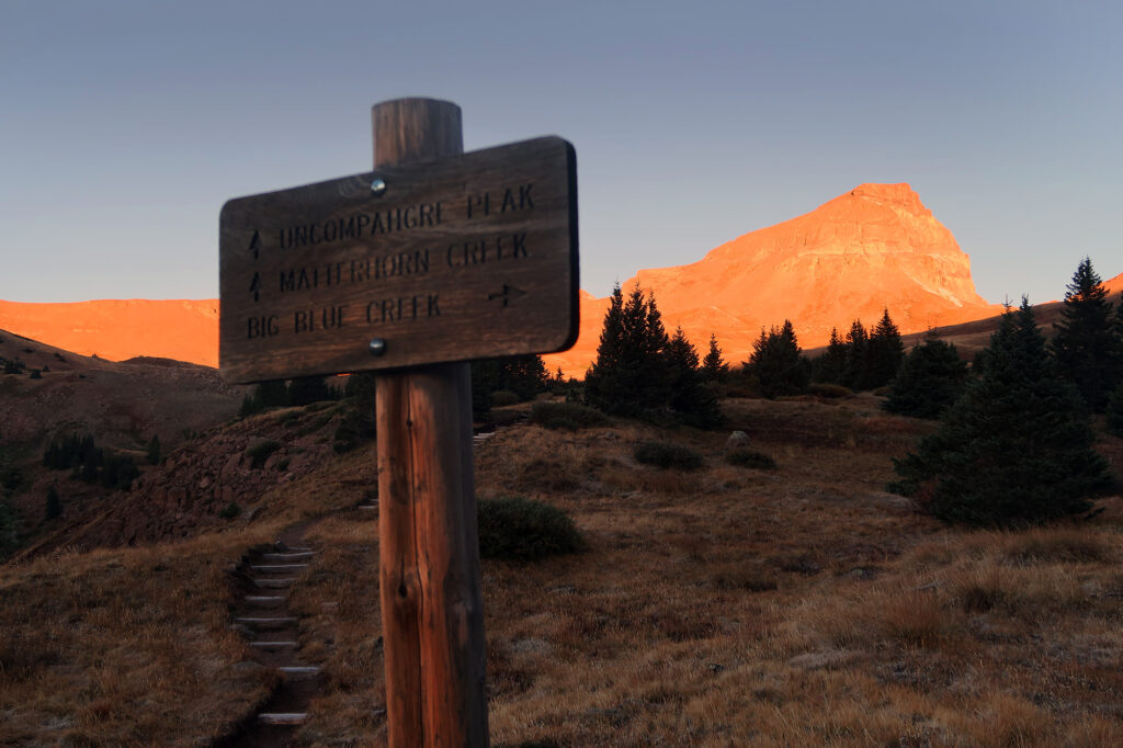
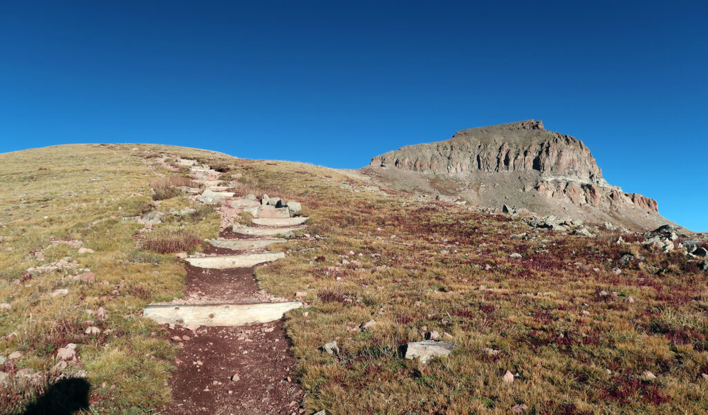
The approach rose gently through the Nellie Creek drainage. It gained roughly 1200′ over the first two miles, from the upper trailhead at 11,400′. From their, it turned left, underneath the summit cliff bands, and towards a gentle ridge to the south.
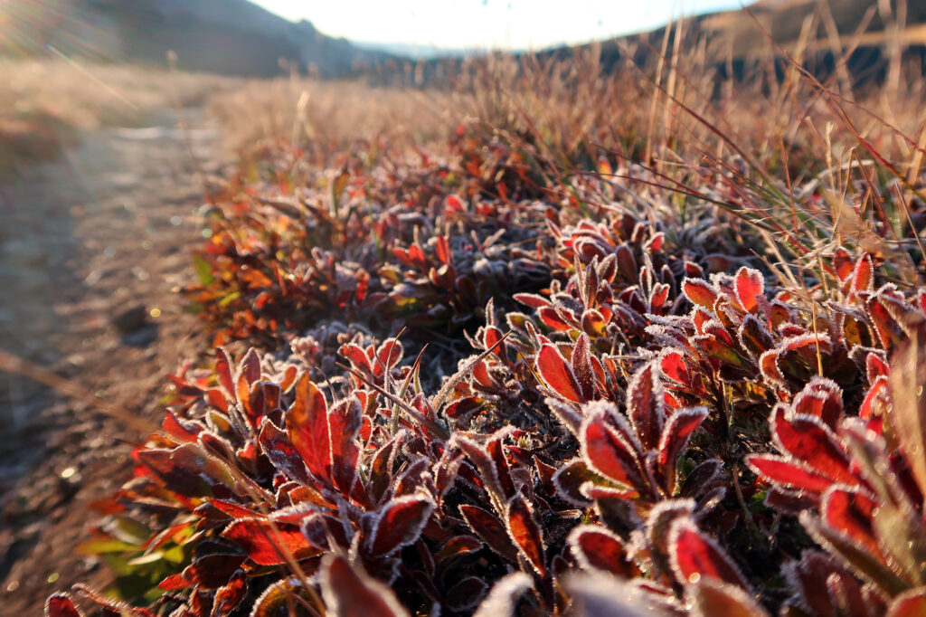
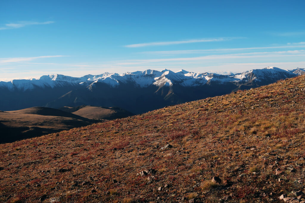
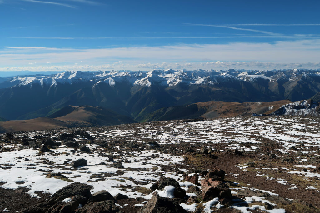
Trees were sparse, and the vegetation had shifted towards autumnal hues of red and burnt orange. Distant peaks to the south were still dusted with snow after a small storm a couple days prior. But the peak looked mostly dry by that Sunday.
Along the ridgeline
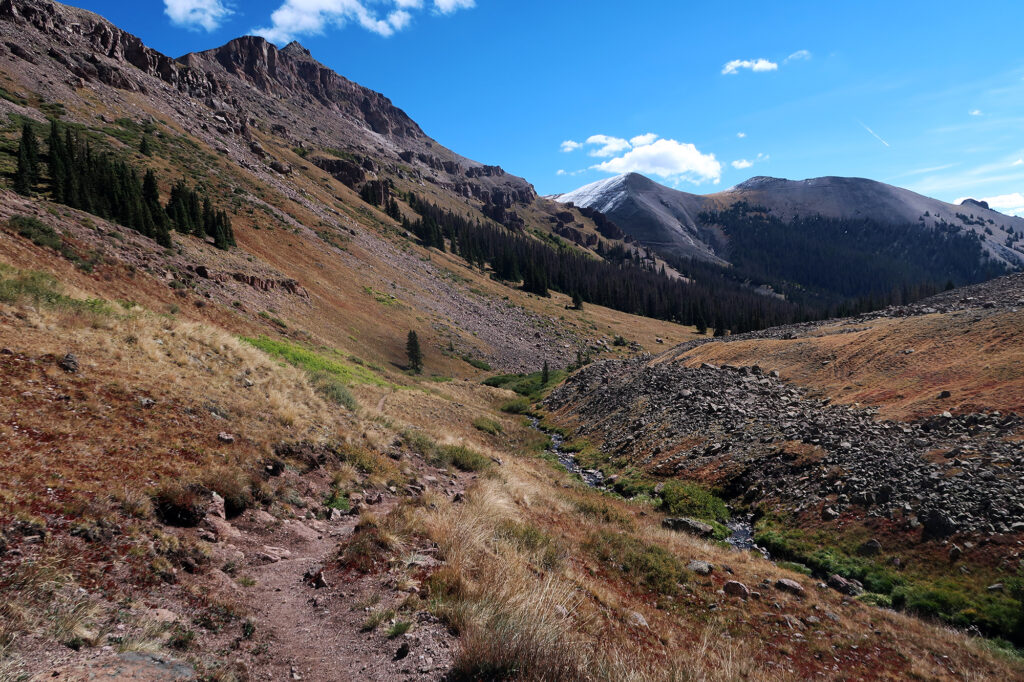
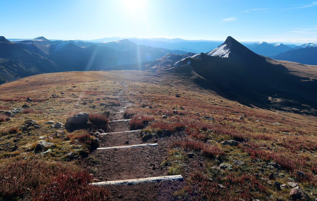
The next mile, towards the high ridgeline, and then towards the peak, grew a bit steeper. It gained roughly 1000 vertical feet, to the base of the “wedding cake” cliff bands on the peak. Here a couple fast trail runners had caught up to me and continued on to the summit.
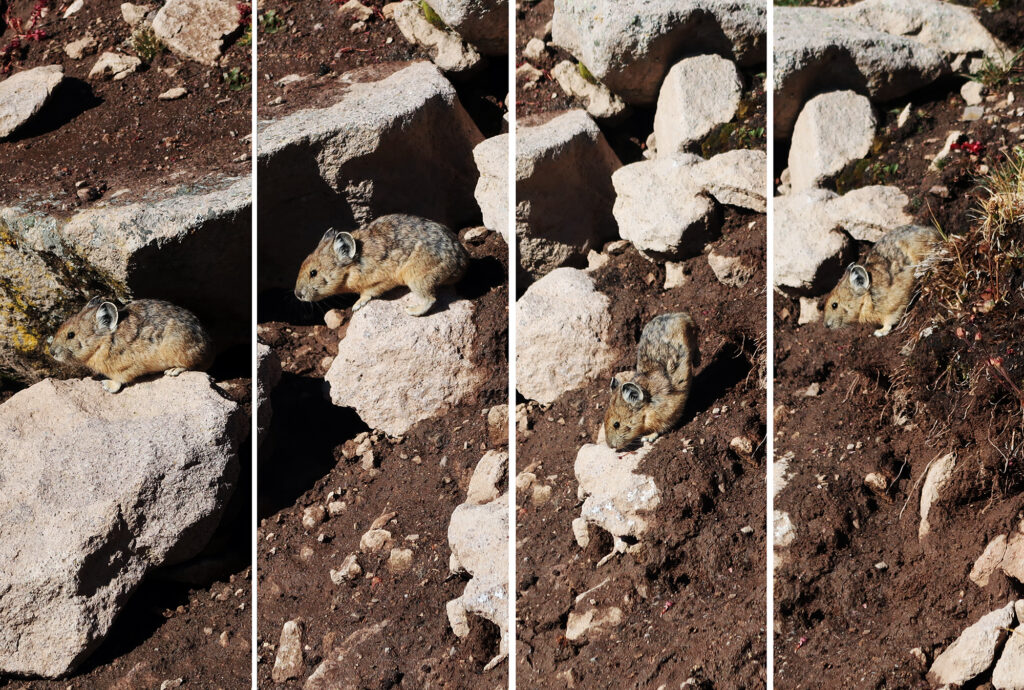
As the grass gave way to rocks and talus, I heard the familiar squeak of Pika. They were scurrying about, gathering detritus for winter.
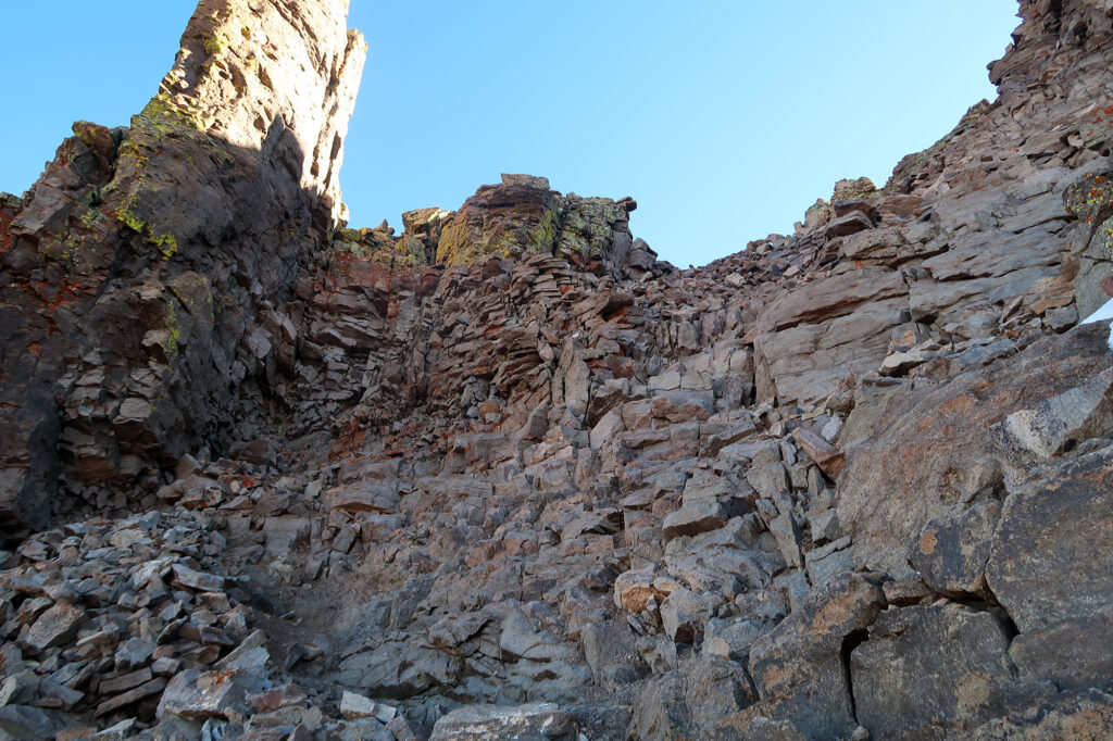
The gentle, well-formed trail rose in some final switchbacks, delivering me to 13,800′. Just 300 vertical feet remained to the summit. But this was where the trail entered more steep/dramatic terrain.
Gaining the summit
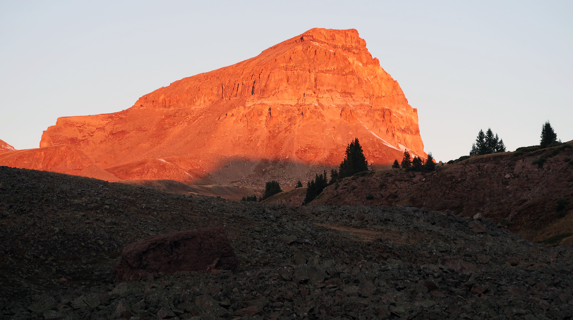
Besides being just plain gorgeous to stair at, Uncompahgre Peak marks the rare Colorado 14er whose “bark” is worse than its “bite”. The peak looks super steep and technical. The summit formation appears from most angles as a series of stepped back, sheer cliffs—a volcanic wedding cake topping out at 14,321′.
But the trail remains firmly “class II” right up to the broad, flat summit plateau. There’s a slight feeling of exposure as you gain the backside of the first large cliff band. And most hikers would likely opt to use their hands on a couple key sections. But the peak is hardly among the most vertigo-inducing fourteeners.
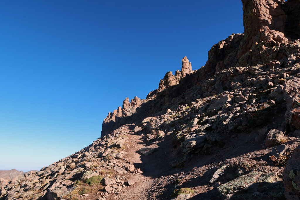
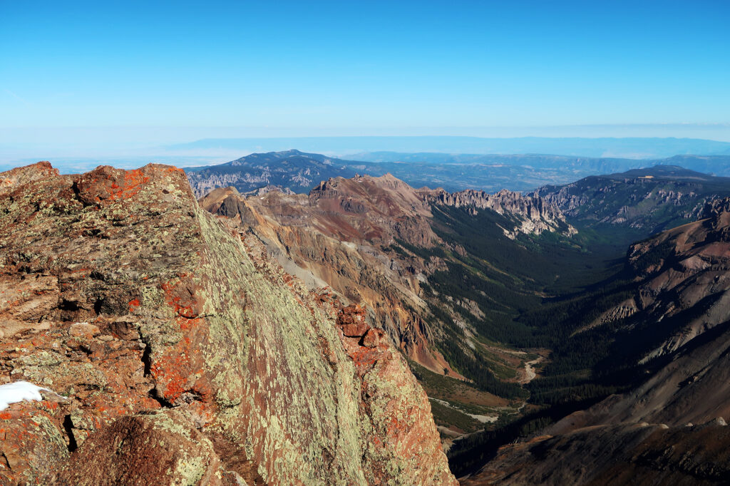
All that said, the route definitely feels a bit impressive. There’s a crux-y gulley on the steepest section that definitely feels like a scramble. The rock is so distinctively San Jaun, with reddish hues and even redder lichen. Small igneous spires poke up here and there giving the arena a touch more drama.
Uncompahgre Peak
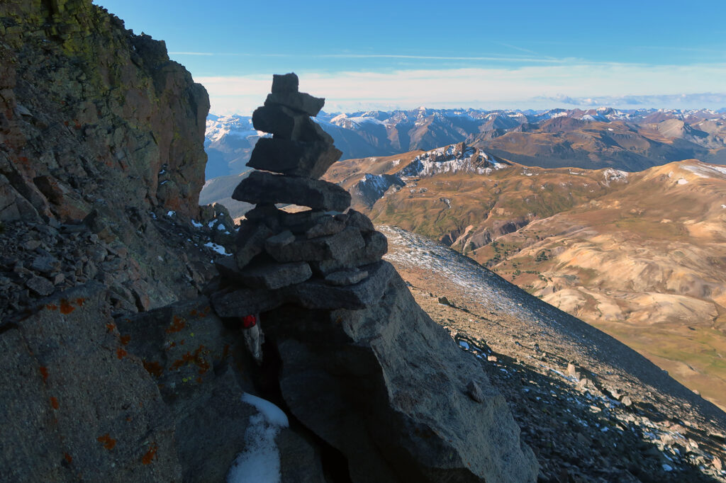
Before long, I was through the steeper pitches, and heading up towards the wide open, slanted summit. The views were breathtaking from up here. I saw the nearby Wetterhorn, Uncompahgre’s sister fourteener. Many distant peaks appeared snow-capped on their northern flanks.
I strolled up the slanting, planar summit area, towards the “true summit”. You could probably fit an off-kilter soccer field up on the peak. I sat and enjoyed the sunshine and some snacks. It would be a pleasant descent back to the trailhead, followed by a white-knuckle descent in the jeep to the valley below. All part of the adventure.