August 27, 2021
Seven Centuries Later
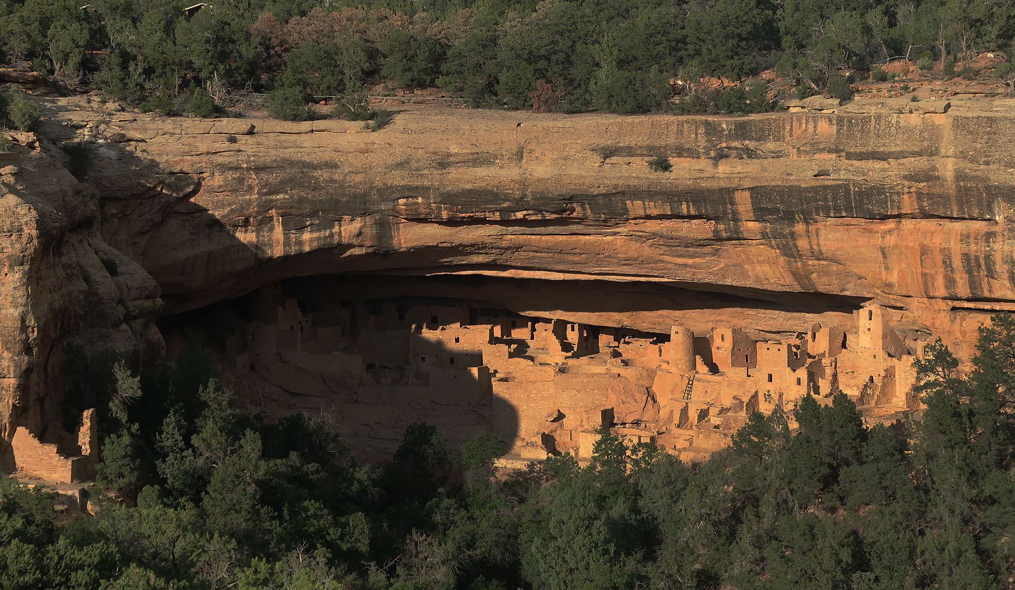
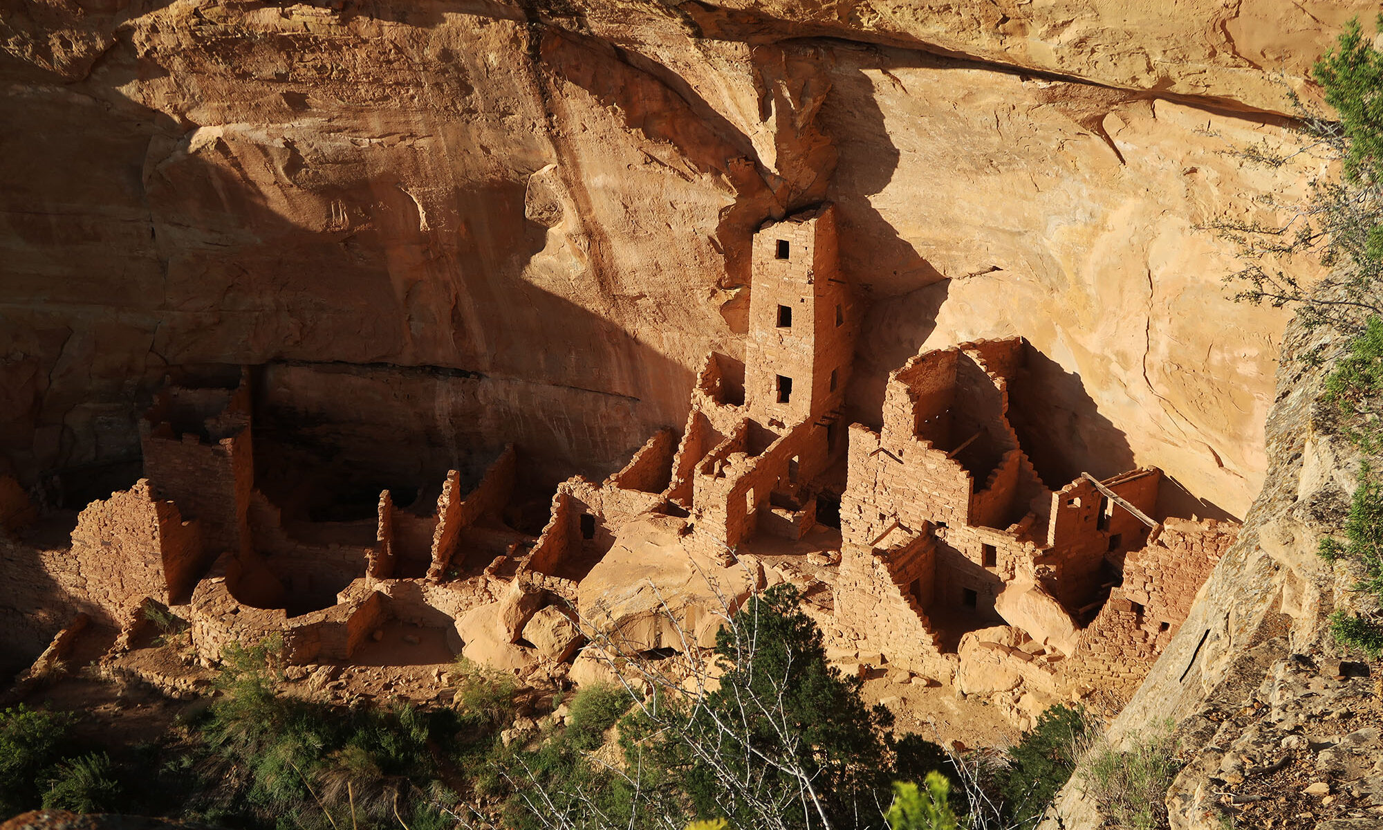
During my recent visit to Mesa Verde National Park, I took a ranger-guided tour of Square Tower House. The “house” consists of a set of stone dwellings built into a cliffside by the ancestral Puebloans. The park contains roughly half a dozen major dwelling sites periodically open to the public in some fashion. Square Tower in particular features the tallest ancient structure in the park.
Continue reading “Square Tower House (Mesa Verde NP)”