
April 15, 2023
Where Maryland meets West Virginia
I sped along the country roads of West Virginia, having just visited the state’s highest summit. I came to a seemingly unremarkable bend in the road, along US 219. A small green sign announced its relevance: “Maryland’s High Point”. I had reached the trailhead.
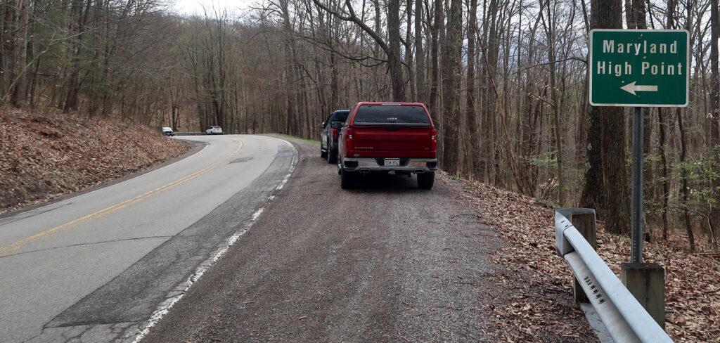
The odd part? I was still in West Virginia. Maryland boasts the only state high point most easily accessed from an entirely different state. Prior to the week of my hike, I hadn’t even realized Maryland borders West Virginia. And yet here I was, 150 miles away from Baltimore, along the bounds of perhaps the nation’s weirdest-shaped state.
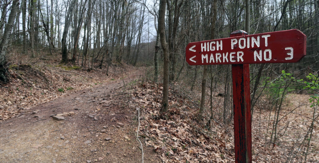
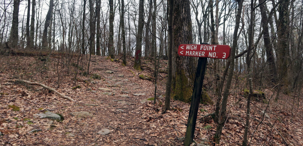
I began up the trail, an old dirt road marked by red wooden signs and spray-painted trees. The density of signage and spray paint was … less than idyllic.
Backbone Mountain
Of the numerous Appalachian state high points, Maryland’s ranks among the dinkiest. Hoye Crest is not a true “summit” by any reasonable standards. Instead, it’s a minor bump along the 39-mile ridgeline known as Backbone Mountain. Backbone Mountain stretches into West Virginia, reaching notably higher elevations. The high point sits less than 300 feet from the border. It’s one of the numerous high points dangerously close to the border of more mountainous states (e.g. OK, NJ, CT, NV, KS among others).
Circumstances like this remind me that state high points are somehow both perfectly well-defined and yet still entirely arbitrary.
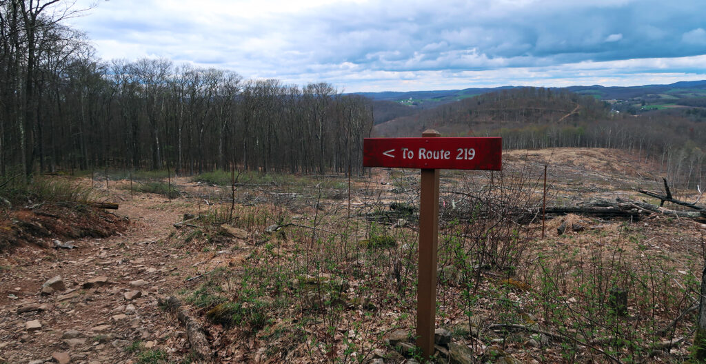
The trail rose along a large fenced-off clearing. Some sort of housing development would soon be built alongside this path. I stared across the clear-cut hillside and then back at all the red spray paint on the trees. “It’s giving FernGully,” I thought.
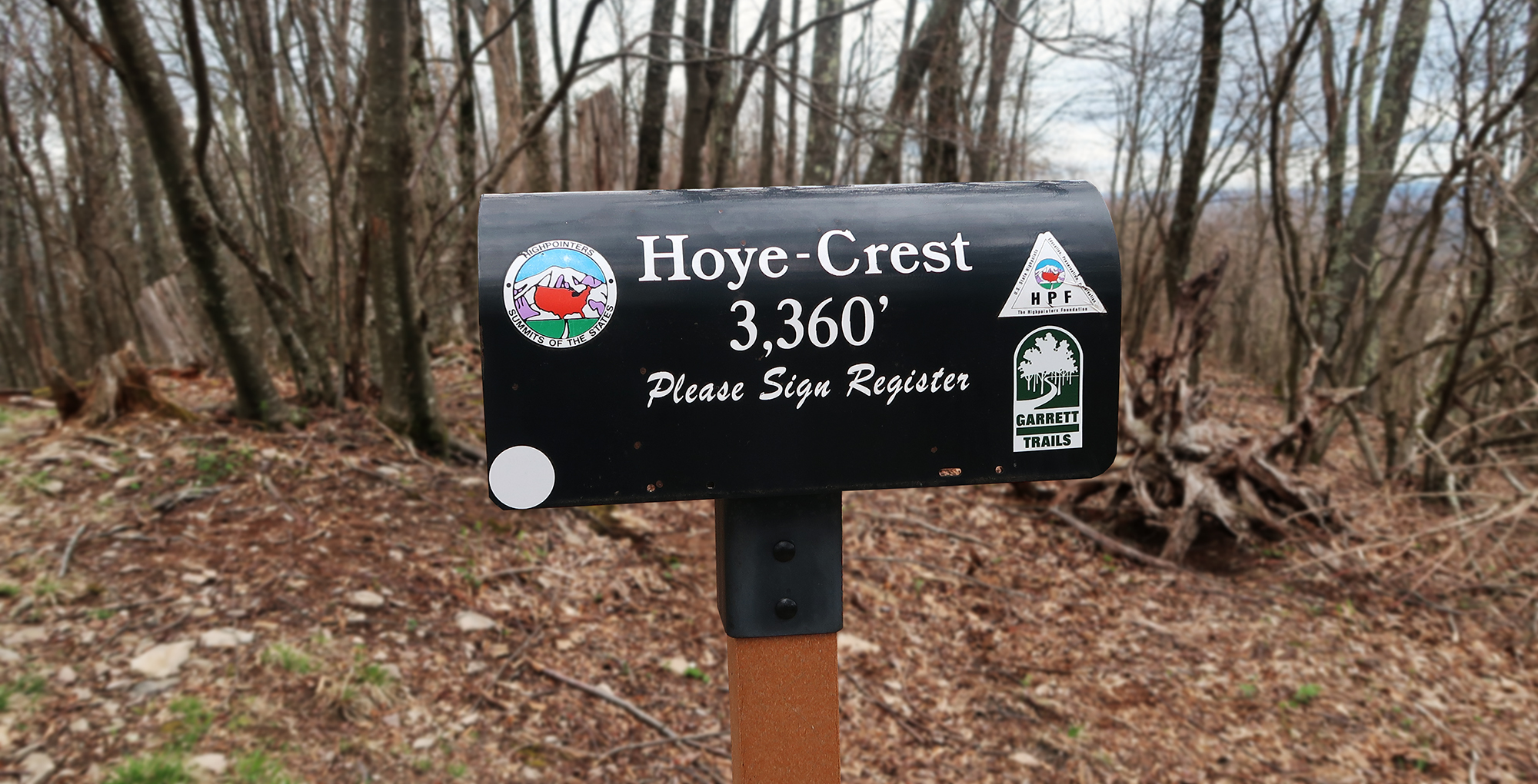
Hoye Crest
The trail rises roughly 700 vertical feet along its one-mile course. All but the final 500-ish feet lies in West Virginia. McMansions sit along the ridge on the Maryland side, accessed by seemingly private roadways. It’s interesting to consider, of these two states, the reliably liberal of the two blocks access to its own highest summit.
In short order, I reached the high point. Here I found a nice bench, historical signage, and a mailbox with a registry. Not too shabby.
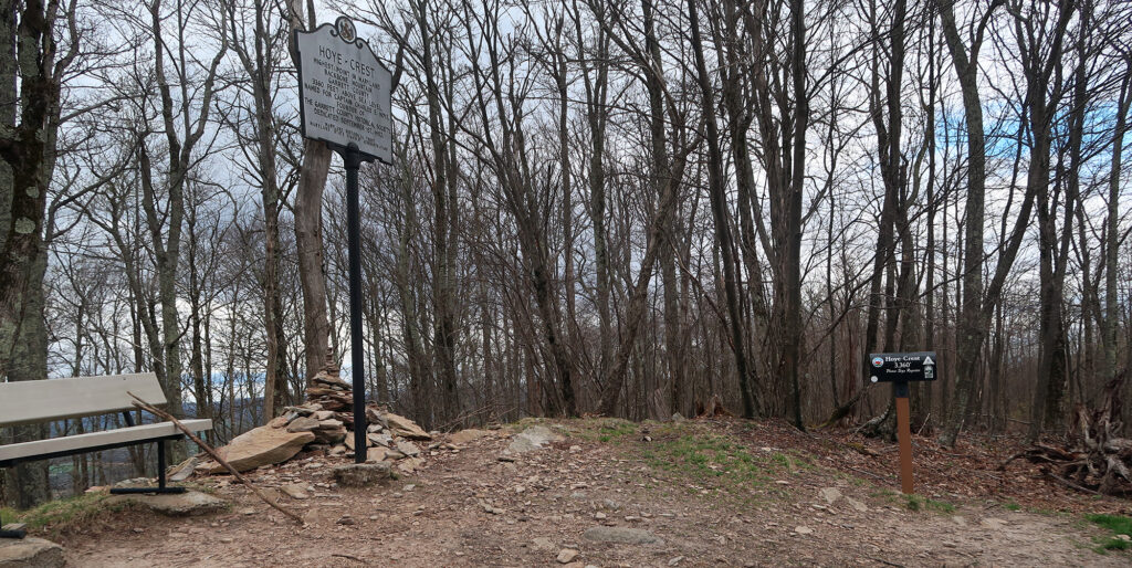
Through the bare trees, I gazed out at the ridge and valleys endemic to the central Appalachians. Like the West Virginian high point I had just visited, Hoye Crest sits in the Alleghany Mountains, running inland from and parallel to the Blue Ridge Mountains.
I sat there for a moment, reflecting on the sheer absurdity of my efforts. Then I picked myself up, and began back down towards the trailhead. There was yet another state high point on my agenda that day. And the goal was to return to Pittsburgh, my point of departure, before sunset.
