
October 7, 2017, Round Pond
Elk Lake and the Dix Range
In the Fall of 2017, I undertook my second backpacking adventure in the Adirondack high peaks. The plan was to case the Dix Range, five peaks within the former Dix Mountain Wilderness area. (The area has since been absorbed into the High Peaks Wilderness).
The Elk Lake trailhead provides the most convenient approach to the Dix Range. A private resort owns Elk Lake itself, providing trails exclusive to their overnight guests. That said, they operate under a conservation easement that allows the public to hike across the land on select major trails. Even these trails close during big game hunting season from roughly mid-October to the end of November. From Elk Lake, ambitious hikers can bag all five peaks in a single day.
But I decided to turn this into a three-day adventure. I wanted to see a bit more of the very large Dix Mountain Wilderness area. So I opted to park alongside Route 73 at the Round Pond trailhead. Round Pond lies 4.3 miles northwest of the namesake summit as the crow flies. The small pond sits a solid 3600 vertical feet below the summit of Dix itself.

Arrival at Round Pond
I parked at the still-vacant trailhead and began the short climb from the roadway to Round Pond. A half-mile and 200 vertical feet later, I arrived at the small lake. On a map, round pound looks very close to the state roadway. But in reality, the elevated spot felt surprisingly quiet and secluded.
Brilliant fall foliage appeared in patches of red and yellow around the lake. And dramatic overcast skies endowed the whole landscape with a bittersweet sense of stillness. Apologies for the poetic license here, I’ll just let the pictures do the talking …

I skirted along the northern edge of the pond. Round pond also features some solid campsites. They went unoccupied early on this Saturday of Columbus Day Weekend.
Along the Boquet River
The trail spent the next three-quarters of a mile steadily rising 500 vertical feet. It then entered a secluded mountain valley. Noonmark and Dial mountains rose up to the north and some Dix Range foothills rose to the south. Within this valley, the trail followed the North Fork of the Boquet River. I passed under a mature, deciduous forest sporting gorgeous shades of orange, yellow, and red.
The trail wound its way through flat deciduous woodlands like this for the better part of two miles. The route occasionally crossed the Boquet over various small bridges. I enjoyed this quiet walk through the autumnal hardwoods.
Slides on Dix
Eventually, the trail grew steeper. Soon it opened up onto a minor slide along Dix Mountain’s northern flank. I took a moment to survey the sheer slabs of bedrock darkened and dampened by recent rainfall. Despite its smooth appearance, I found the slabs had good traction. The exception was a narrow area where a permanent stream flowed. Here aquatic vegetation made things super slippery.

Atop this slide, I gazed out over the hardwood forest I had just walked through. Low lying clouds obscured any higher peaks or farther-reaching views.

1500 vertical feet later, the vegetation had turned entirely to boreal, conifer forest. I had essentially hiked into a cloud. Around the 4000’ mark I came to a choice between descending into Hunter’s Pass or continuing to Dix’s summit. I chose the latter, with the vague hope that the clouds might dissipate soon.
Dix Mountain (#7)
This was not the case. I pushed towards the summit and broke out above the tree cover. There I found myself in a thrashing maelstrom of water and fog. The mountain seemed angry! I pulled on a puffy vest, a hard rain shell, and some light gloves. I felt as though I were inside a demonic car wash tunnel. My hands quickly grew cold and numb.
Part of me really wanted to tick off all five peaks of the Dix Range that afternoon. But I decided to wait a day, in case the weather would afford me some beautiful October views. The prior afternoon I had already submitted Cascade and Porter in a cloud. And it didn’t seem right to continue experiencing high peaks in zero visibility.

Descent to Slide Brook Lean-to
I descended the marked trail on the far side of Dix. After passing “the Beckhorn” in dense fog, I dropped down towards Dix Pond and Elk Lake. I would tackle the rest of the Dix Range in the morning.
Back in the trees, the weather went immediately from demon car wash to quiet, misty forest. Soon I dropped below the clouds where only a light rainfall persisted. It’s amazing how weather can evolve so dramatically with just a small shift in elevation and exposure.
Upon reaching the valley floor, I turned south and followed the trail down to the Slide Brook Lean-to. There I set up a very muddy camp for the evening. Despite the weather, myriad other campers had taken the best campsites by the afternoon. I wound up pitching my tent awkwardly close to the trail. I attempted to build a fire, but no dice. Everything was too damp and/or I was too inexperienced. Last I checked, the DEC still allows fires near Dix.
This may sound a little miserable, but I enjoyed my evening. With a hot meal in my stomach I crawled into my tent. I pulled off all my wet clothes and changed into nice, dry sleepwear. I fell asleep to the sound of raindrops on my tent fly.
Heading back onto the Dix Range
The next morning, it was still raining. I decided to sleep in and relax a bit, hoping the clouds might move along. Alas, there was no break in the weather.
Around 10 am I decided to just break camp and get to peak bagging. October in the Adirondacks is really a double-edged sword. You enjoy beautiful foliage and nice cool temperatures. And the bulk of flies and mosquitoes are gone for the season. But the weather seems to break towards clouds and rain far more often.
At any rate, I packed up and departed the Slide Brook Lean-to. Macomb Mountain marked my first target that day. I would approach the southernmost of all the high peaks via its famed slide. The herd path to Macomb Slide proved a bit tricky to locate. But I eventually crossed Slide Brook and found a far more well-worn path. You should, if memory serves, be on the north bank of the brook.
The journey from Macomb to South Dix, Grace, and Hough peaks takes place entirely along “trailless” herd paths. And I felt a bit nervous as to how that’d go. The first stretch to Macomb Slide definitely did involve a bit of wayfinding. But once you’re out of the valley the hardwood forests give way to conifers. And the trail becomes exceptionally easy to follow. It forms a well-worn tunnel through dense greenery.
The Macomb Slide
A bit under a mile and 1000 vertical feet after leaving the valley trail, you come upon the slide to Macomb. This slide formed somewhat recently and covers most of the remaining distance to the summit. Lots of helpful rock cairns helped me decipher when it was time to leave the woods and head up these rocks.

This slide proved both rather steep and full of loose ball bearings. I went slowly with a full pack. I took a bunch of small stops to catch my breath and drink some water. Occasionally, the cairns built by fellow hikers provided hints of when and where to zig zag. Make sure to pay close attention, since you can easily miss some of these smaller cairns.
About halfway up, a couple on a day trip, traveling light, caught up with me. I tried to keep pace with them for most of the remaining slide. It felt a bit comforting to be with other people for this steep and rocky ascent. We would spend the rest of the day leapfrogging each other along the ridgeline.
Macomb (#8)
Though under a half-mile in length, the slide gains another 1000 vertical feet. I’ve always felt vertical rise provides a better predictor of hike time than distance. I can walk a mile down a sidewalk in 20 minutes. But ascending 1000 vertical feet usually takes me 45-60 minutes, regardless of distance.
I walked along the densely forested ridgeline. Eventually, I reached a broad, flat rock that formed the summit. A small, metal, geological survey pin marked the true summit. Severe blowdown on Macomb’s west falk likely provided sweeping views. I suspect this involved a great perspective on Elk Lake and the Colvin Range. All I saw was cloud.
I began the descent from Macomb to the north, along the ridge towards South Dix. The herd path remained easy to follow through dense forest. After descending roughly 700′, I reached the col towards South Dix.
South Dix (#9)
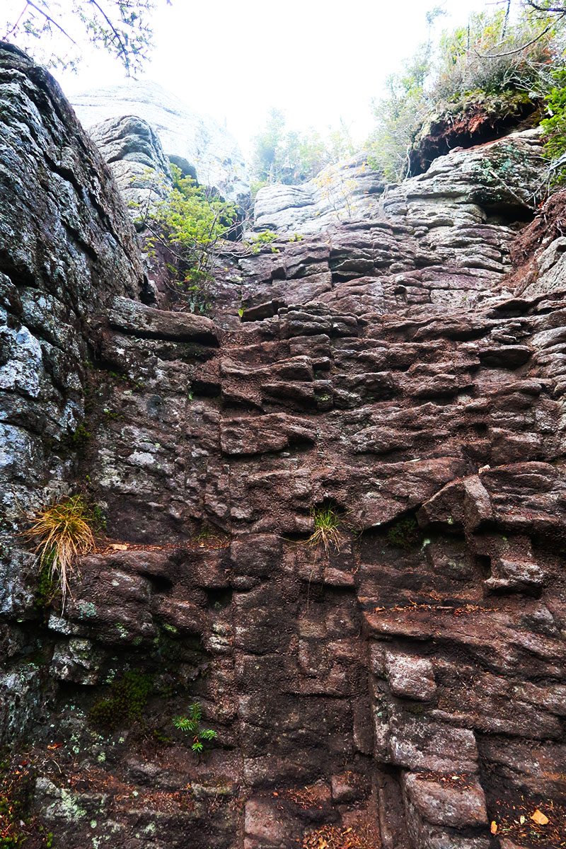
Then began a brief 300’ climb to South Dix. Halfway along, the unmarked trail broke out onto an exposed rocky ridge with a series of ledges. Cairns marked safe passage. I spotted a group of young-ish friends with giant packs also hiking the ridge.
At long last, on the rocky ledges of South Dix, a very strong gust of wind picked up. It served as a massive blow drier for us hikers and all our equipment. And just like that, the clouds gave way to reveal a partial view to the south. What a welcome sight!


The trail continued to a fork. You could remain straight to Hough and Dix peaks or turn right to the true summit of South Dix. I turned right and found the summit area. From there I continued East along a short spur to Grace Peak.
Views atop Grace (#10)
It hiked down and back up 300 vertical feet to Grace, along a well-worn 1-mile herd path. If I were smart I’d of dropped my pack back at South Dix. But instead, I dropped it in the col before the ascent of Grace. I took my water bottle and headed up to the bare rock summit.
Arriving atop Grace, I discovered the winds had carried away even more clouds. I could now enjoy breathtaking views east. I saw clear through the Eastern Adirondacks, towards Lake Champlain, and to the Green Mountains of Vermont. At last some views!


Then it was back the way I came, to South Dix. Then I turned right at the junction, and on to Hough. These peaks were starting to come easy.
Hough (#11)
It climbed a solid 500’ from the col between South Dix and Hough to Hough’s summit. The peak was somewhat forested but had great views of Dix itself. I was struck by how cuspy the main Dix peak appeared. It seemed a fitting flourish for New York’s sixth tallest peak.

It was late afternoon as I ascended towards Dix. The ridgeline curved around a bowl containing a couple of slides. The Beckhorn and the Summit came in and out of view through the krummholz.
Along the Beckhorn to Dix (again)
Although I had passed along the Beckhorn the afternoon prior, I couldn’t see more than a few feet in front of my face. With newfound atmospheric clarity, I saw why this prominent outcropping deserved its own name.

Fun fact of the day: “beck horn” refers to the pointy end of an anvil. And from a topo map, you can kinda see how folks arrived at that name. The rocky outcropping seemed to me plucked straight out of a romantic-period painting.

It was an easy hike/scramble from the Beckhorn to the summit of Dix. I found the views in all directions well worth this second summit. Elk Lake shimmered below a still-brooding atmosphere. I saw the broader Adirondacks, Lake Champlain, and Vermont. Giant and Rocky Peak Ridge in particular stood out from this peak.

Night Hiking to the Boquet lean-to
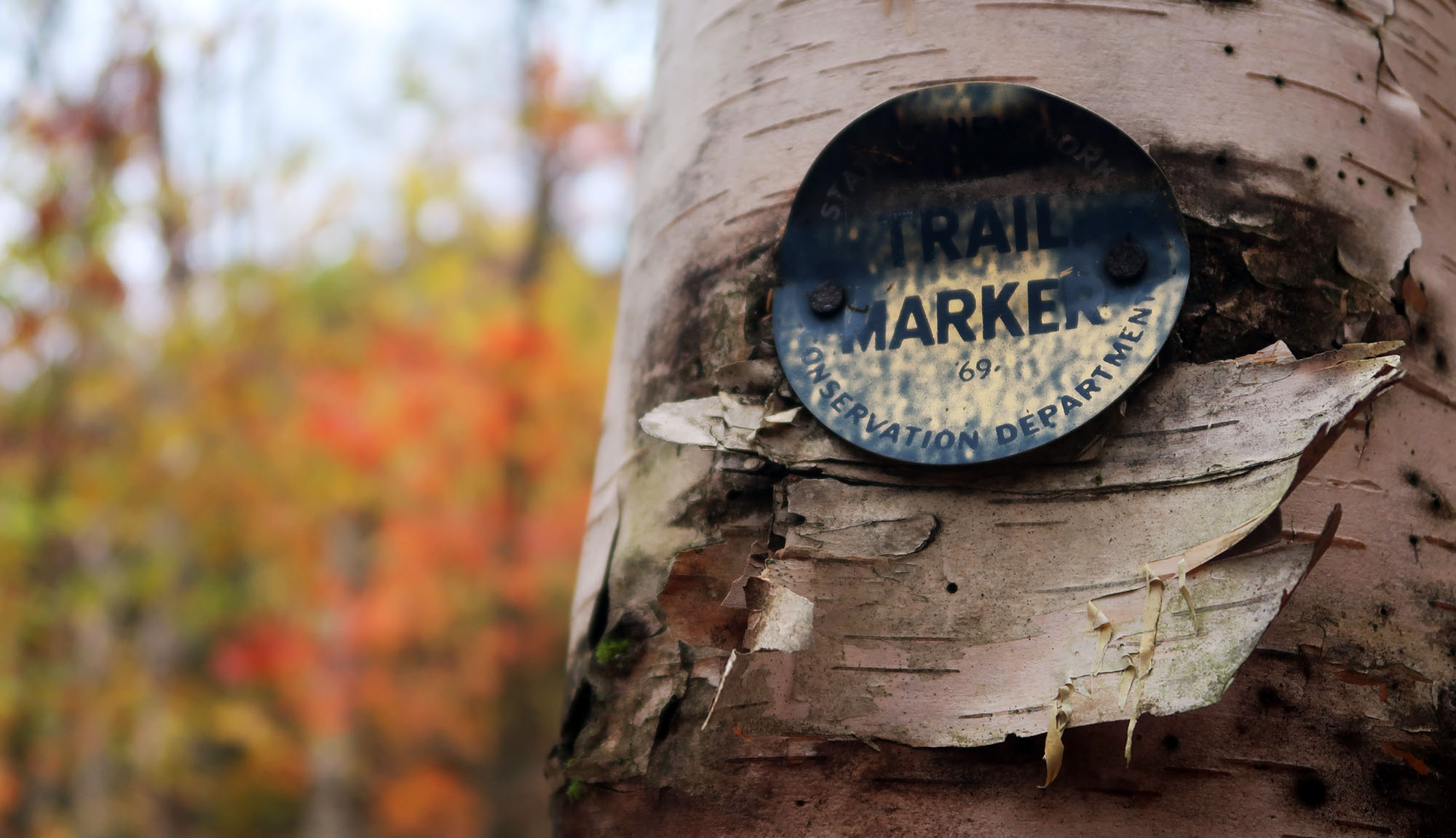
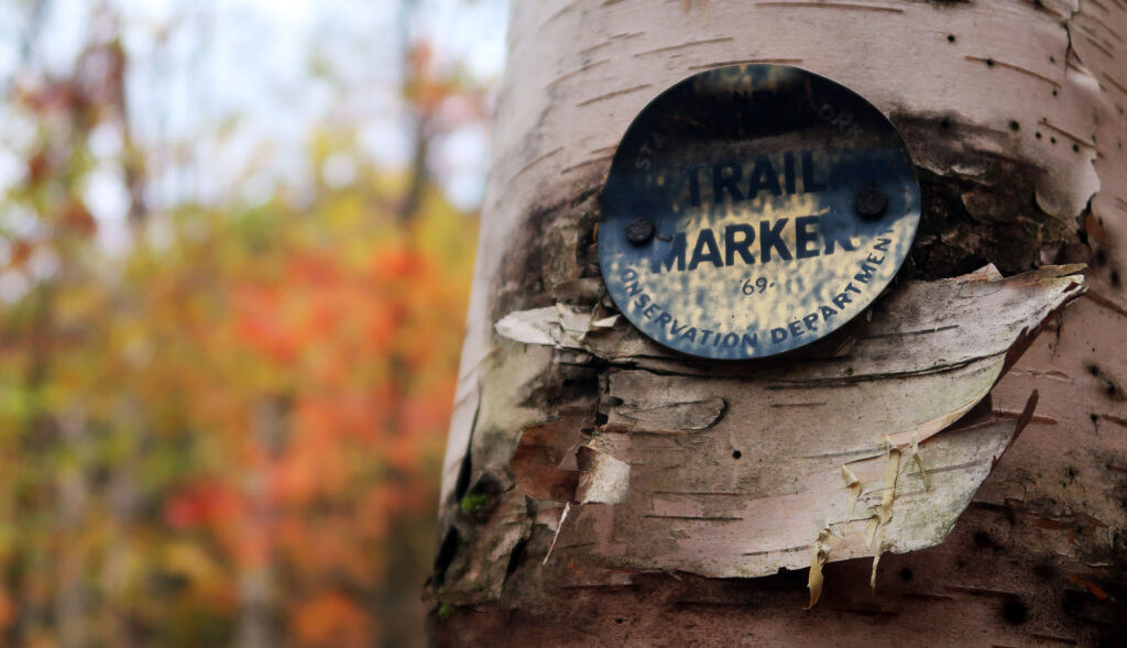
I descended Dix back towards the Boquet River to the north, along the trail I had used the day prior. By the time I reached Dix’s northern slide, night had fallen. My late start combined with shrinking Fall days led to some impromptu night-hiking. Luckily my headlamp was charged and ready to go. And I soon discovered that the DEC trail markers are often reflective, like road signs.
A few miles later, I reached the now-removed Boquet Lean-to. I cannot speak to why this lean-to was removed. But the experienced backpackers who graciously invited me to enjoy their campfire kept going on and on about how bear-infested this area was. They told me the hiker’s log in the lean-to was filled with accounts of bear visits and stolen food.

At any rate, I pitched my tent in the somewhat muddy tent sites beyond the lean-to. The next morning I broke camp and hiked back out towards Round Pond. My adventures in the Dix Range had drawn to a close. It was another fun weekend in the forever-wild Adirondacks.