June 10, 2024
Arrival
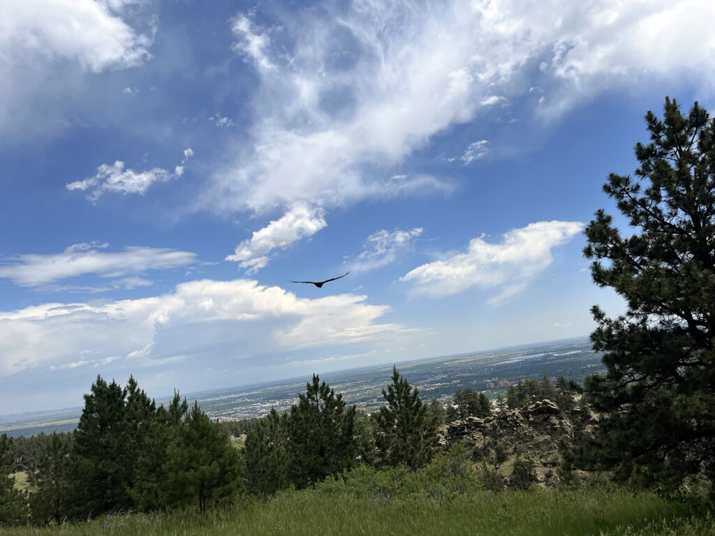
We arrived at the large (and largely empty) parking lot beside the National Center for Atmospheric Research (NCAR). A brutalist research lab rose up on this grassy plateau, surrounded by open rolling hills peppered with tall, sparse evergreens. Behind the lab, rising much higher in the distance, were the southerly rock formations of Boulder’s famed Flatirons. The lot also doubled as a trailhead for recreating amongst these giant rock slabs.
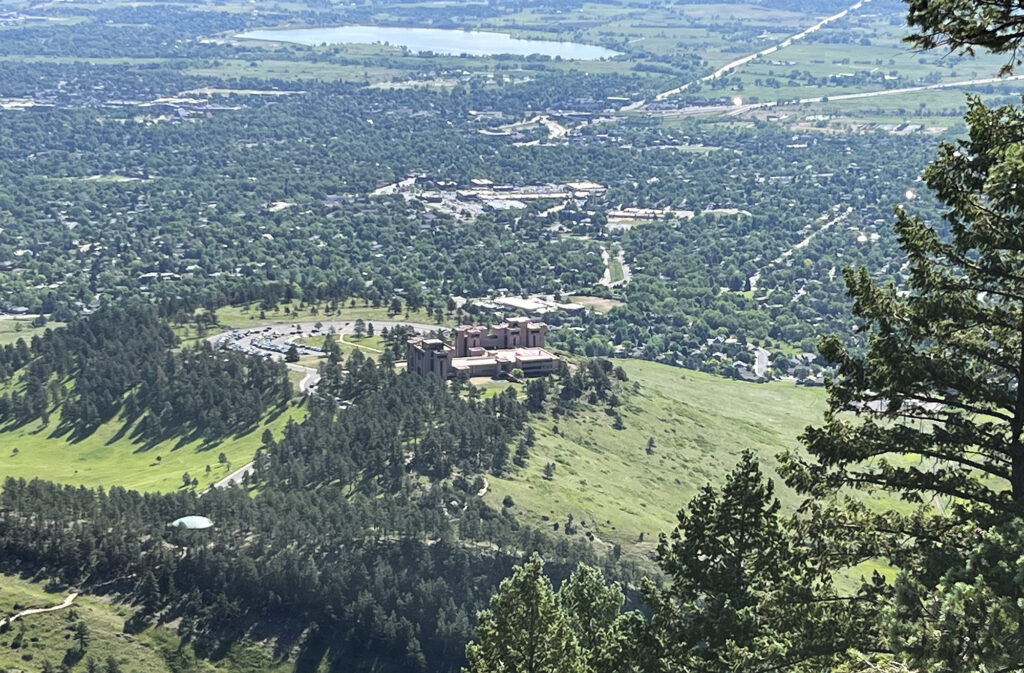
We strapped on our daypacks and set off on the rolling, dirt trail towards the Flatirons. Our mission for the day was to take on some “entry level” Flatiron Scrambles: “Sunnyside II” and “Buckets”. But first there was a traditional hike, rising roughly 500 vertical feet along the Mallory Cave Trail.
We ascended the trail with golden morning sun at our backs, reaching our first rock scramble a bit before 8am. We encountered a handful of other early risers, but mostly had the gently rising trail to ourselves.
The Flatirons
The Flatirons refer narrowly to a set of 5 massive, rock slabs that tower off in the distance above Boulder, Colorado. More broadly, it can refer to an extended smattering of slabby/slanted rock formations West of Boulder. For this introductory adventure, we’d be in the far, southern extent of the formation.
The Flatirons slant at an impressive and imposing 50-60 degrees. They are uniformly aligned, each rising to the West, as if to point towards the high Rocky Mountains hidden behind their towering masses. The alignment was no accident. During the formation of the Rockies (the “Laramide Orogeny”), these rock layers were pushed up from deep beneath the surface of the continent. They represent a layer of Pennsylvanian Rock. They formed roughly 300 million years ago—five times older than the mountains that punched up through them. But they are much younger than the “basement rock” exposed on the highest peaks of the Front Range, like Longs and Grays Peaks.
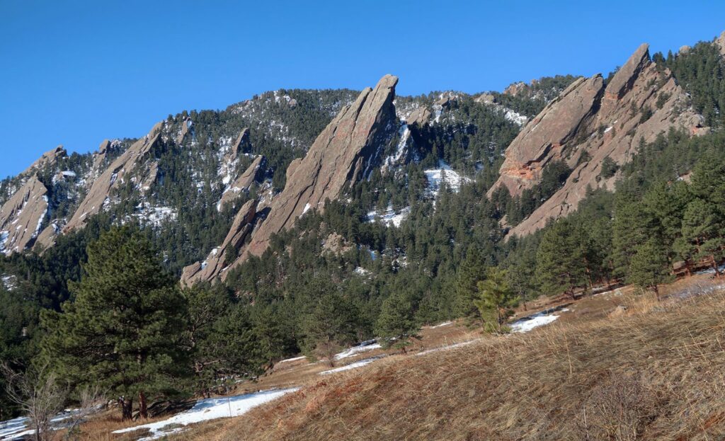
The Flatirons are part of the broader “Fountain Formation” that extends through much of Front Range Colorado and Wyoming. Other famous upturned Fountain Formation rock includes Red Rocks and the Garden of the Gods in Colorado Springs. All three formations sport reddish-hued rock typical of the Pennsylvanian period. 300 Myr ago, the Earth’s oxygen content was dramatically higher, oxidizing iron in rock and lending large swaths of the planet a reddish hue. This period in Earth’s history was replete with tropical forests, and giant insects and amphibians. Pretty terrifying to consider.
Sunnyside II
Sunnyside II is a “class IV” ascent … steeper than a typical ledgy scramble in the mountains, but not quite full-on rock climbing. If that sounds vague and poorly defined to you … yes. The route sits just off the Mallory Cave Trail, and runs up a rock formation called “Der Zerkle”.
I stared up at the route, with a mix of dread and disbelief. The “scramble” looked more like a full-on rock climb, just angled at 50-60 degrees, rather than straight up. “So this is Class IV”? I thought. This was the realm of no-fall-zones.
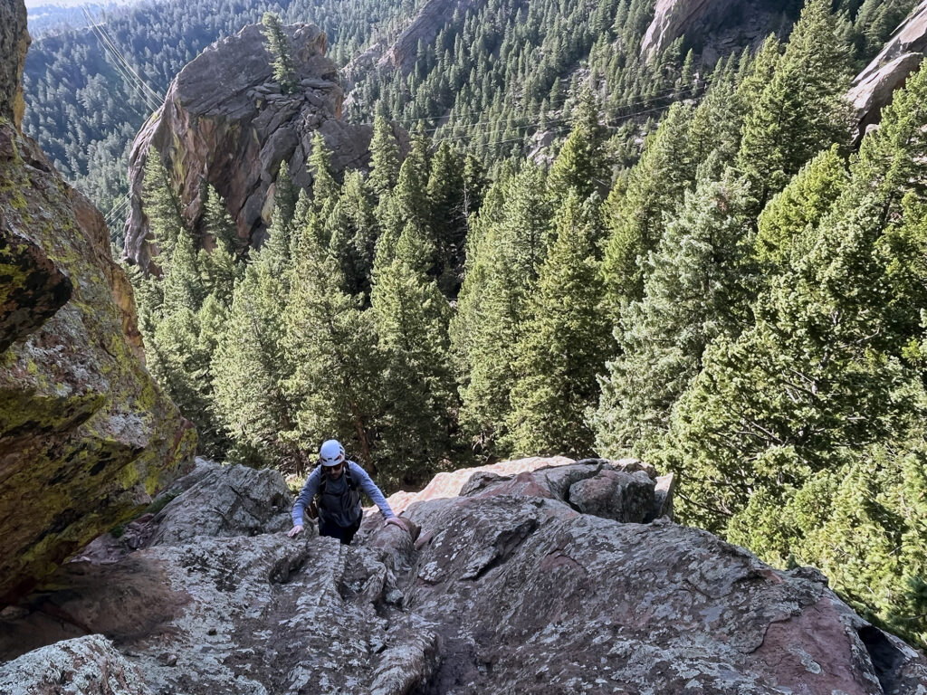
Around the time my buddy and I reached the base, a large group also arrived. It was an outing of the Colorado Mountain Club (CMC) and we actually knew some of the folks in the group.
The only thing scarier, in my mind, than scurrying up the giant slab of rock in front of me was having to do so in a traffic jam, behind a bunch of other climbers. So I stopped thinking and just started to climb.
Ascending Sunnyside II
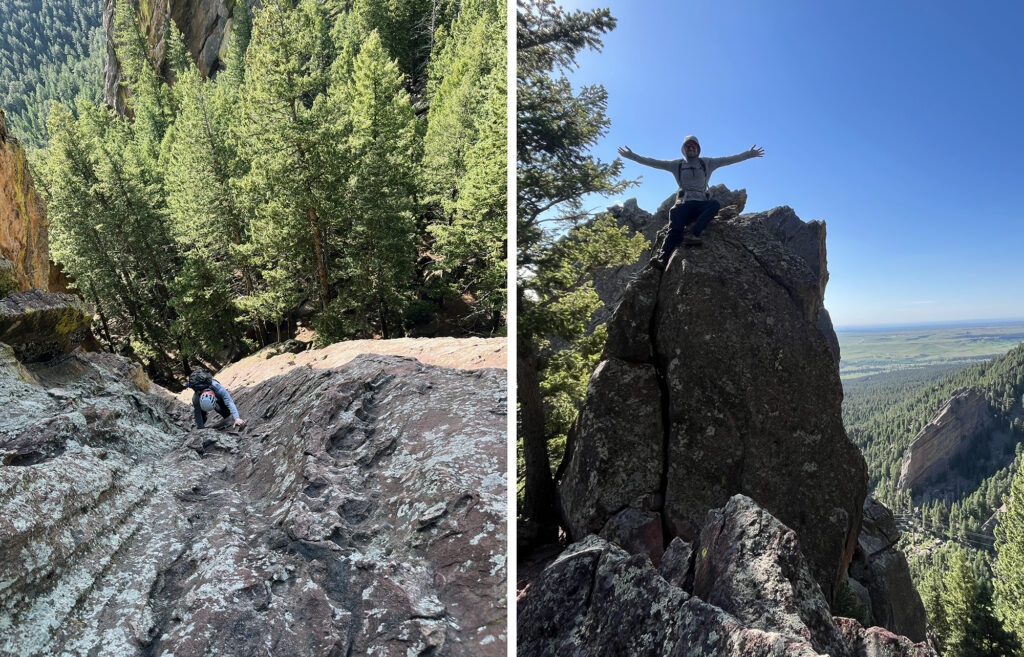
The holds were large, numerous, and obvious. And the rock was grippy. About halfway up, I reached a short stretch that grew even steeper. The holds were almost like a ladder, and I thought to myself “oh man, this is just straight up rock climbing”. I tried traversing sideways to “get off” the feature. But soon I realized the formation ended to the left in a sheer drop. It was up or down. Sideways was not an option.
I returned to the somewhat obvious route and continued ascending. Soon enough I reached the top, and safety. There was a lot of adrenaline coursing through my veins at this point. My heart beat fast, but I was back on terra firma.
A gateway to scrambling
How did I get to this slightly crazy point? It began with a book.
After moving to Colorado, I began a mission to summit every Fourteener in the state. There are 58 such peaks, and I had thus far climbed 44 of them. Of the remaining 14 most were highly technical (Class III and Class IV ascents). Before attempting, say, Capitol Peak, I wanted to gain more comfort with scrambling.
And so I started researching non-fourteener scrambles. These were appealing for a few reasons. First, fourteeners take a lot of time and effort. You spend most of a day or weekend ascending 3000-6000 vertical feet. Most of that time is spent on non-technical trails. And my remaining fourteeners were mostly far away, in the San Juans. Second, there just aren’t that many of them, and very few that serve as a “bridge” to technical climbing. They go from straightforward hikes to deadly peaks pretty rapidly. And third, in early June, most of them were still covered in snow. The Flatirons by contrast had reached dry, summer conditions.
So I picked up the somewhat deceptively named book The Best Flat Iron Scrambles. I say “deceptive” because in my mind—in most peoples’ minds?—scrambles are Class III and IV routes. Things like Katahdin or the Wetterhorn. But this book turned out to be almost entirely low fifth class ascents. These were routes, like the Freeway, that some reasonable people would describe as “free soloing” rock climbs. Sunnyside II was one of just a couple Class IV routes in the book. So I figured, well, I’ll start with that.
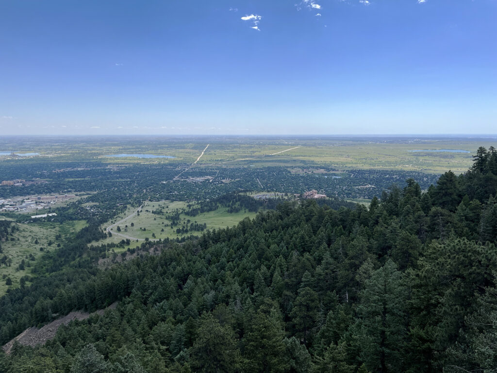
More Hiking
After summiting Sunnyside II, my friend and I stayed to chat with some of the CMC folks on the group outing. He was way more keen than I was on this whole “scrambling” thing. And so he eventually convinced me to give it a second try. And a third. I could feel my brain slowly re-normalizing to the concept of class IV slab climbing. Yes, tripping and falling would likely be lethal. But that just means you need to spend the 10 minute climb being extra careful. Right? Right.
My original proposal for the outing was just Sunnyside II. A brisk hike, a scramble, a descent, and lunch. Clean and simple. But my friend was keen on trying another “Class IV” scramble somewhat nearby called Buckets. So we headed that way.
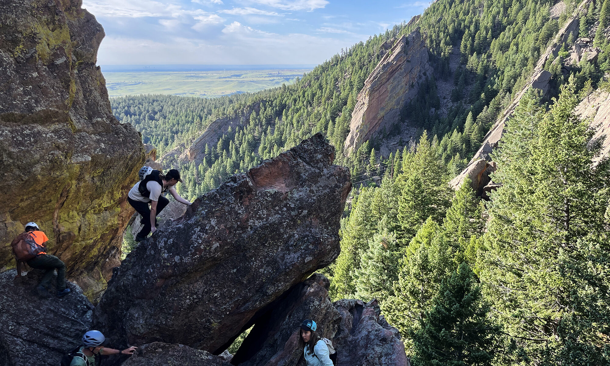
To get there, we ascended an unlabeled herd path in a ravine beneath the wildly popular Royal Arch formation. In fact, most folks reach Buckets via that trail. There were some other folks out scrambling on nearby spicier routes, like “El Camino Royale”.
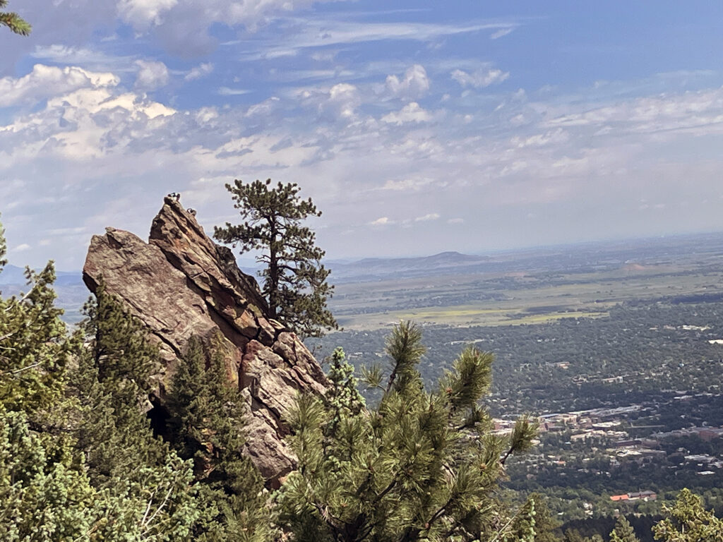
Onward to Buckets
En route to buckets, we first climbed a nearby shorter formation called the “Amoeboid” which is fortunately easier to climb than spell. The route looked very easy from the bottom, but got slightly steep and slabby near the middle. This was a good lesson in a core principal of staying safe in the mountains: looks can be deceiving.
From there, we continued on the herd path to the base of buckets, and looked up at a route that was steeper, longer and scarier than Sunnyside II. Wonderful.
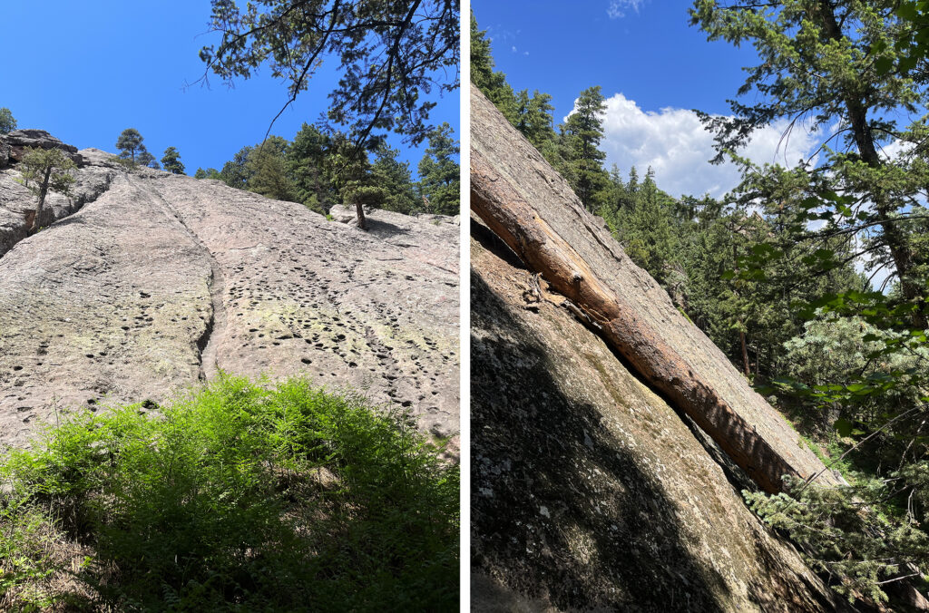
The route began with what the book called “fantastic buckets” … basically foot-sized divots in the rock. This made for very straightforward climbing. But they grew smaller and shallower as we went higher.
We made our way up the route, slowly but surely. This definitely was a step up from the prior route.
Topping out Buckets
Eventually I drifted into a channel in the rock to the right. It felt safer to me. But towards the top I realized the tradeoff of this was a very smooth slab traverse off the route. This was definitely the highest-adrenaline moment of my day. I was putting a lot of faith in the static coefficient of friction between my rubber soles and the rock.
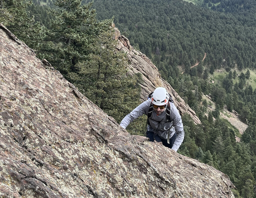
I reached a flat enclave, coated in a bed of pine needles. I sat down to just sort of decompress and let my brain spin down a bit. There was a short scramble above this part, but from here we were largely in the clear. My friend eventually appeared as well. Second moment of big relief. I hope he didn’t follow my improvised beta!
We descended the dirt trail just off to the south of the formation. A big selling point of these flat iron routes was that often you could walk right off the slab or do a quick rappel to safer ground. And in this case there was no need to descend the same route—thank god. Later I would google Buckets and discover many folks consider it Class 5. I had inadvertently just done my first “free solo”. Hardly the Dawn Wall, but still. I considered writing a strongly worded letter to the author of The Best Flatiron Scrambles.
At any rate we were safe and felt quite accomplished with our day. We began the hike back out to the lower rolling slopes, and back to the NCAR trailhead.

Enjoyed reading this. Agree, the local vernacular for ascending Flatirons is somewhat unique. A more precise term for the 5.0 and above routes is for sure Free Soloing.