September 9, 2023
Fall in the Sawatch
Just north of Poncha Springs, I pulled off US-24, down a series of dirt roads towards the Mount Shavano trailhead. Around 5 am, I donned my headlamp and set off down the trail towards the summit.
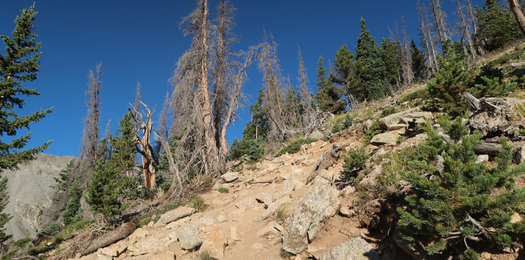
Like other Sawatch 14ers, the journey to Shavano and Tabeguache begins on the Colorado Trail. This rolling-to-flat section proves brief: just half a mile in, the summit trail branched off upslope. Then began a series of well-maintained switchbacks to treeline.
Fall had arrived in earnest and the days were growing shorter. Roughly 90 minutes into my hike, direct sunlight finally arrived on the lower slopes of Shavano. From the looks of it, my adventure that day would involve classic September weather: blue skies, warm sun, and crisp air. It’s probably my favorite month for these kinds of hikes.
Angels and Demons Talus
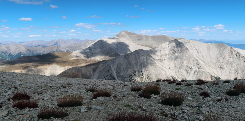
Roughly 2200 vertical feet into my day (two hours, at my pace), the trees stopped and I had a head-on view of the “Angel of Shavano” basin. In spring time, deep snowpack lingers in this area, forming a sort of humanoid figure of a woman with her arms stretched up in exaltation. It looks a bit more Emmy-award than eclesiastical in my opinion. But by September the snow had entirely vanished from this area.
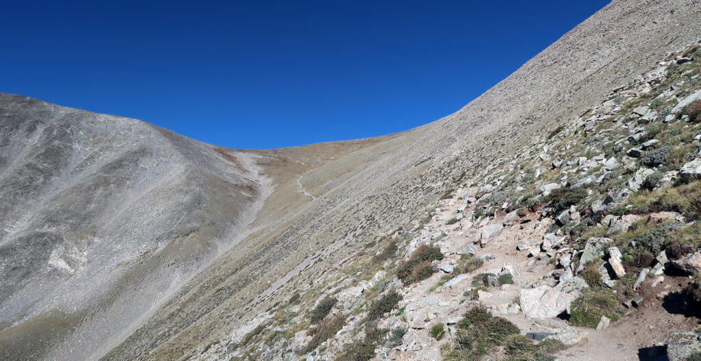
The trail ramped across the angelic talus field, towards a minor saddle near 13,000 feet. The Angel of Shavano forms a very popular ski descent in spring time. I had assumed it was a crazy steep couloir (the sort of extreme feature crazy Coloradans love to throw themselves down). But this slope maxes out around 40-45 degrees, making it more akin to the Highland Bowl than the Cross Couloir.
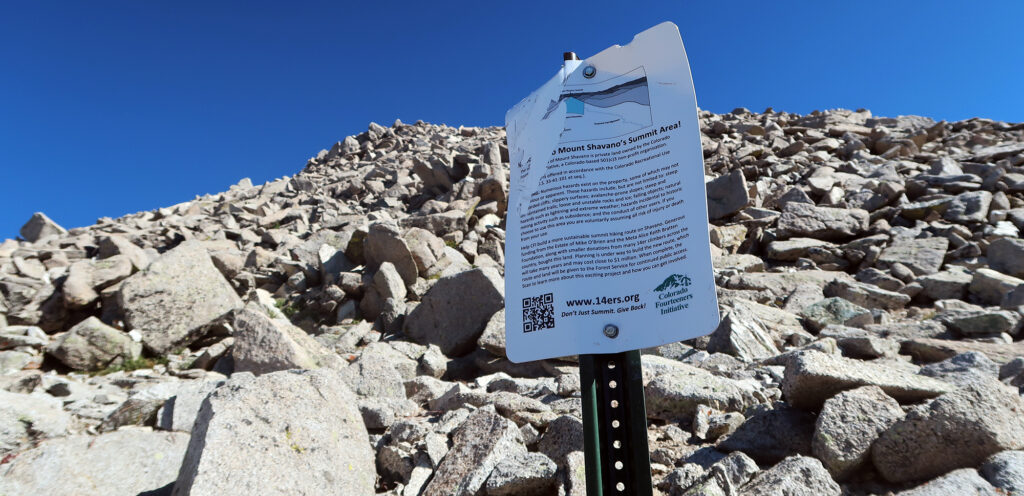
About an hour later, I reached the summit area. A metal sign announced I was entering private land, helpfully bought by the Colorado 14ers Initiative. Perhaps a dozen 14er summits sit on private land or require crossing private land to access. Two peaks—Mount Lindsay and Mount Bross—have been closed off for years. Others, like Lincoln and Democrat, open and close haphazardly. Thanks to the 14ers Initative, Shavano access is no longer subject to the vagaries of property owners.
Mount Shavano
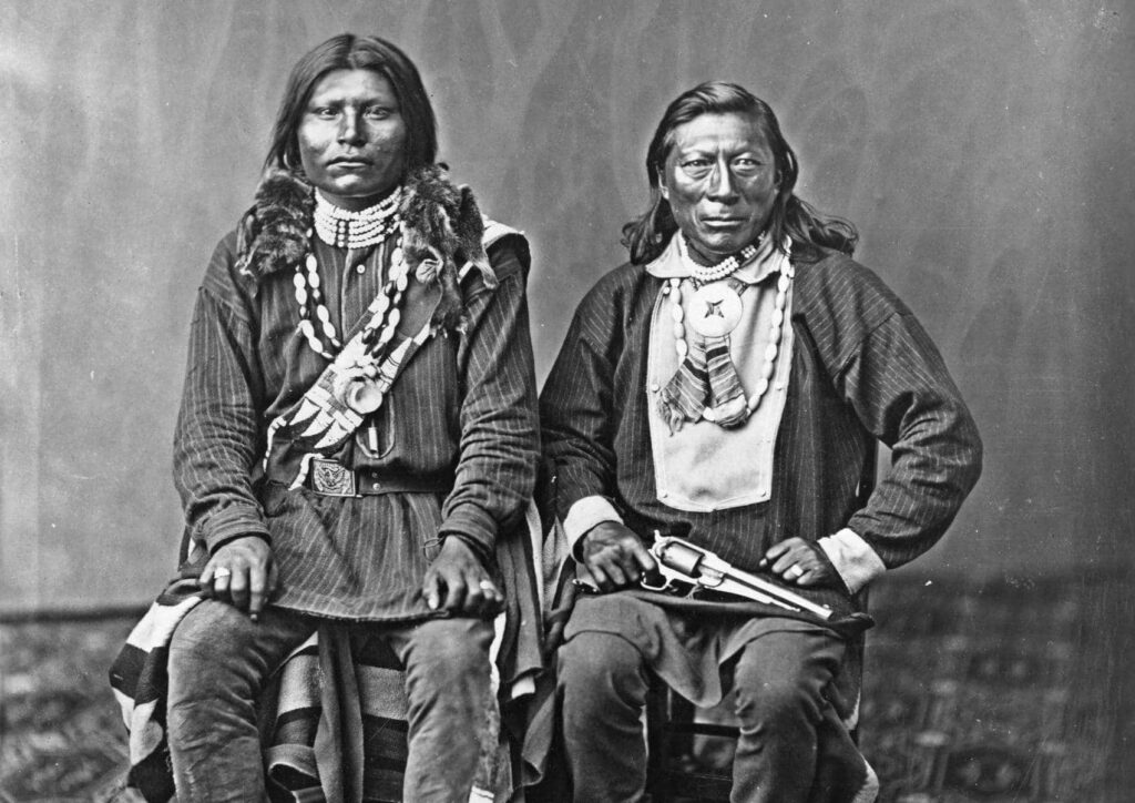
Mount Shavano bears the name of Ute Chief Shavano, a native leader who resisted white settlement in Southwestern Colorado but was ultimately forcibly moved to Utah. This makes both Shavano and Tabeguache among the few Colorado 14ers named for American Indians. Nearby Mount Antero (another 14er) and Mount Ouray (a shorter peak) likewise bear the names of Ute Chiefs.
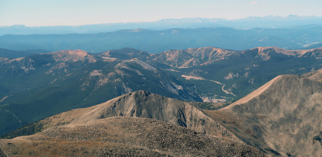
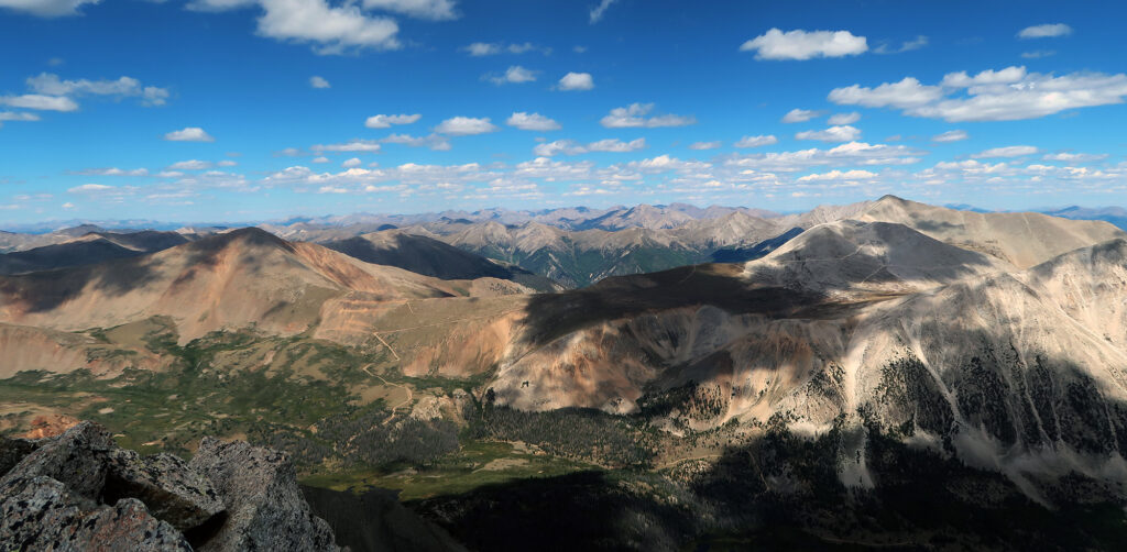
I reached the summit where a small group of day hikers had already begsan congregating. The day was warm and sunny, and so we could relax and recuperate. I surveyed the scene of the southernmost Sawatch 14ers. In the distance, to the south, I saw the road winding over Monarch Pass, and the Monarch Ski Resort trails above it. There are just two ski resorts in the mighty Sawatch Range (Monarch and Beaver Creek), and they lie at opposite extremes. Most of the range is protected by wilderness designations.
I snacked and rested up for the next leg of the journey: traversing between Shavano and Tabeguache.
Traversing between Shavano and Tabeguache
Tabeguache Peak lies just northwest of its parent peak, Mount Shavano. The spur trail runs roughly a mile each way, and round-trip adds roughly 1100 vertical feet on top of Shavano’s 4500′ ascent. That makes for over a mile of vert in total—a big day, though perhaps standard fare by Sawatch standards.
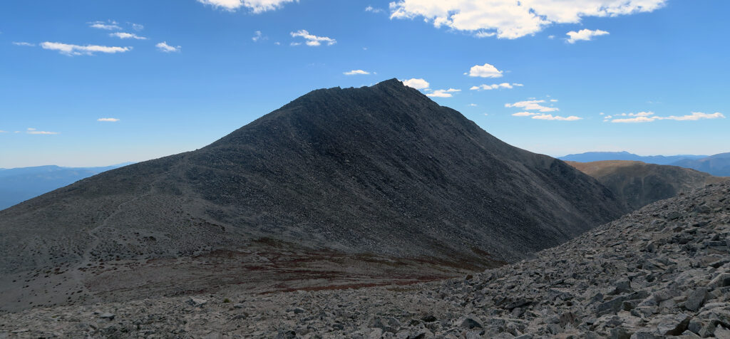
From the top of Shavano, I began an annoyingly long and annoyingly flat traverse, balancing on large chunks of talus. But before long, the descent began and something resembling a trail slowly formed. The ascent to Tabeguache proved both shorter and more sure-footed.
You can directly ascend Tabeguache via an alternate route. The trailhead for this approach begins much deeper into the Sawatch, along a road requiring high-clearance 4WD. But most folks just grab it from Shavano as a two-fer. Gotta save vert wherever you can!
Tabeguache Peak
The Tabeguache (pronounced TAB-a-watch or TAB-a-wash) were a band of Ute people who lived in southwestern Colorado, near present-day Montrose and Gunnison. The name may mean ‘people who live on the sunny side.’ On this sunny September weekend, the name samed appropriate for their namesake peak!
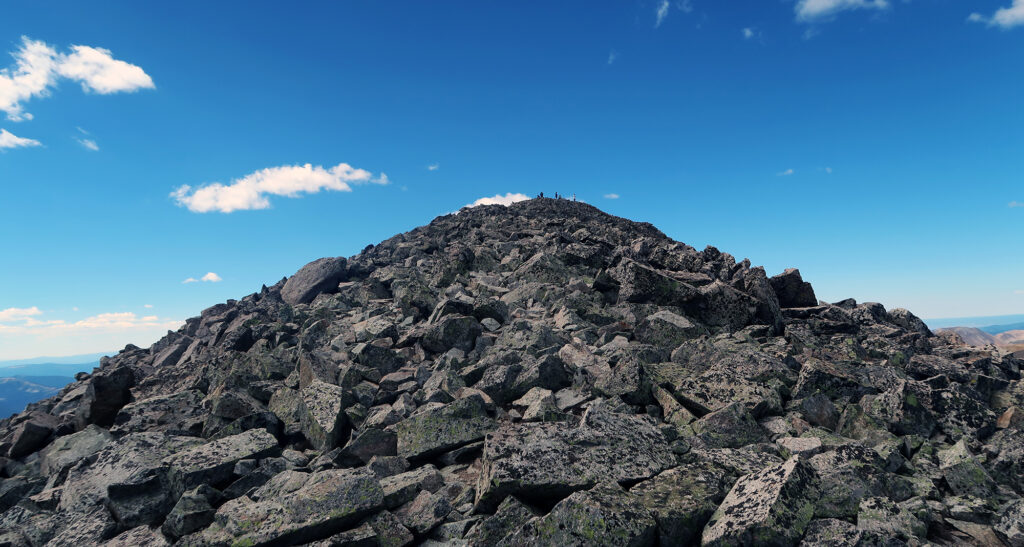
I sat on the peak and enjoyed some summit snacks. There was still the annoying business of re-summitting Shavano. That last 700 vertical feet clouded over my otherwise celebratory mood. But with gorgeous weather and gas in the tank, it was hard to get too bummed about it. I gazed north towards Mount Antero, spotting all the crazy jeep roads zig-zagging about its slopes.
The Return Journey
Then it was down to the col, and back up over Shavano. I tried to shave off the summit with a bit of contouring around the talus slope. This was a complete waste of time, since steeper slopes basically forced me back onto the summit. But we do what we can.
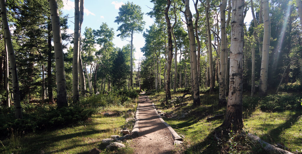
The trail down Shavano was far more pleasant. It soon turned back into a level route on packed dirt, with ample switchbacks. Before long I was back to the Colorado Trail, bumbling through aspen groves in the late afternoon. It was a gorgeous end to a gorgeous day.