
March 9, 2025
Late Winter on the Western Slope
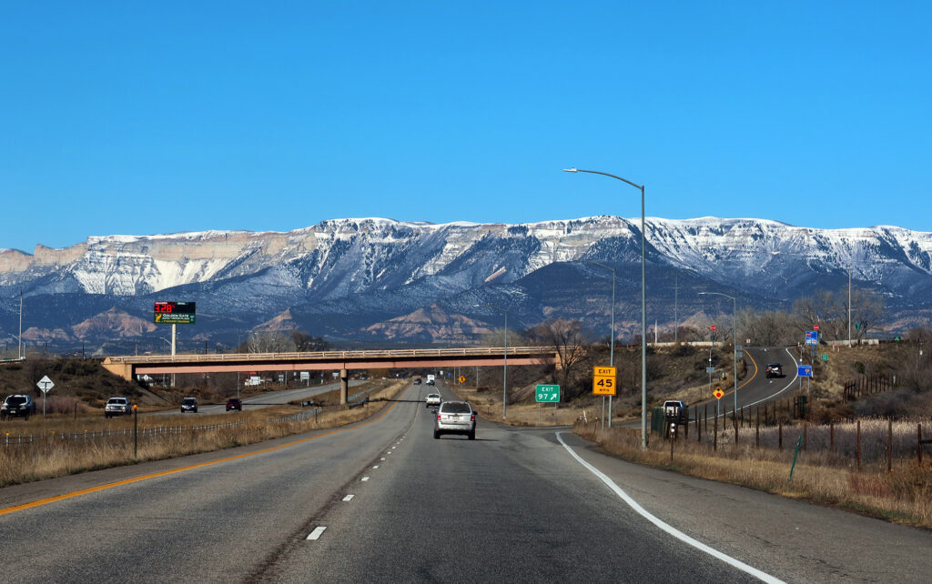
I zipped along I-70 West, through Glenwood Canyon and Glenwood Springs, following the Colorado River downstream towards Rifle. The night prior, the umpteenth winter storm had pummeled the High Rockies, dumping powder on its 14ers and ski slopes. But I was in the mood for a “normal” hike on firm soil.
Luckily you can find almost any conditions in Colorado in March. You just need to pick the right altitude. And Rifle, ~5,500 feet elevation, would provide some snow-free recreating.
Arrival
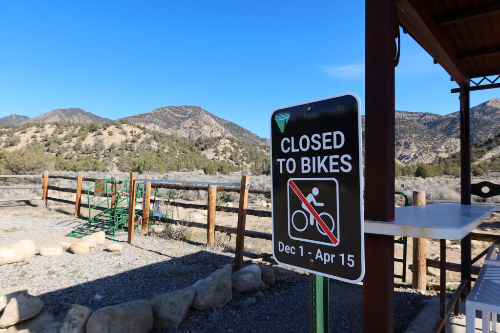
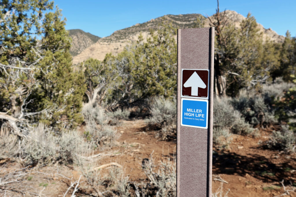
From the interstate, I headed northwest on “Government Road”. A few miles from town, I reached the trailhead. The Rifle Arch trailhead welcomes both hikers and mountain bikers, boasting a recently-built “Grand Hogback” network of flowy MTB trails.
While I love mountain biking, I definitely don’t enjoy hiking on trails with heavy MTB traffic. Luckily, the hiking trail to the arch itself is fully separated from the MTB trails, with only a few well-marked, occasional intersections.
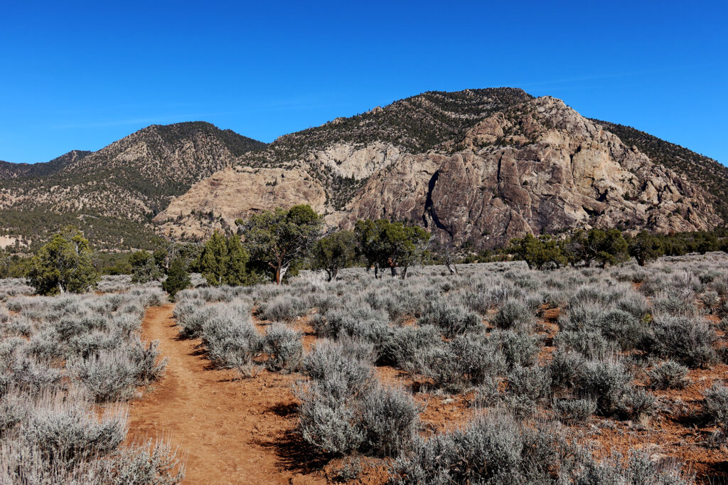
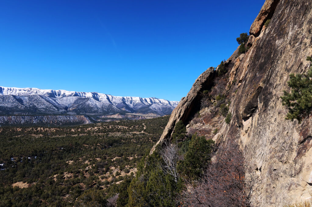
I set off down the hiking trail. The first half mile features a moderately steep ascent onto a broad plain roughly 200 feet above the roadway, but well below the Grand Hogback. It then runs roughly flat, crossing a field of sage brush and sparse pinyon pines, dipping across a small wash en route.
The Grand Hogback
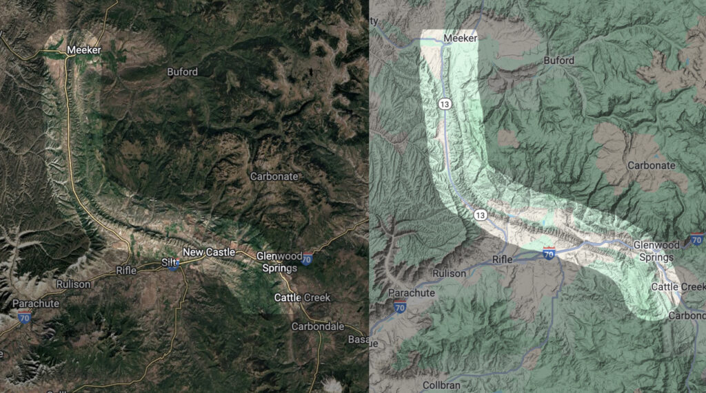
Rifle Arch protrudes from rock cliffs on the southwestern flank of the Grand Hogback. Geologists consider the hogback to mark a 70-ish mile stretch of the boundary between the Rocky Mountains, to the East, and the Colorado Plateau, to the West.
During the formation of the Rockies, ~70-50 million years ago, the uplift caused layers/strata of rock along the present day hogback to tilt steeply upward. Millions of years of erosion peeled back weaker rock layers, leaving exposed beautiful striated bands of tougher rock, most notably the resistant sandstones of the Mesaverde Group.
You can see the full extent of the hogback on topo maps, stretching from the northeastern edge of the Roaring Fork Valley, crossing I-70, tacking west, to the north of Rifle, and then turning north towards Meeker and beyond.
The Grand Hogback has an Eastern counterpart of sorts, though it’s composed of different rock layers. Interstate 70 crosses an even longer hogback, known as the Dakota Hogback, on its path from the Denver Metro into the foothills, on the Eastern edge of the Rocky Mountains. The Dakota Hogback stretches (albeit discontinuously) from Northern New Mexico to southern Wyoming.
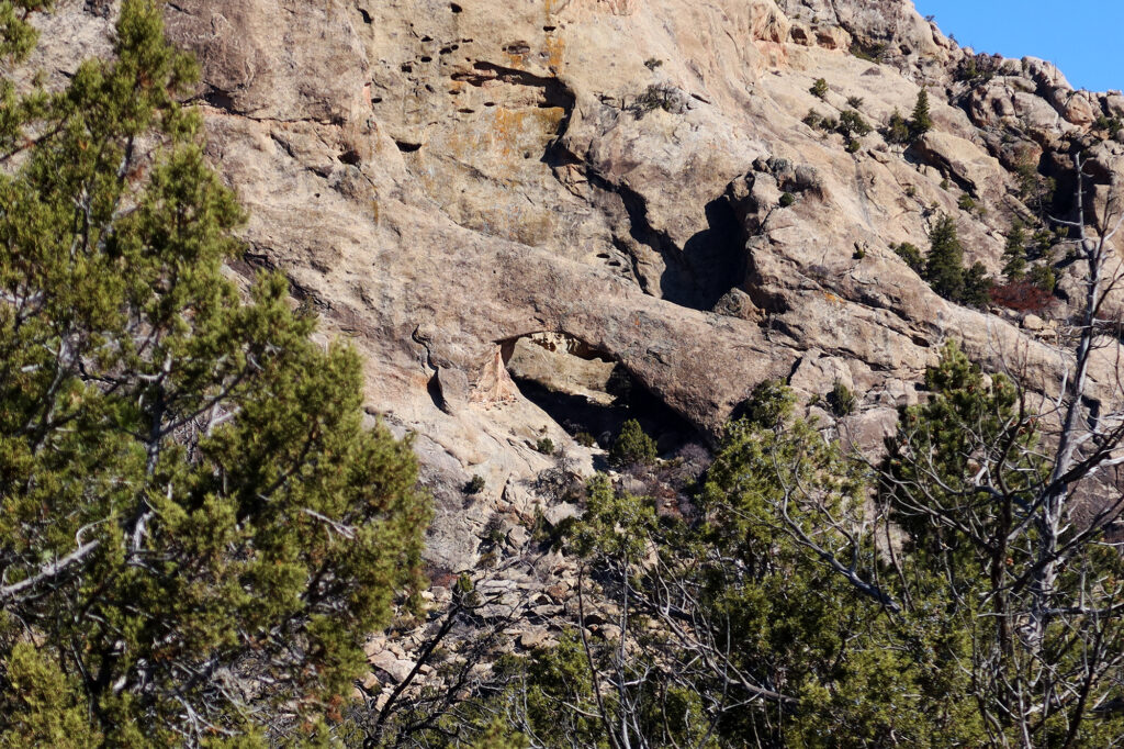
Approaching Rifle Arch
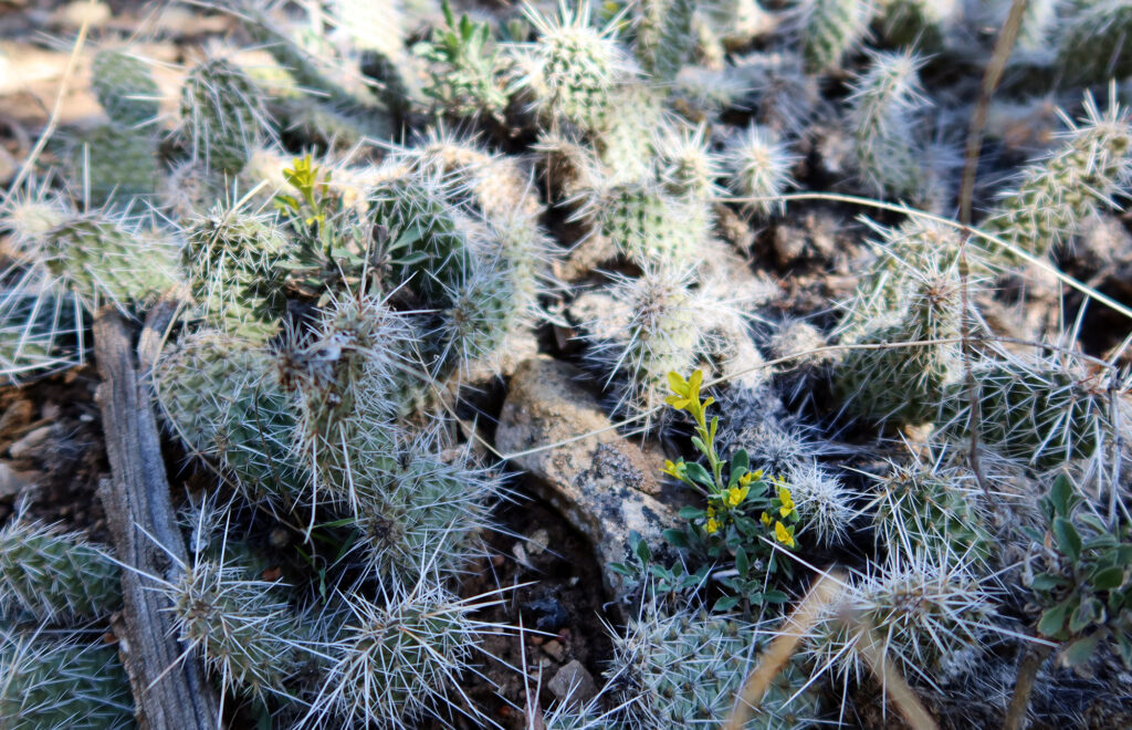
After roughly a mile, the trail dipped into the shadow of the hogback, with Rifle Arch and its surrounding cliffs looming above. Beneath the shade of taller pinyon, I saw an interesting mix of cacti and early spring flowers.
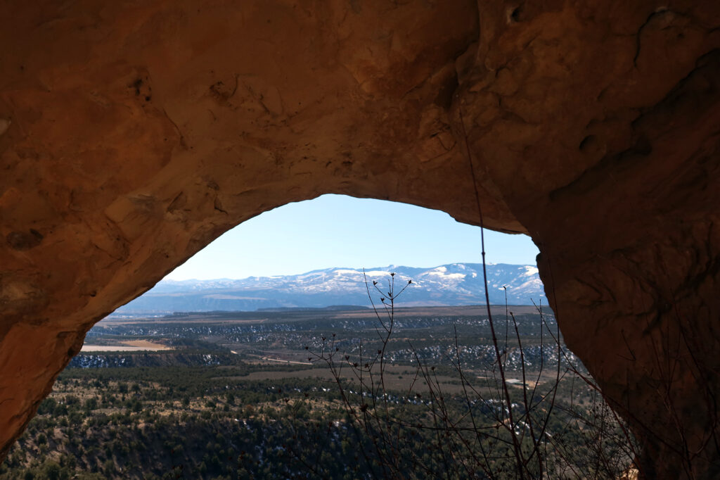
Then the trail climbed quite steeply, gaining roughly 600 vertical feet from the flat plains to the arch itself. As I rose higher, I gained impressive views across the valley, towards the snow-dusted slopes of the Roan Plateau.
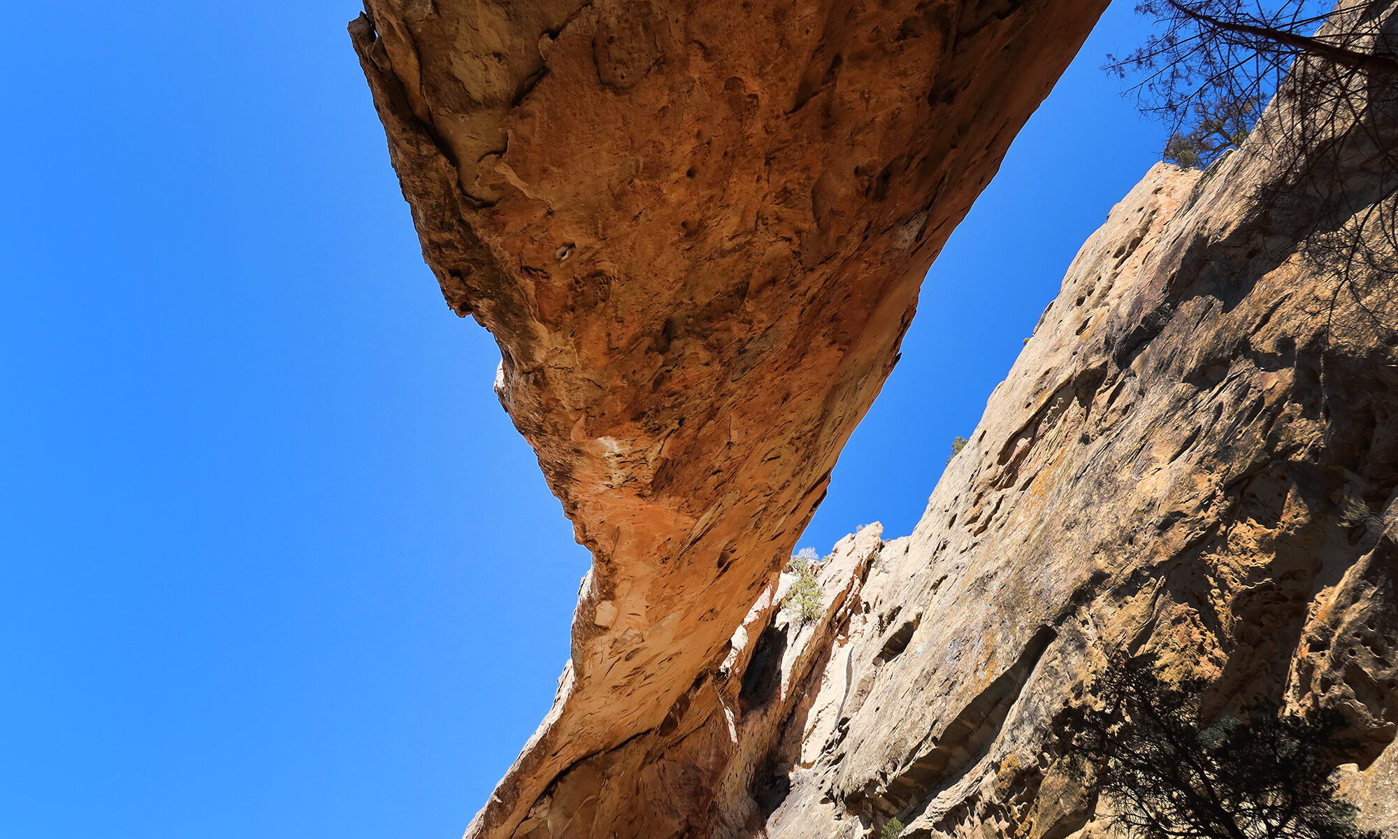
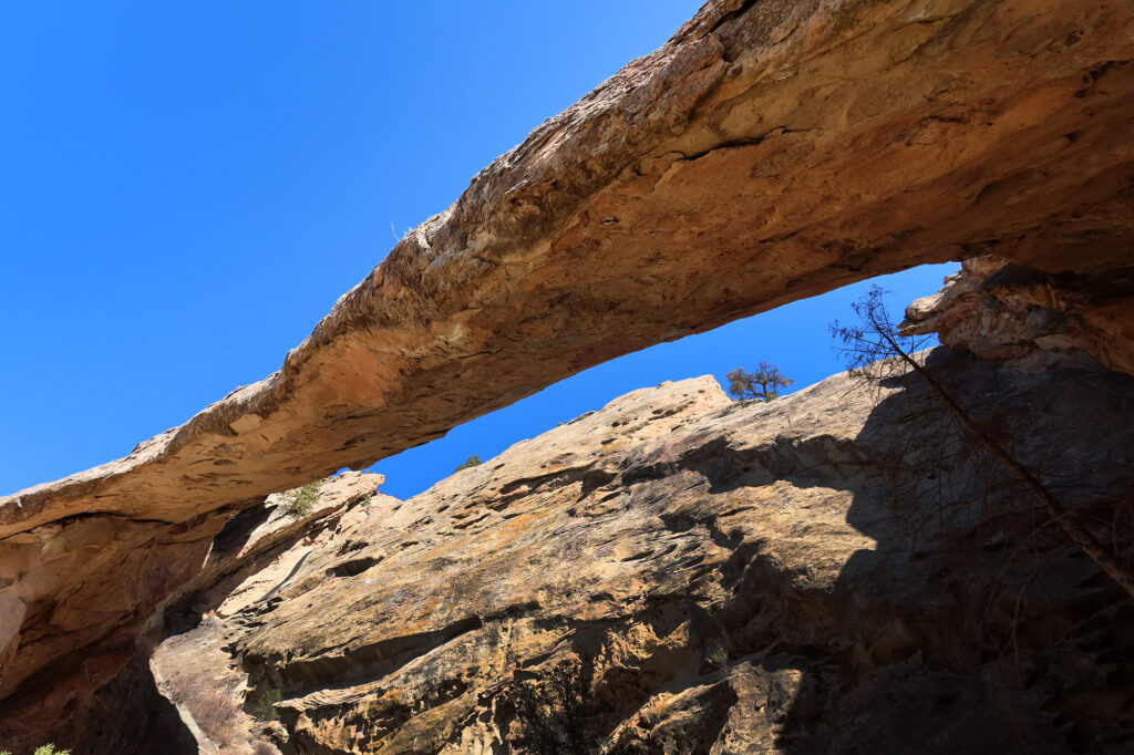
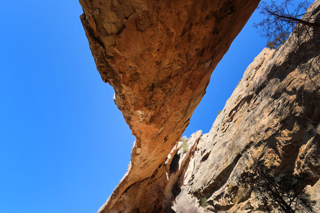
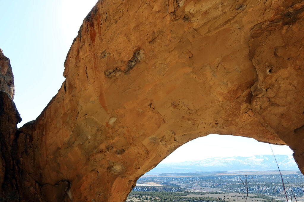
Rifle Arch
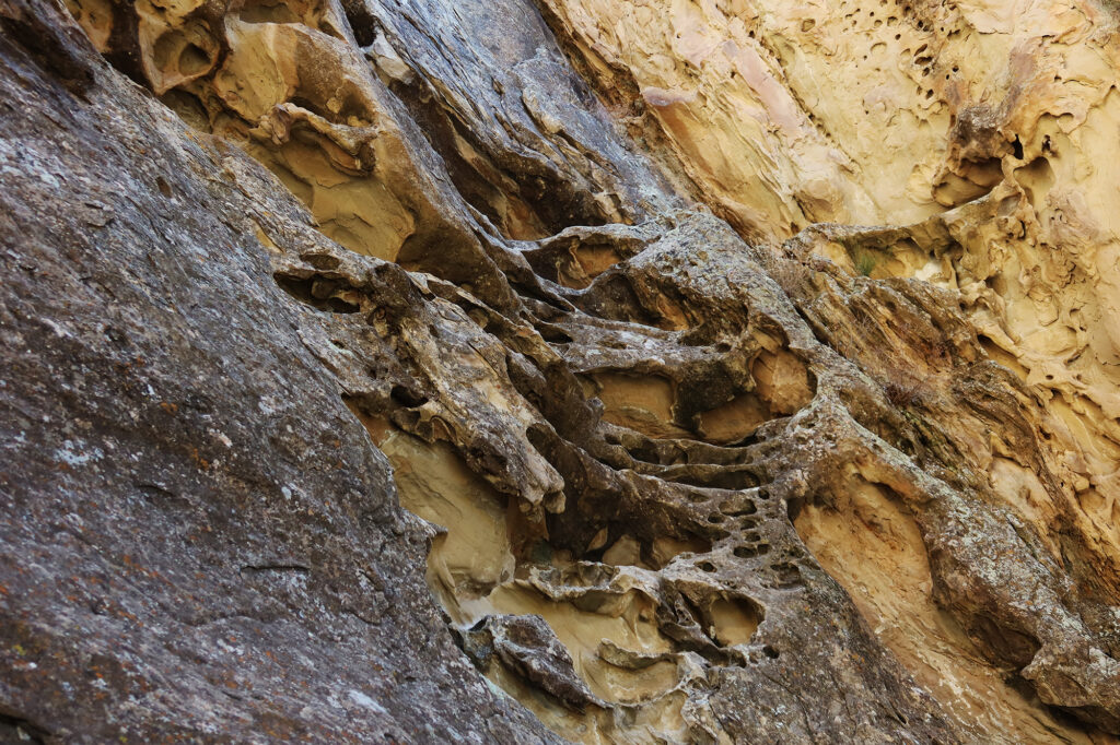
After some huffing and puffing I made it up the steep, rocky trail and beneath the arch itself. I found it both very impressive and very intimate. I shared the arch with just one other hiker that day (a warm, sunny Sunday). You can amble/scramble behind the arch, to nearly eye-level. The sandstone cliffs behind it are full of all sorts of scoops and buckets, something I vaguely recall seeing near other arches.
Utah gets all the glory for its stunning sandstone arches, most notably in Arches National Park. If you ask an in-the-know Coloradan they may point out that the Centennial State indeed boasts the largest collection of sandstone arches outside of Utah (though just barely), namely Rattlesnake Arches. And Front Rangers, particularly those self-congratulatory provincialists of Boulder, will be quite quick to recommend a stroll up to Royal Arch in the Flat Irons.
Rifle Arch, it seems, has a way worse PR team than its counterparts in Boulder and Grand Junction. It’s not an S-Tier Arch, like Delicate Arch, or Mesa Arch, or Landscape Arch. But I found it pretty darn impressive. Certainly more impressive than Royal Arch (C-Tier, at best).
I guess what I’m saying is, if you find yourself passing through Garfield County / Western Colorado with a bit of time to kill, definitely consider checking it out. This is a very solid—dare I say underrated?—adventure.
This looks fun! Thanks for sharing 😊