August 7, 2021
Ascent along Denny Creek
Mount Yale lies in the heart of Colorado’s Sawatch Range. The Sawatch is the apex of the Rocky Mountains, home to the lion’s share of fourteeners in Colorado, the Rockies, and the Lower 48 in general.
The standard route begins at the Denny Creek Trailhead. There you’ll find a paved parking lot right at 10,000’—a somewhat rare luxury among fourteener trailheads. This combined with Yale’s not-too-technical class 2 route makes the mountain super popular among hikers.

My hike actually began just under a mile down the road at the College Peaks Campground. This large, creekside campground offers ample, spacious, tree-covered camping spots. You can (and should) reserve one well in advance!
In the age of COVID, cheap lodging has seemingly disappeared from even lower-key outdoorsy areas, like in the Sawatch. Luckily campgrounds have remained very affordable, provided some initial investments in the gear.
Great Trail Maintenance
I’ve found the Sawatch Fourteeners have exceptionally well-maintained trails. For instance, La Plata was a fine example of this. Mount Yale was no exception. The Denny Creek approach featured a well-packed dirt route, with ample switchbacks and erosion-resistance measures like log- and stone-stairwells.

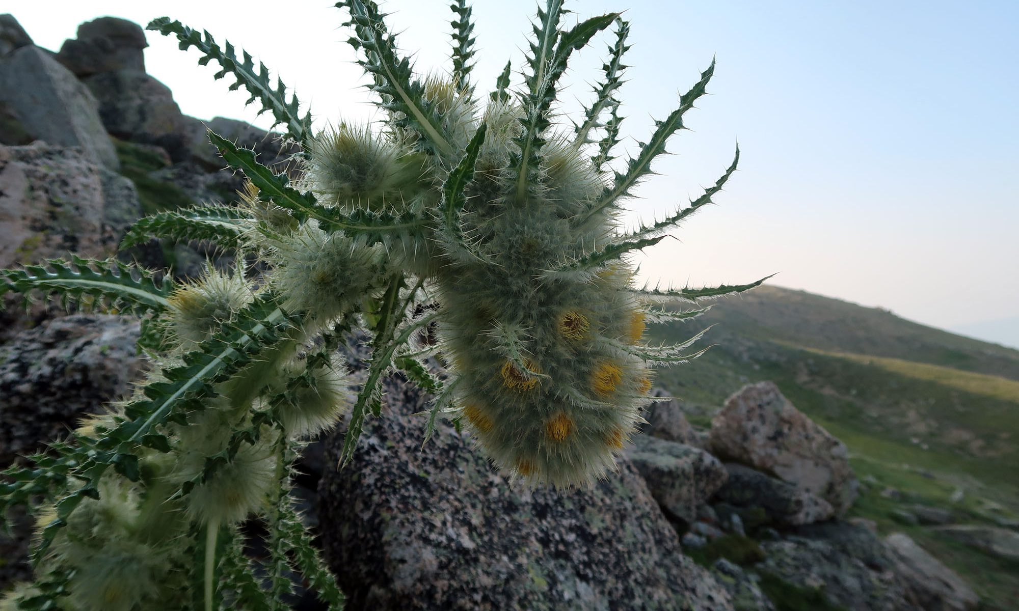
And even in mid-August, it was still wildflower season in the high country of the Sawatch. This included some rather bizarre thistle! Later I would learn said thistle is actually a newly classified species, appropriately named the ‘funky thistle‘. The funky thistle is apparently endemic to the Colorado Rockies (excepting a small presence near Santa Fe).


Smoke in the Alpine
The first two miles rose at a gentle pace, gaining just over 1000 vertical feet. The trail then rose up, out of the deep valley. As the views expanded and the sun rose higher, I saw the region was thick with smoke from wildfires both in Colorado and further afield.


Eventually, the trail left the trees and valley behind and began ascending towards the high ridge in an endless series of tight switchbacks. This section seemingly took forever! A few brief segments traversed flatter terrain. But for the most part, the trail remained consistently steep.

As the trail rose higher, above 12000′ and towards 13000′, things got a lot colder. The wind picked up. The air was not only filled with smoke but also humidity. The sun rose above the smoke and clouds and the direct light disappeared. The temperature also fell.
My fellow hikers (and they were legion!) spanned a spectrum between well-prepared and miserable. Many of us came prepared with ski gloves, hard shells, and winter hats. But some folks seemed to be in a lot of pain, struggling to stuff their frozen hands into the pockets of their running shorts.
Mount Yale and the Collegiate Peaks
In 1869 a group of students from Harvard Mining School embarked on an expedition through the high Sawatch with their professor, Josiah Whitney. They summited nearby Mt Harvard (14,421′) and Yale (14,200′). They named the taller peak after their alma mater, while naming the shorter after Whitney’s school. Josiah Whitney is also the namesake of the tallest peak in the lower 48: California’s Mount Whitney.

Other nearby fourteener peaks would soon receive University names, including Princeton, Oxford, and Columbia. Together these mountains are often referred to as the “Collegiate Peaks”. Mount Yale was my first of these mountains, though I had already climbed a couple other peaks in the Sawatch, including the tallest: Mt Elbert.
The high ridge to Mount Yale
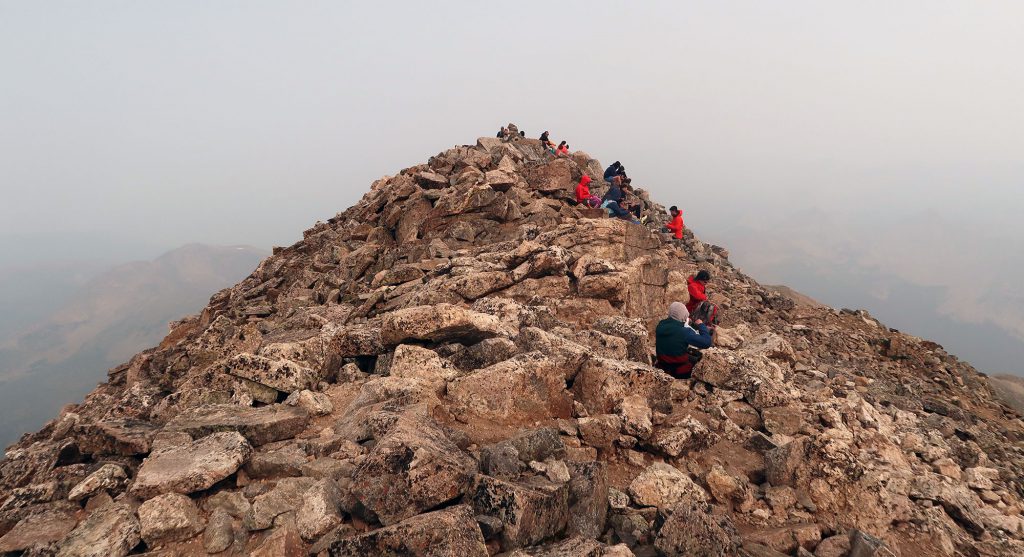
After seemingly endless switchbacks, the trail crested the rocky barren ridgeline at just under 14,000′. The last stretch involves a bit of scrambling along boulders to the true summit. While the ridge is delightfully narrow, it’s not especially exposed.

The wind whipped fiercely from the south. The smoke-filled sky seemed downright overcast. And I couldn’t see much from the summit. Hilariously, almost everyone was huddled just beneath the ridge on the leeward side.

Descent Back to Camp
Mount Yale presents a safe, well-maintained class-2 route to its summit from a convenient, paved trailhead. But make no mistake, this is an intense hike! In all, I ascended roughly 4,200 vertical feet on a hike that took the better part of a day. The weather atop these peaks is hit or miss. You could have a warm sunny day at a brisk 45 Fahrenheit. Or you could easily lose feeling in your bare hands. Come prepared for either.

Eventually, I was down in the far-warmer Valley. The Sun decided to come back out. It was delightful arriving in camp to a shady tent for a nap and some iced drinks. Eventually, I pulled myself out of my sleeping bag to make a nice hearty dinner of corn on the cob and pork tacos. A ‘graduation ceremony’ of sorts.


