
July 26, 2021
Indian Peaks Wilderness
When an avid hiker friend informed me she’d be coming through the Front Range this summer, I knew I needed to find a solid hike to show off the Colorado Rockies. I wanted to find something a bit more expansive than the Flat Irons; but also an experience that avoided I-70 traffic and hours of driving.
At first, I gravitated towards Rocky Mountain National Park. Neither of us had been, despite numerous adventures in Colorado. But notorious crowds and red tape scared me away.
I was stuck. Then, while staring at Google Maps in satellite mode, I noticed the Indian Peaks Wilderness. The same jagged, dramatic, snow-capped peaks that comprise the apex of RMNP continue south, more or less as impressive-looking, into this primitive area.

Indians Peaks sports its own red tape you should be aware of. For starters, we needed timed parking permits. We were accosted almost instantly after arrival by someone ready to check our permit. But these are far easier to procure than for RMNP.
Glaciers in Colorado?
Every good hike needs a payoff. Typically a mountain summit or lush waterfall will do. And this hike would involve views of many peaks and cascading streams. But our payoff was a bit more unique for Colorado: an alpine glacier.
Our target that day was Isabelle Glacier, one of just a handful of small (and receding) glaciers in the state. The popular image of the Colorado Rockies involves snow-capped peaks. But in fact, nearly every peak in the state reaches a bone-dry state by late August and into September. Of the few snowfields that survive through the summer, most are just that: snowfields. Just a handful of these snowfields meet the criteria for a glacier: a moving mass of ice comprised of many, many years of snowfall.

The Cascades and Northern Rockies are chock full of glaciers. On Mount Ranier, some span several miles in length and reach hundreds of feet in thickness. Beyond these regions, their presence is exceedingly rare. About a dozen tiny ones exist in the Sierra Nevada and the Colorado Rockies. Utah and Nevada each sport just one glacier at last count.
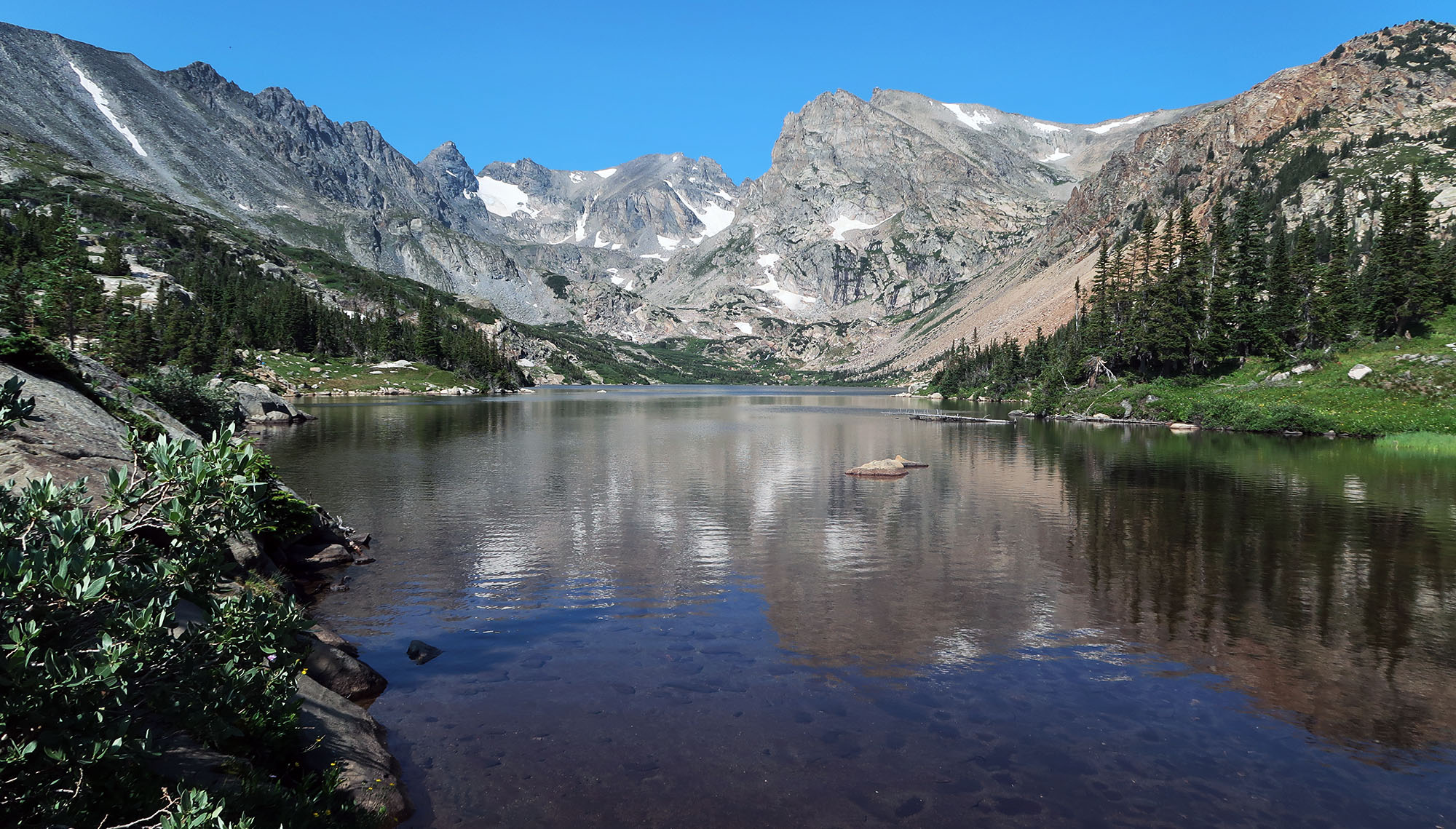
Lakes, wildflowers and snowmelt
Our hike was gorgeous. It ran roughly 8.5 miles, round trip, ascending just 1600 vertical feet. The trail led us past three successively smaller and higher-altitude lakes: Long Lake, Lake Isabelle, and a small tarn just below the glacier.
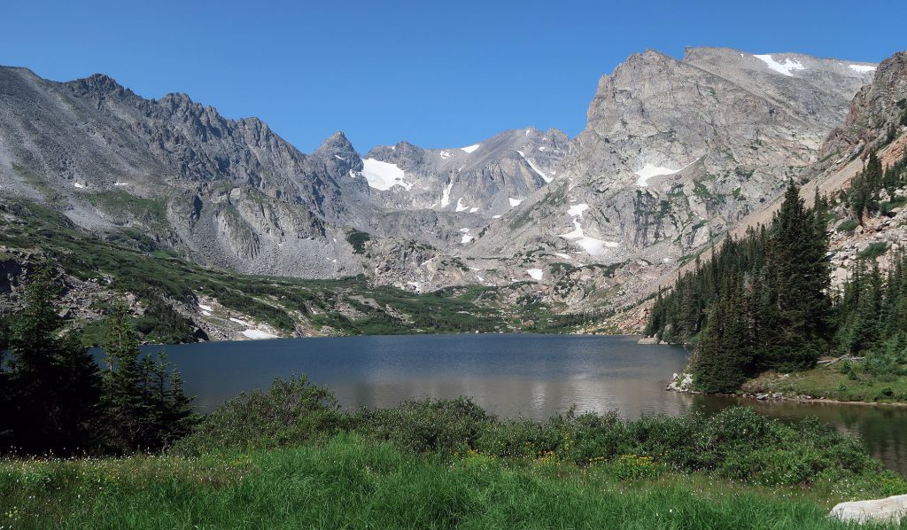
The trail slowly evolved from piney forests, to open alpine meadows, to bare rock. The trailhead sat at 10,500′ whereas the path terminated above 12,000′. Along the whole route, wildflowers festooned the fields and forests.


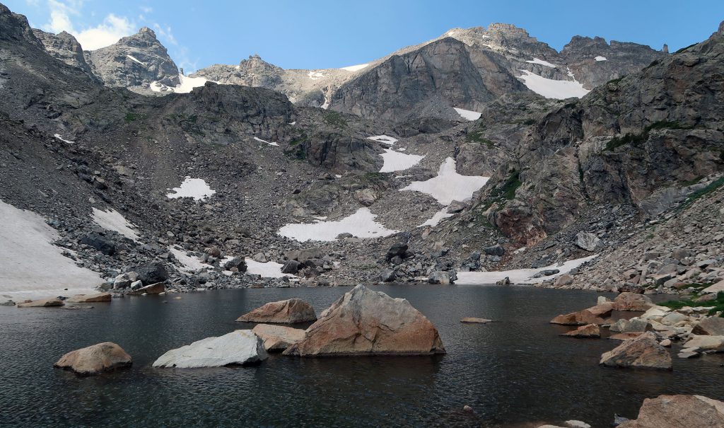
Onward to the South St Vrain Tarn
The trail remained easy to follow throughout. While mostly a gently rising dirt path, small portions involved uneven traverses across lakeside slabs and a bit of scrambling through boulder fields.

After Lake Isabelle, the trail rose quickly along the rushing South St Vrain Creek. The vegetation grew stunted, and then quite sparse. Here we entered the lowest portions of the alpine.

We then reached the third and final lake. This small tarn sat amongst bare rock scree fields and patches of late July snow. The jagged peaks of the Continental Divide stood nearby, hovering over the shadowed landscape. And it was quiet—we saw just one other pair of hikers up here.
The Isabelle Glacier
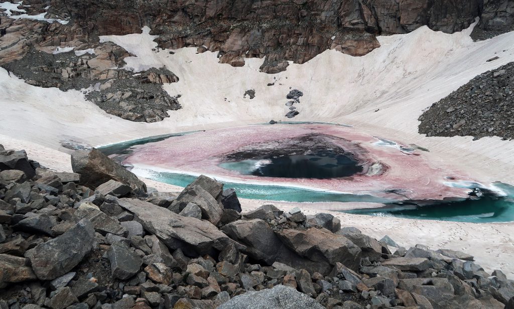
A series of tight switchbacks took us over a rock face above the tarn. Then we crossed a field of large boulders and stared across at our final target: Isabelle Glacier. It may not have been massive. But it struck me as dramatic in its own way.
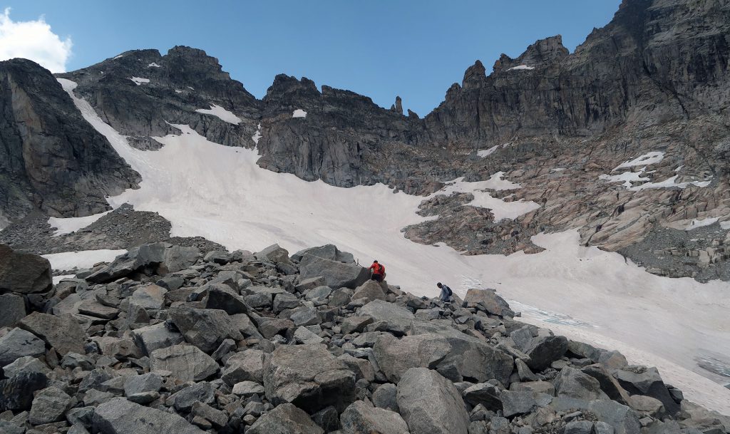
The upper slopes flowed downward from just beneath the walls of the Divide. It then continued and deepened towards a local depression, where it sported its own molten lake of deep blue waters. Speckles of glacier blood lent the scene a bit more color and contrast.
We scrambled across the giant boulders (a terminal moraine?) and set foot on the snow. The sun came in and out of moody clouds overhead. As far as payoffs go, this hike had a pretty excellent one.