
February 23, 2020, Rhus Ridge trailhead
A big change of scenery
Deep snow and wintry landscapes have dominated most of my early 2020 adventures. But this hike would prove quite the opposite. Just hours earlier I had arrived at SFO for a job interview in Silicon Valley. It was a Sunday afternoon and I had time to kill before the next day’s interrogations. My original plan was to wander around San Francisco, but I missed the CalTrain, and the next departure was a shocking 90 minutes later. After wandering around the Mountain View farmer’s market and grabbing a couple of tacos, I decided to load up All Trails and find myself a good hike.
A short Uber ride later, I was at the Rhus Ridge trailhead, in shorts and sneakers, ready to ascend to the summit of Black Mountain. I passed through the small (and busy) parking lot, and soon found myself in a sunny, warm, lush environment of grass, flowers and leafy trees—in mid-February!

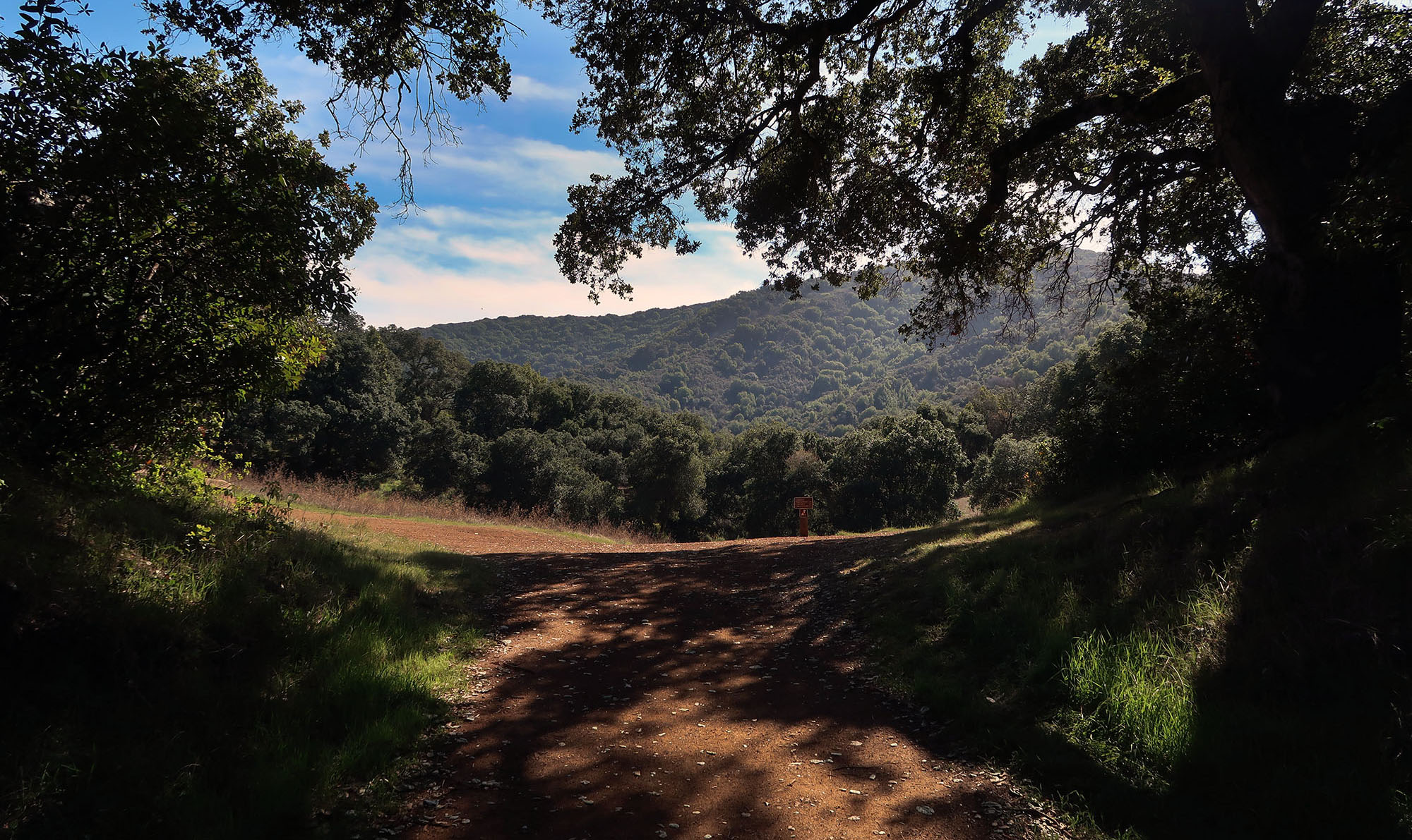
The first moments of the hike begin under a light canopy of trees, within a lush, grassy canyon. I walked past a small property where a horse was tethered outside, eager to greet passers by. The trail began as packed, red dirt and remained that way pretty much throughout the hike.
Rhus Ridge
The trail begins with a steep ascent of Rhus Ridge, with some switchbacks en route to some grassy fields roughly 800 vertical feet above the trailhead. This section is wide enough to carry vehicles and features increasingly awesome views of the surrounding hillsides and broader Silicon Valley. Initially the views are just of rich people’s houses. But then the Stanford bell tower and radio dishes come into view.

Perhaps 100 vertical feet below the meadows, an overlook affords views towards San Jose and (on a clear day) San Francisco. Cupertino is in the foreground, with the Apple campus clearly visible. I could spot perhaps three bridges crossing the southern portion of San Francisco Bay, along with Moffett Airfield and the new google campus under construction. In the distance were mountains to the East.

Rancho San Antonio Preserve
Eventually, the climb let up, and the trail passed beneath a bit more tree cover en route to the beautiful meadows of the Rancho San Antonio Preserve. Here there were several options for where to walk next.


The trail to Black Mountain stuck to the right of these meadows, along a ridge line and beneath light tree cover. The February flowers and green grass lining the trail continued to amaze this snowbound New Yorker.

Onward to Black Mountain
The meadows above Rhus Ridge turned out to be a nice pause in the relentless vertical of this hike. Make no mistake: despite being just moments away from one of the country’s largest urban areas, this ascent packs a punch. You ascend 2,500 vertical feet from trailhead to summit. That’s the kind of vertical drop a lot of ski resorts brag about. That said, the trail remains soft-packed dirt throughout, without a single rock scramble, mud patch, or washed out section. For a hiker trained on Adirondack wilderness, this proved quite a pleasant surprise.
The trail also winds along switchbacks, packing in a fair bit more mileage than the map suggests. The switchbacks featured increasingly expansive views over the meadows of the preserve.


Finally, after passing under some power wires and up yet another steep climb, the summit came into view. The trail left the preserve and I found some unsettling signage related to local mega fauna.

The summit sported wide-open meadows and a strong, consistent breeze. It wasn’t the most amazing view (the Pacific was hidden behind seemingly endless mountains of similar stature). But it measured up just fine to the effort involved. An overall decent ascent!

how long did this take one way?
i’m thinking 1 hr for 1st steep mile, 20min/mile for middle three miles and 1-1.5 hr for last mile,
maybe 3 hours?
thanks
Hi Grace,
The total ascent is roughly 2500 vertical feet and the mileage is not excessive … so vert is likely the limiting factor. I think 3 hours is a safe bet for someone with hiking experience / in decent shape. My rule of thumb is one hour per thousand feet. It’s a gorgeous hike and the trail is in great shape!