January 27, 2025
Refugio San Gabriel
We arrived at Refugio San Gabriel in the late afternoon. This was the lower of two huts we’d stay at en route to summit Cayambe, Ecuador’s third-tallest peak. Summit day would involve high winds, crevasse-riddled glaciers, and volcanic rock, high above tree-line. But here just below 12,000′ elevation, the scene involved grazing cows and shrubby trees swaying in the breeze.
It was the “wet season” in the Ecuadorian Highlands, their equivalent of winter. Downslope from us was sunny and dry. But afternoon storm clouds obscured the summit far to the northeast, and soon rain reached the hut.
The goal for the night was simple: more acclimatization. For nearly a week our guided team had been focused on getting our bodies in shape for summiting some of Ecuador’s tallest summits. This began with a hike right out of Quito, the capital city, to over 15,000 feet. Then a second, lower hike around Cuicocha Lake .
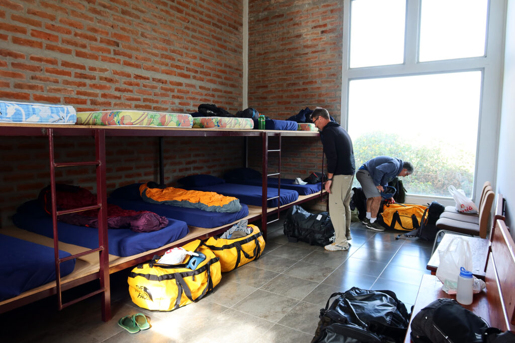
We tucked into a hearty meal at the surprisingly modern and spacious “hut.” We had the place to ourselves that night. Like many of our meals, it began with Locro de Papa, a traditional Ecuadorean potato soup. Properly fed, hydrated, and acclimated I was feeling optimistic about falling asleep at 12,000 feet … something I’d attempted but never properly accomplished before.
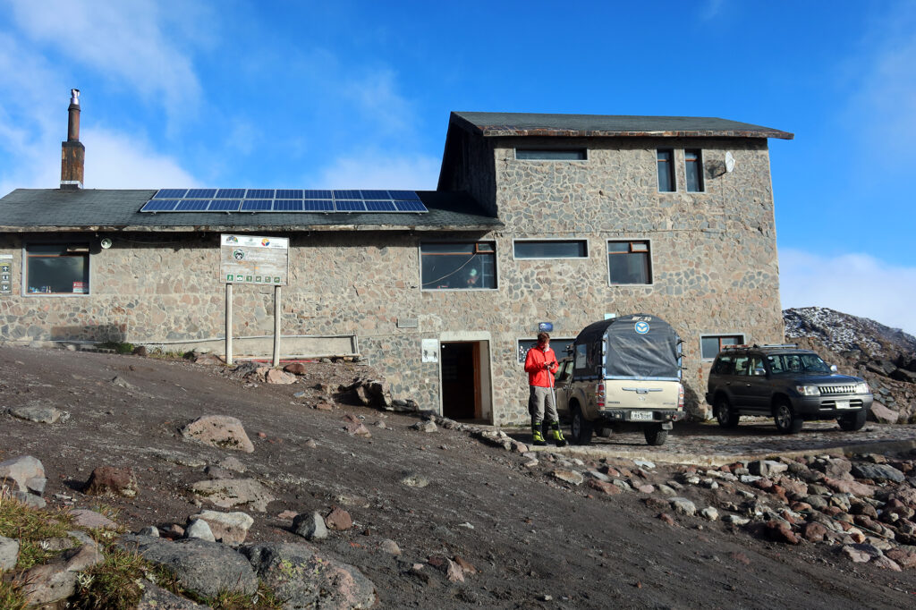
Refugio Ruales Oleas Berge
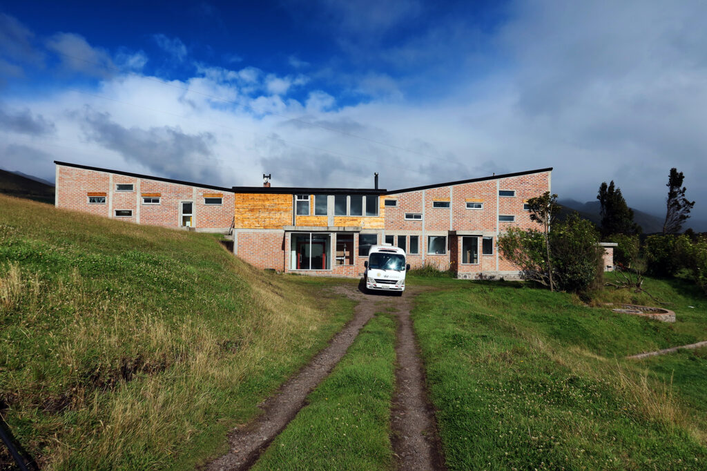
The next day we packed up into our van and trundled up more dirt roads to a much higher hut, Refugio Ruales Oleas Berge, at 15,000 feet above sea level. It felt a little like cheating, just driving up to 15,000 feet. In the United States, reaching that kind of altitude means something. First off, you’re in Alaska, by default, freezing your ass off on some massive glacier. But in Ecuador, it’s a dirt road to a hut with flush toilets and catered meals.
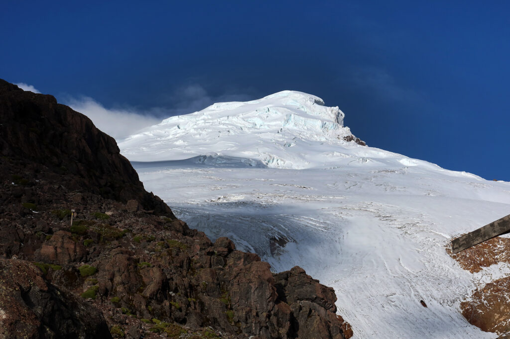
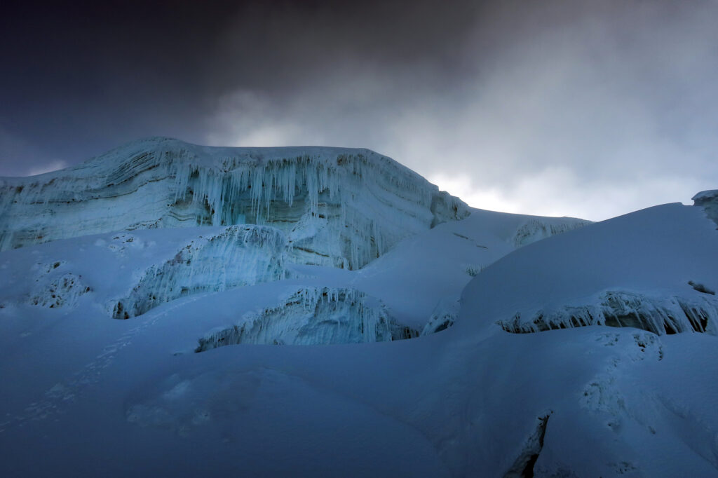
We unloaded our gear and brought it into the second hut. The grass and cows were long gone, replaced by bare rock and scree fields. The steep, glaciated slopes of the upper mountain loomed above us, coming in and out of the clouds.
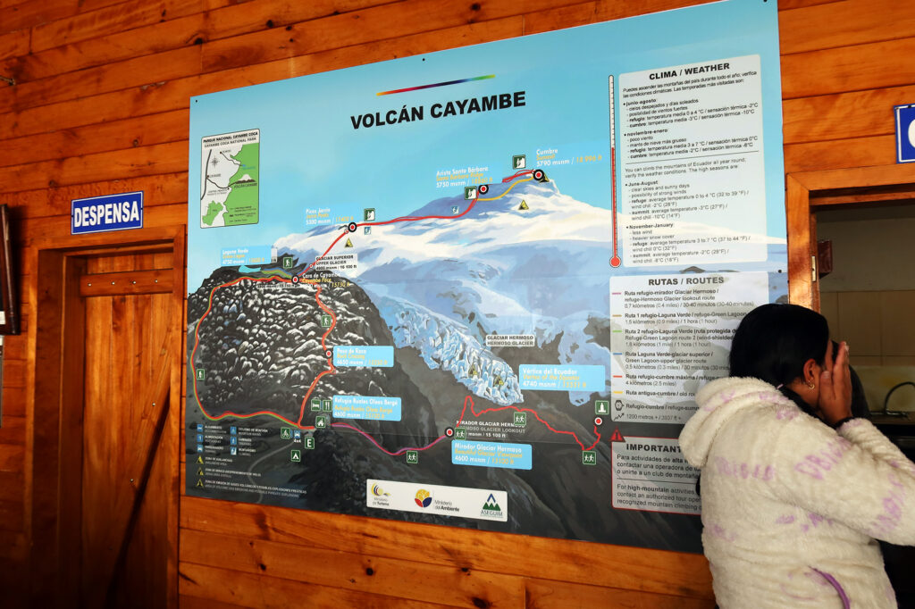
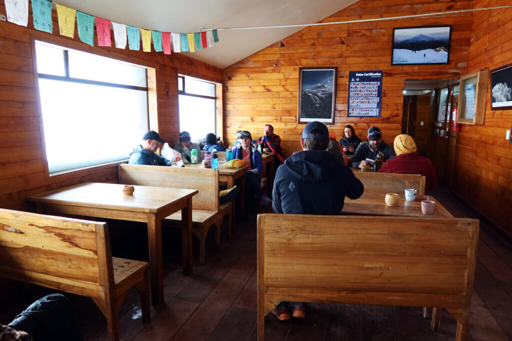
We spent most of the day just chilling in the hut, chatting and playing card games. This hut was crowded, with day visitors coming and going, buying food, and setting off on hikes around the park. A giant map of Cayambe hung on the wall, showing us the route to the nearly-19,000 foot summit.
Final Preparations
Our American guides introduced a half dozen Ecuadorian guides who would join us on summit day. This left us with a combined client-to-guide ratio of nearly one-on-one. This meant most clients would be roped to just one guide. We’d stick together throughout the summit attempt, but the arrangement nonetheless gave us a ton of flexibility if folks needed to turn around or got delayed for some reason.
The lead guide told us not to “read too much” into our assigned guides. But of course I was left to concoct theories as to why we were assigned various people. One theory I had as to my assignment was optimistic. My guide seemed pretty young and ambitious. Maybe I got assigned him because, as a Coloradan, I was among the better-acclimated on the team. I wondered if they were giving him a better shot at racking up some summit/success stats. I don’t think it was a coincidence that of the pairs who eventually reached the summit, both American guides were present. But a second, more pessimistic theory emerged. My guide knew almost no English. And I had also developed a reputation as a rather chatty (annoying?!) climber. Maybe they just wanted to spare everyone more small talk.
We tucked into yet another delicious Ecuadorian meal. It began with more potato soup! I was getting hooked. Then it was time to “sleep” in our bunks before a classic alpine start in the small hours of the morning. Somewhat acclimated, I had successfully slept at 12,000 feet the night before. But at 15,000 feet, I did not expect a repeat victory.
Summit Day on Cayambe
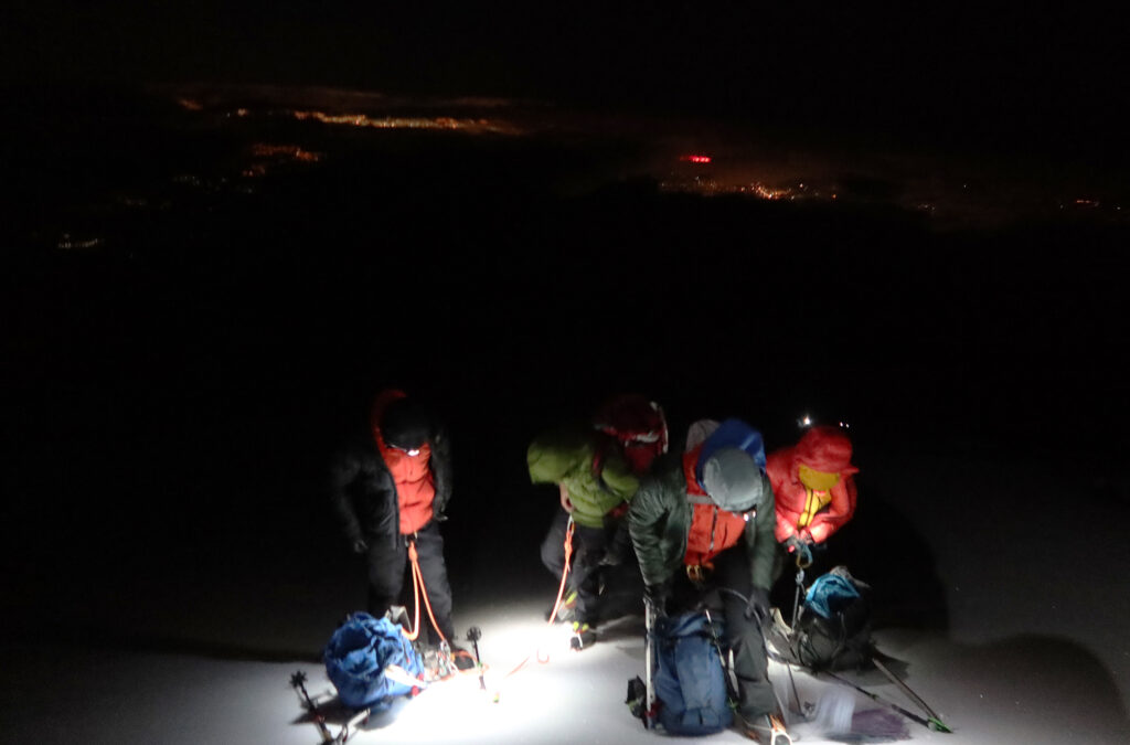
I forget exactly when we began our summit day. But midnight is as good a guess as any. I forgot to turn on GPX tracking until quite close to the summit (around 6am !!). Wind howled outside the hut in the darkness. Wind was perhaps the core theme of our trip, scuttling our next summit attempt on Cotopaxi.
Moisture was another theme. Our guides recommended we start in hard shells. I wore my GoreTex ski shell and “rain pants.” I almost never ascend mountains in this kind of gear. Colorado is blessed with bone dry weather. Even when it’s snowing it’s somehow dry as a bone. I usually ascend 14ers in just a baselayer, maybe a thin fleece sweater. Even in winter.
But Ecuador was a different beast, apparently. Soon after leaving the hut, my hood went up and stayed up for most of the climb. A light rain/snow/sleet mixture sped sideways through the beam of my headlamp.
The ascent began as a non-technical hike. For the first thousand vertical feet we ascended switchbacks up a rock ridge lookers left of the summit. But roughly an hour into our adventure, we reached the lower glacier.
A special summit
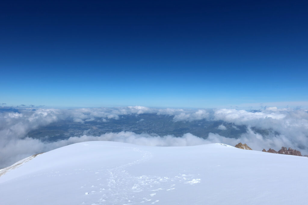
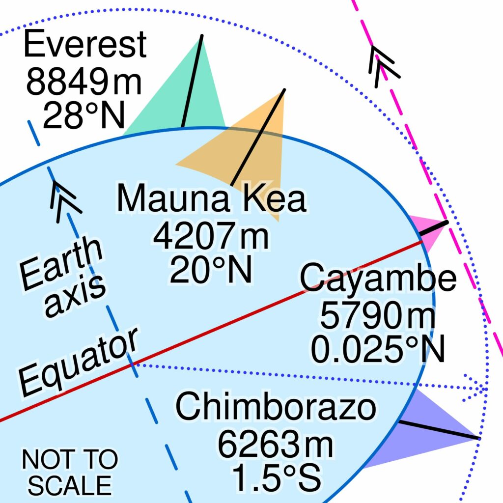
Cayambe is not the highest peak in Ecuador (both Cotopaxi and Chimborazo stand taller). But it still boasts a couple claims to fame. That’s because it stands smack dab on the Equator. I mean, the summit is slightly north of the equator. But its permanent snowfields extend into the Southern Hemisphere. That means it boasts the only permanently snow-covered spot on Earth’s Equator.
This also means the 18,996-foot summit is the farthest point on Earth from the planet’s axis of rotation. When you stand atop Cayambe, you are spinning faster than anyone else on Earth.
Thanks to the Earth’s “bulge,” nearby Chimborazo (Ecuador’s tallest peak) actually holds the distinction of being the farthest point from the center of the Earth. This makes Chimborazo, along with Mauna Kea, one of those “well actually” summits that come up in comparisons with Mount Everest, and the claim of “tallest peak in the world.”
Precisely no one is making claims like this about Cayambe. But the fact remains: Cayambe’s summit is the the most centripetally-blessed point on the planet.
Onward and upward, onto the glaciers
We strapped on our crampons, roped up behind our guides, and set off onto Cayambe’s upper slopes.
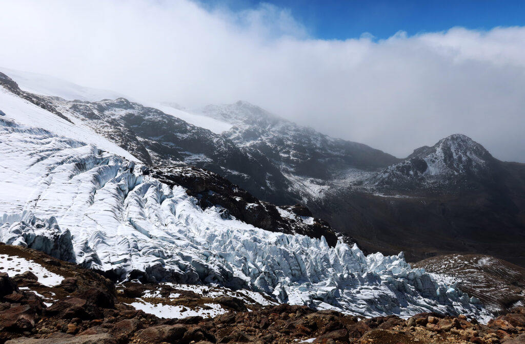
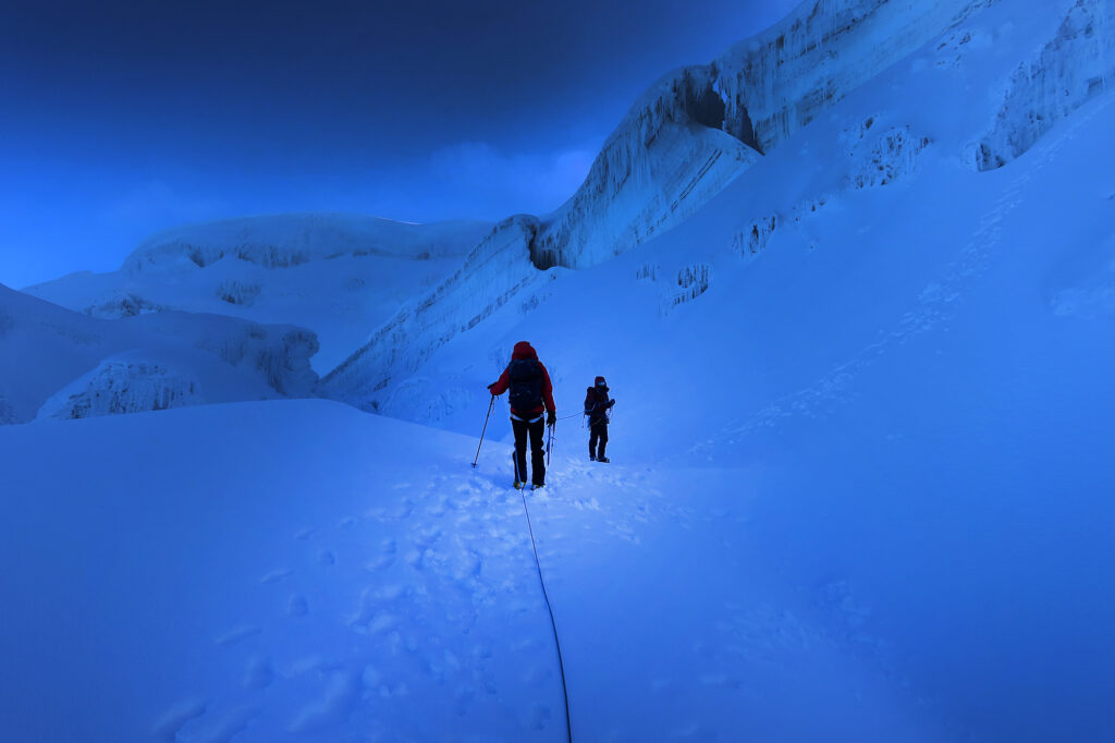
Years ago, with the same guiding company (RMI) I did a week-long “mountaineering seminar” on the slopes of Mount Rainier, learning about traveling on glaciers, crevasse rescue, anchor building. But the fact remains: I am extremely inexperienced on glaciers. What I do know: danger lies beneath. As these “rivers of ice” flow down a mountain, they follow the undulating slopes beneath them. Rolling onto steeper slopes, the glaciers crack open, like a poorly-made swiss roll on the Great British Bake-Off. These are “crevasses” (crevices) that continue to lurk beneath the surface years after that area of the glacier has flowed beyond the offending terrain.
On mountains like Rainier, they can be hundreds of feet deep. Falling into one is comparable to falling off a high-rise building. On Cayambe, I’m not sure how deep they get. The mountain had some spicy terrain, particularly near the summit. But my naive impression was the crevasses were probably not “Rainier level.” That said, it doesn’t take hundreds of feet to turn a fall into a life-altering event. And unlike the standard route on Rainier, we did not have any pre-set ladders on this summit. Also unlike Rainier, I didn’t discern any clearly flagged/trodden trail from base to summit. You needed to come with “beta” and navigation skills in hand.
That’s why we ascended roped to experienced guides. Should we fall into any sort of terrain feature, they were well equipped to get us out of trouble.
Cayambe is an ancient name
I make a point of trying to learn how the mountains I climb get their names. Most mountains (even relatively young ones) have stood through the entirety of human history. As a result their names and symbolism can shift as peoples and empires rise and fall from power. Deciding how to refer to a mountain can quickly become politically fraught.
But the great Ecuadorean volcanoes buck some of these trends in interesting ways. Cayambe is neither a Spanish nor an Inca name. It predates these empires that came and went from the Andean Highlands, and broader South America. The volcano and nearby city take their name from the Kayambi people—the spelling with “K” being a modern, de-colonialized way of writing the same indigenous word that Spaniards transcribed with “C.”
The Inca reached this region barely a half-century before the Spanish, but the people of the Ecuadorean Highlands rapidly adopted (and re-shaped) the Incan lingua franca of Quechua. As a result, we don’t have a good sense of what “Cayambe” actually means, besides the fact that it refers to the snow-capped, third-tallest peak in Ecuador. The etymologies of Cotopaxi and Chimborazo appear to follow similar arcs, though that doesn’t stop people from retrofitting Quechua “folk etymologies” onto them.
Climbing higher
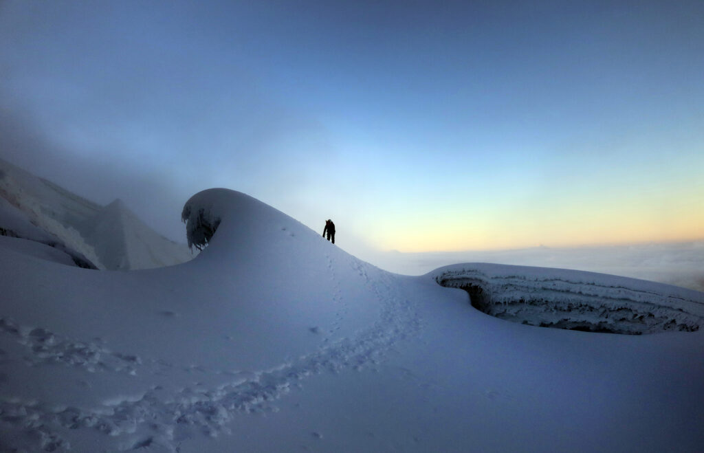
I dragged my feet writing this blog post. It’s been roughly 9 months since our ascent. But in my mind I can still break the glacier ascent into “thirds.” The first third was the kinda steep “lower glacier.” In the dark of the night I didn’t notice much beyond a smooth snow slope.
The “middle third” was probably more like a 20% stretch that was very low-angle. This was quite a relief as we had pushed well above 17,000 feet and I was definitely feeling it. I had correctly pegged my guide as something of a keener. Early on he pulled in front of the lead guide, ‘dragging’ me along for the ride. For the record, I think I did a good job keeping slack in the rope, maintaining that ideal hyperbolic cosine shape. But at altitudes entirely new to my body, I was definitely getting slighty gassed. The day before we had practiced stepping sideways up the mountain in our crampons. It was a technique that worked nicely switchbacking up moderately steep icy slopes. But it was a movement I had *not* trained prior to arriving. And my legs were feeling it.
Fortunately the lead guide would occasionally call out to slow down so we could all stay together. I definitely appreciated the moderated pace. About halfway up, some of the climbing pairs began peeling off and turning around. As a result, one of the few double-client ropes had to split up, and another client joined my rope. Sadly he was also quite fit, and we stayed in front, with me huffing and puffing to keep up. I wasn’t wearing a heart rate monitor, but this was not a “zone 2” kinda day.
Towards the summit
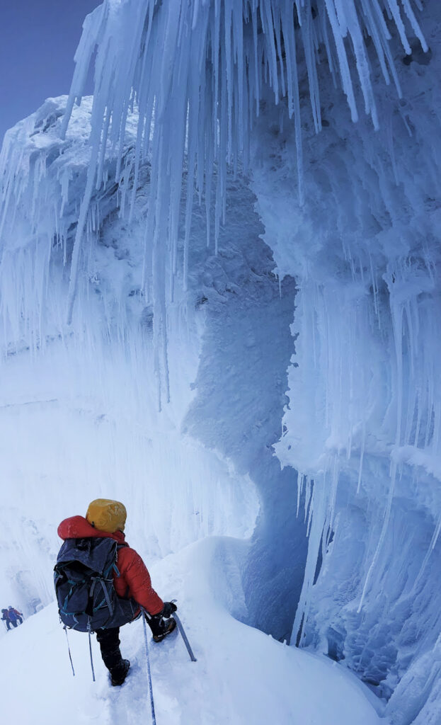
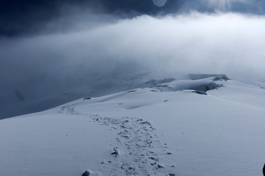
The “final third” was where things got interesting. The glacier became more visibly complex. We passed under, across, and alongside vertical faces of ice. I couldn’t tell you which were crevasses or bergschrunds or what not. But it all looked pretty awesome. At one point we reached a fork in the road where a judgement call needed to be made on how to proceed. This came with an added benefit of waiting for the other guides to catch up so we could deliberate.
We ascended a handful of notably steep sections. We switched to front-pointing, kicking steps into the ice. I plunged my ice axe into the slope. We were around 18,500 feet, ascending onto multiple “false summits.” I was definitely feeling the altitude at this point. Nothing novel or particularly challenging was happening to my body/brain. Rather I just felt a lot more gassed than usual. I felt very similar on Mount Whitney, a few years prior, coming straight up from the Bay Area and having not really trained for it. But for Cayambe, I had trained intentionally. And acclimated.
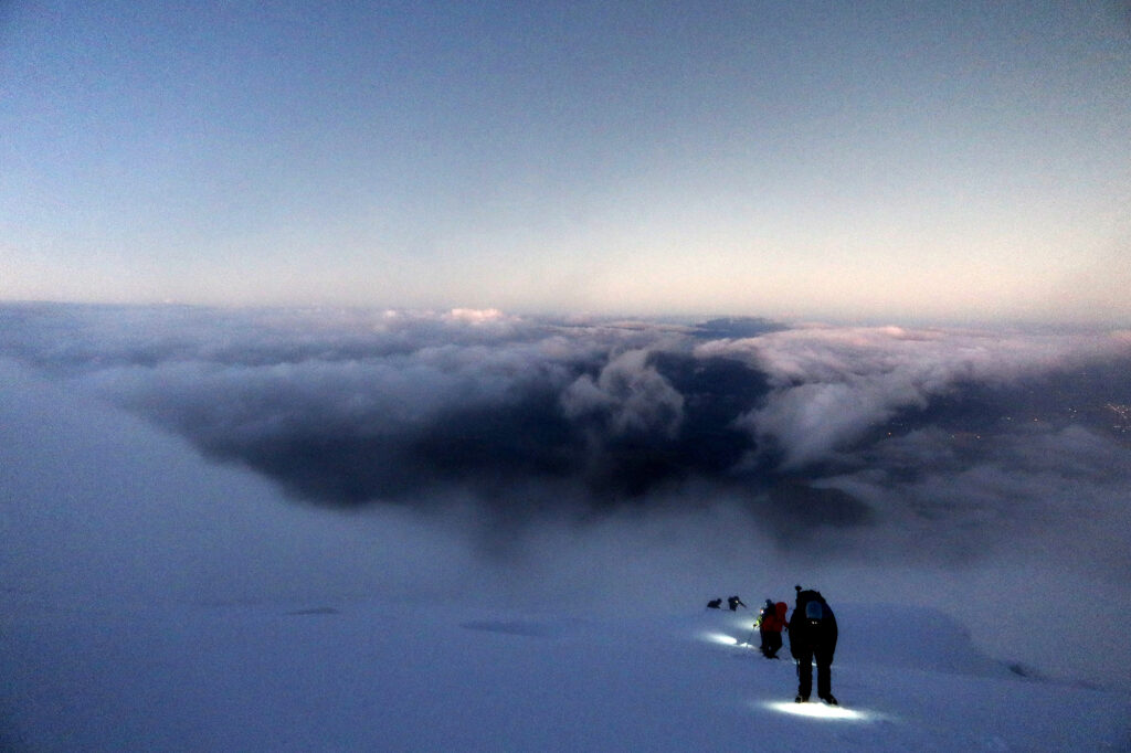
All that said, the upper mountain was beautiful. The pinkish/orange hues of sunrise certainly dressed up all that snow and ice. Evidence of Ecuador’s moist climate were on full display. Massive, clear icicles festooned many of the glacier’s features. It looked very different from Colorado or Washington. With all the wind and mild precip of our ascent, we were accreting icicles as well. From start to finish, my hard shells never came off.
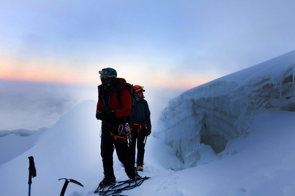
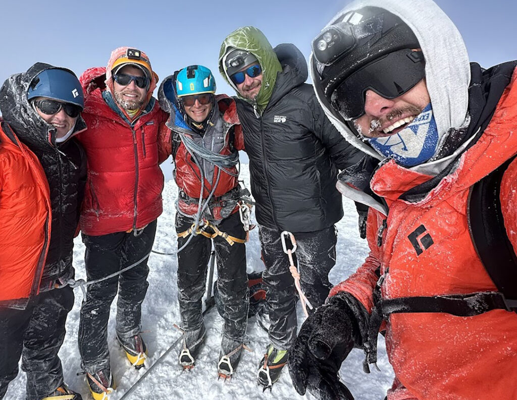
Cayambe!
Eventually we reached the summit. Ten clients began from Rivendell the hut, but by the summit we were down to just four clients and three guides.
I didn’t know what to expect at 18,996 feet, but things felt pretty pleasant. I can’t remember if the wind had died down. This was likely the windiest experience I’d ever had above treeline on a mountain (though I’d need to revise that statement on Cotopaxi in a few days). But the sun was up. And we were done with “up.” So it struck me as perfect picnic weather.
One of the Ecuadorian guides was saying the night before to pack some pure-sugar snacks. That our digestive systems wouldn’t likely handle much more than like, a jolly rancher. I decided to put my digestive tract to the test (for the sake of future expeditions) by eating a baked good with jam and peanut butter along with a shelf-stable corn tamale. I am proud to report my GI tract handled it like a champ.
We huddled for some group photos. Sadly, I don’t seem to have one with the final the summitters. Then it was time to descend.
The descent
The decent went incredibly smoothly. Our guide placed an ice screw as we came down one of the spiciest sections. Staring off down the steep slope, now fully illuminated by the morning sun, I was thankful for that.
The sun rose higher, and we finally managed to shed our hard shells. Descending quickly and efficiently is one of my relative strengths on mountains … I think because I do so much skiing, and thus have indefatigable quads. We pulled ahead of the other groups and down onto the lower glacier.
Fully illuminated, I noticed the lower glacier was riddle with tons of tiny crevasses. We were constantly stepping over the cracks in the snow. But eventually we reached the rocky ridge beneath the glacier, and could de-rope and de-crampon.
By now I was exhausted as we hiked back to the hut. It was still mid-morning when we got back to the hut. Time for a nap at 15,000 feet!