
October 8, 2022
Departure from Ketatahi
I arrived around sunrise at an empty Ketatahi Park and Ride. Several other hikers pulled in as I waited for our 7 am shuttle to Mangatepopo trailhead. But the massive car park would remain largely empty throughout the day. Early October was hardly “high season” for the Tongariro Alpine Crossing. And shuttle service was still fairly limited.
This stunning, point-to-point day hike through Tongariro National Park would mark my final hiking adventure in New Zealand. My trip began in late September, amongst the heavily glaciated “Southern Alps”. Those mountains came about largely through plate tectonics, forming the backbone of the stunning South Island. In contrast, Tongariro NP surrounds the tallest peaks of the North Island—largely born from volcanic activity.
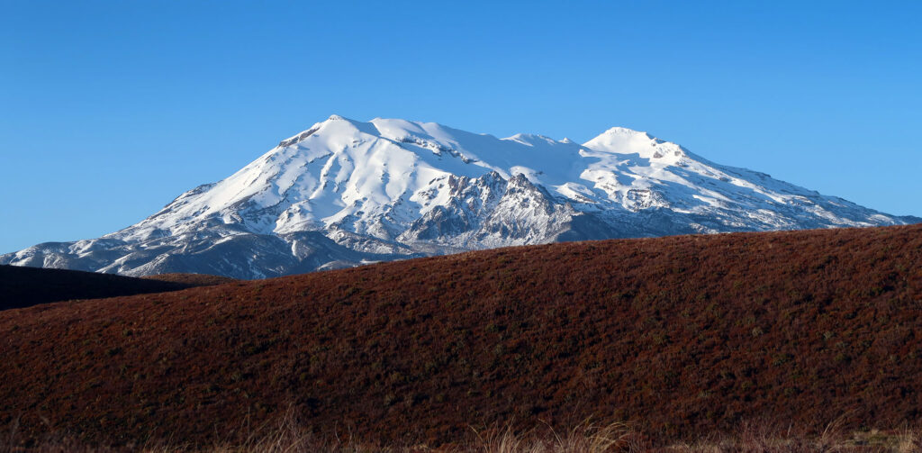
The van pulled up and we all piled in. Roughly 25 minutes later the driver dropped us off at the hike’s typical “starting point” of Mangatepopo. Even down here, around 3500 vertical feet (~1000 meters), the landscape was devoid of trees. Early morning sun lit up the snowcapped peaks of nearby Ruapehu.
Onward and Upward
The van departed the car park and I began my ascent. The dozen or so other hikers soon thinned out. A pair of trail runners sped ahead up the browned lower slopes. But most folks lingered at the trailhead to fidget with gear and brace for the day.
Tongariro Alpine Crossing runs just under 13 miles from Mangatepopo to the Ketatahi Car Park. You can hike the trail in either direction. But the latter trailhead sits roughly 1000 vertical feet lower in elevation. In between, the well-built path passes through a high alpine zone between volcanic peaks. Steam vents from the landscape, amidst small lakes of deep, saturated blues and greens.
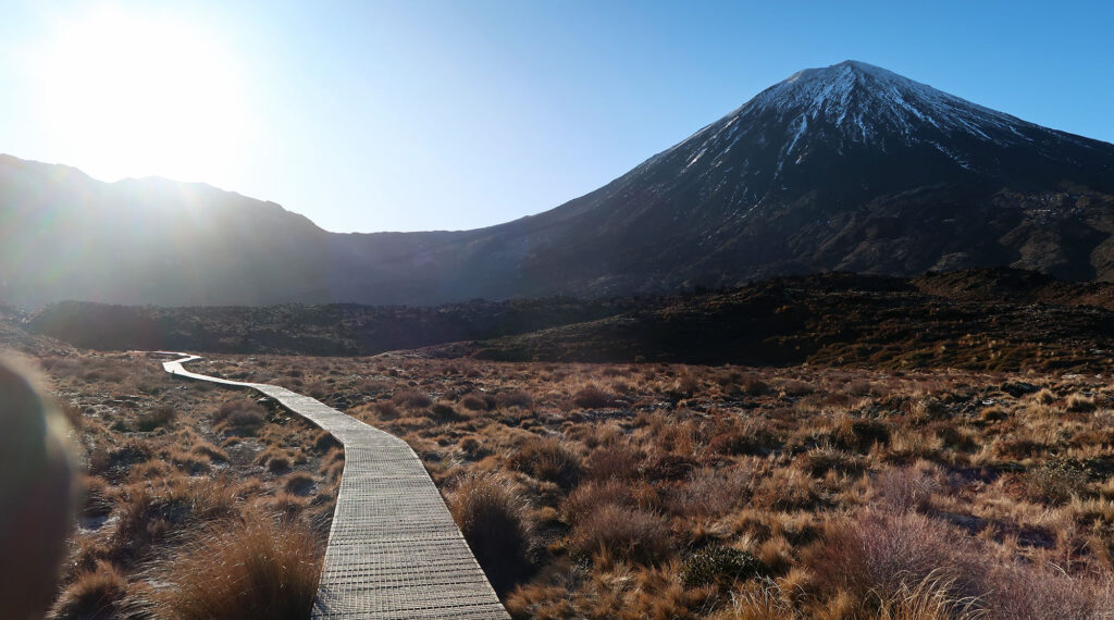
The ascent begins with a gradual rise. You gain roughly 800 vertical feet in the first two miles. The route seems very well cared for. Long boardwalks wind through the landscape of low-lying grasses and bushes.
By October snow had entirely disappeared from these lower slopes. But lingering snowpack would still coat the central ‘high alpine’ portion of the hike. For this reason, I saw relatively few fellow trekkers on the route. I’d encounter perhaps just 50 other folks that day on the trail.
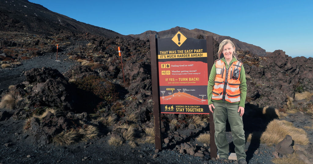
But you could see signs everywhere of the route’s extremely heavy usage in the summer months. And I mean literal signs. Every quarter mile or so, on the lower approach, you’d see warning placards. Avalanche danger! High winds! Do not proceed if the weather looks bad! I quickly got the sense that a lot of casual day-trippers have run into issues on the high, exposed saddle area.
Mount Doom
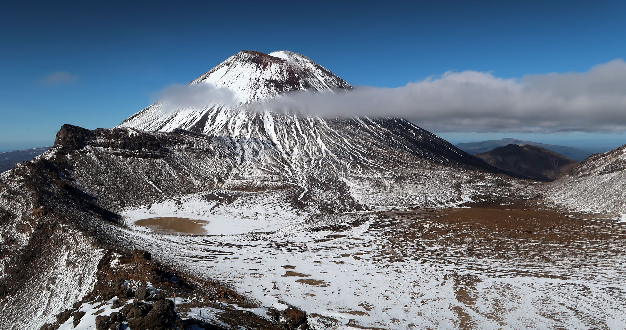
Looming above and to the right, for the entire first half of the hike, was Mount Ngauruhoe. This pleasantly symmetrical volcanic cone forms the highest point of the Tongariro complex. That said, it’s materially shorter than Ruapehu to the south—the North Island’s highest summit. These two clusters of volcanoes tower over the comparatively gentle landscape of the North Island.
Ngauruhoe served as the stand-in for “Mount Doom” in the Lord of the Rings film trilogy. This seems fitting as the volcano ranked as the most active, by far, on the North Island throughout the 20th century. More recently, the peak has sat largely dormant.
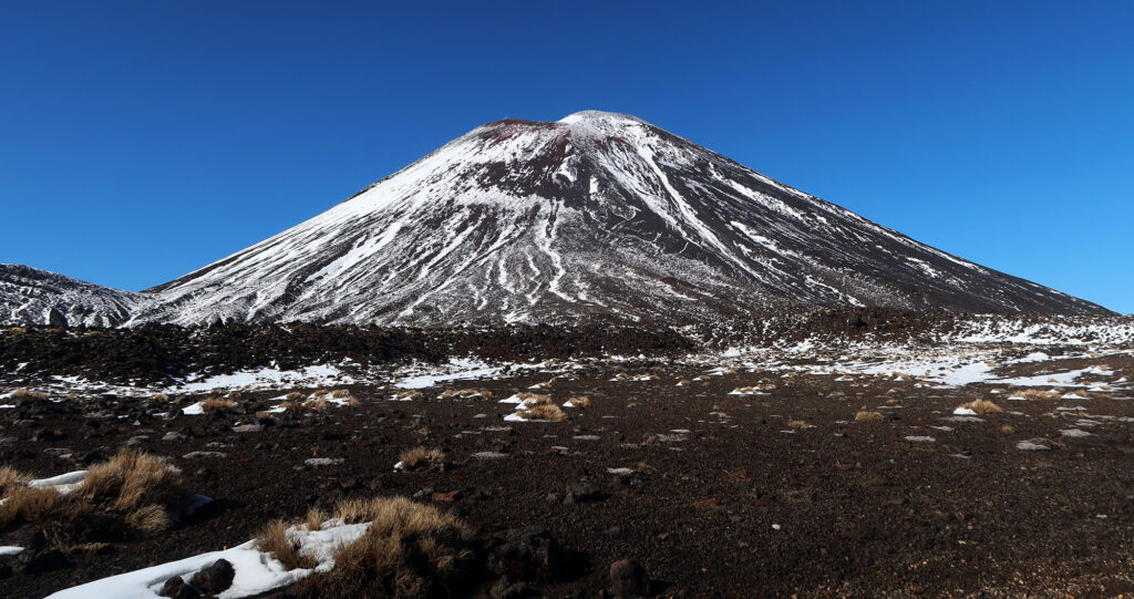
Many folks choose to hike this peak during their crossing. But in recent years, the park rangers have strongly discouraged this side trip. Local Maori consider the peak sacred and off-limits.
I continued towards the upper reaches of the crossing. The snow began in patches. But soon it coated the route. I had brought microspikes, in case I needed traction. But the trail was never very slippery.
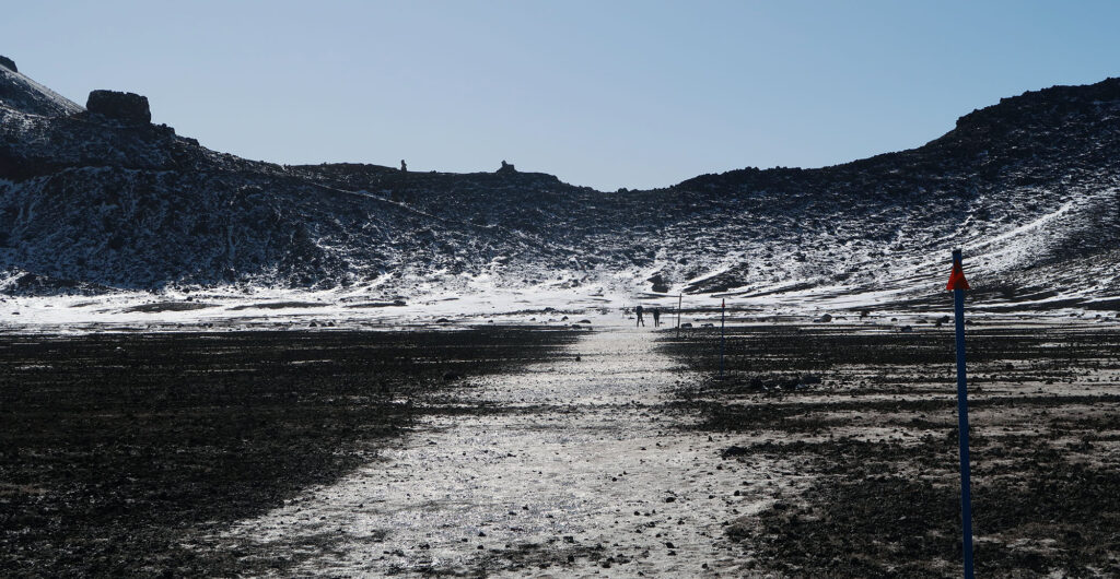
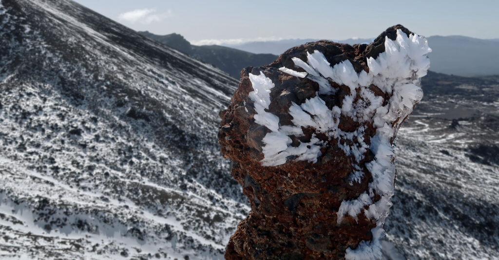
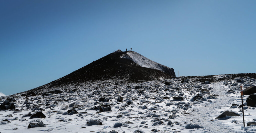
I pushed onwards towards the “summit” of the route. Actually, it’s a col between volcanic peaks that leads into the high valley of the route. Thick chunks of rime ice on boulders betrayed the harsh weather often seen on this route.

The Volcanic Landscapes of Tongariro Alpine Crossing
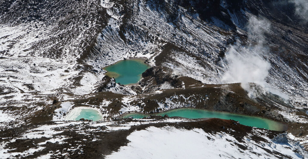
As I reached the top, I caught my first glimpse of the route’s central, high valley. A trio of “Emerald Lakes” stood below me. Minerals in the water lent their surface a surreal, saturated appearance. In the distance, I saw a larger, third lake.
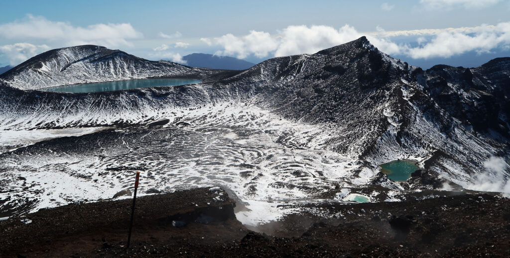
Steam wafted up from seemingly everywhere. Steam rose not only from the lakes but also from the rocks along the route. Everything seemed a bit more colorful than it should be … the greenish-blue water. The bluebird sky. The red, volcanic talus fields. Folks tend to describe the crossing as “otherworldly”. I’d tend to agree.
At this point, most of the “work” was behind me. I had reached the high point—the point of no return. I’d spend the next mile passing through the mostly flat Martian landscape of the massif. Then it was all downhill to the car park.
Bless with Blue Skies
New Zealand has gained a reputation for moody and fickle weather. In fact, the day prior I had enjoyed a very wet and windy hike down near the island’s southern coast. But the gods, it seemed, had smiled on me this day. A few clouds wafted along through the deep blue skies. But mostly I experienced sunshine and calm winds. What a treat!
The crossing continued on, now past the larger lake to the north. I deeply appreciated how peaceful and remote the hike felt in early Spring. I didn’t intend to come to New Zealand this time of year. But a last-minute opportunity had presented itself. I had a month between jobs, and that month happened to span late September and early October. Many of the South Island’s popular treks were still socked in. But it seems I had perfectly timed Tongariro. It had melted off enough to largely eliminate avalanche risk. But enough snow remained to fend off the crowds.
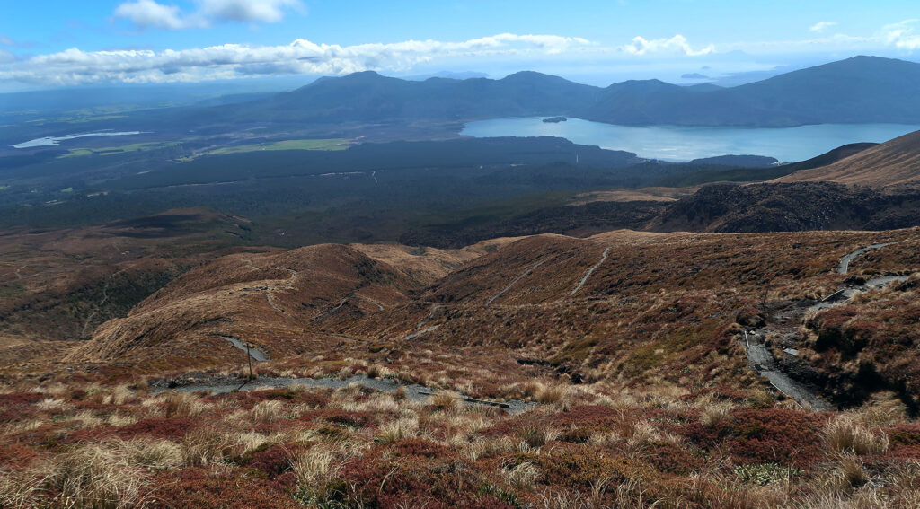
Down towards Taupō
The trail continued past Blue Lake and onward to the grassy, northern slopes of the massif. The view now stretched far to the north and west. I saw lakes and hills and endless skies. A verdant spring had come to the North Island.
I followed the snaking, whimsical switchbacks down the grassy slopes. Steam still rose from folds in its ridges. And eventually, I reached the final, forest section of the trail. People go as far as to claim Tongariro Alpine Crossing as the “world’s best day hike”. I’m not sure I’d go that far. But having passed through so many dramatic landscapes in just one short hike—I kind of get it.
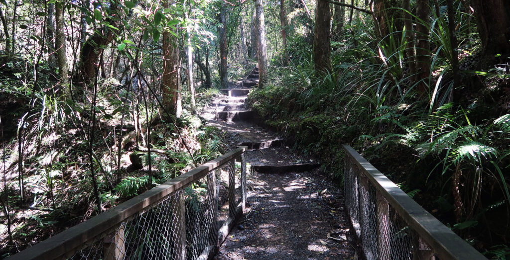
The final stretch runs along a babbling brook with small waterfalls. Thick stands of trees and bushes give this zone a jungle-like feeling.
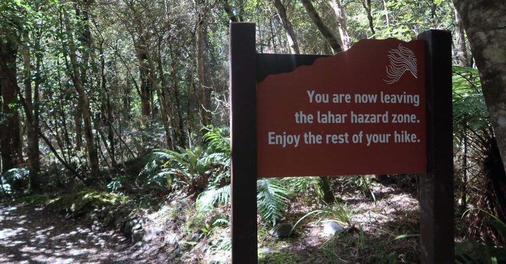
Finally, I reached the terminus of the trail. I’d spend another half mile tramping down the dirt road towards the big car park where the shuttle first picked us up. It’s a rare treat to hike point-to-point without retracing your steps.