Jan 3, 2025
Arrival
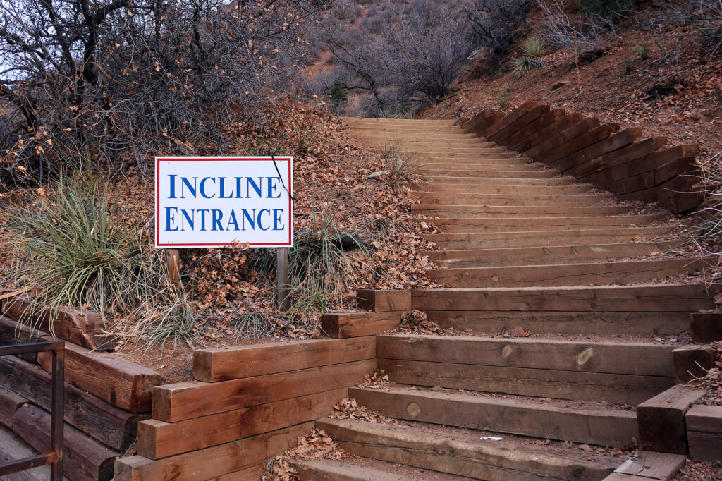
I parked in one of the large, paid lots at the base of Manitou Springs. It was 7:45am on a Friday in early January, and the lot was basically deserted. From the lot, I caught a glimpse of a bullet-straight cut through the pines of the nearby foothills below Pikes Peak. That cut was my intended hike that morning: the Manitou Incline.
By luck, one of the numerous shuttle buses to my intended trailhead pulled into the lot. I boarded the bus and enjoyed a quiet, solo ride to the base of the Incline. The shuttle bus dropped me off across from the Pikes Peak Cog Railway. The Cog was a far more comfortable way to ascend Pikes Peak. But I was there for conditioning, not comfort.
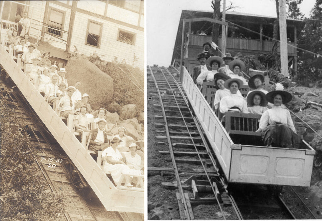
An abandoned funicular, turned endless stairway
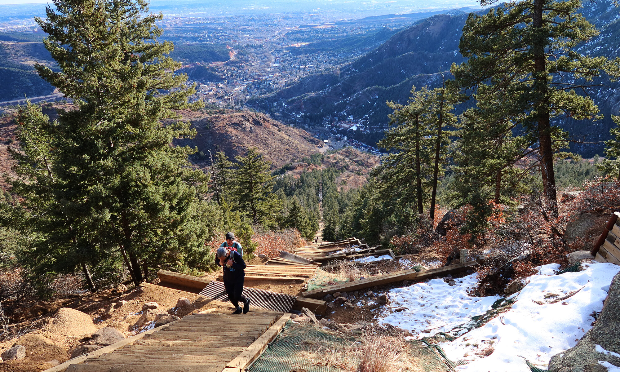
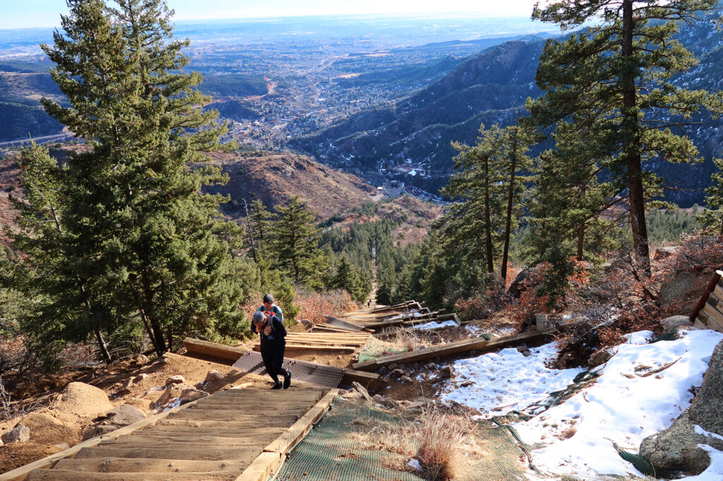
The Manitou Incline is more medieval torture device than scenic hike. It’s a series of wooden “steps” that ascends roughly 2000 vertical feet in about 0.8 miles. That’s equivalent to taking the stairs to the top of the Burj Khalifa in Dubai—the world’s tallest building. Fun, right?
The incline ran as a funicular railway for nearly a century. A cable pulled an open-air car full of tourists up the incline to a summit house high above Manitou Springs. A rockslide damaged the tracks in the 1990s, and the owners of the nearby Cog Railway decided against repairing the attraction.
Portions of the incline remained on land owned by the Cog Railway and Broadmoor Hotel until the mid-2010s. The patchwork of ownership meant hiking the incline wasn’t technically legal/sanctioned until 2013. From what I’ve read, the Incline is quite popular and competes for parking with the more remunerative Cog Railway. But today the incline is entirely on public land, and has been renovated into a well-loved recreational attraction.
Onto the Manitou Incline
Things began easy enough. I had complicated matters by wearing fifty pounds on my back. This was a “training hike” for my upcoming trip to Ecuador, and I had dumped a weighted vest and a couple iron plates into my pack. More fun.
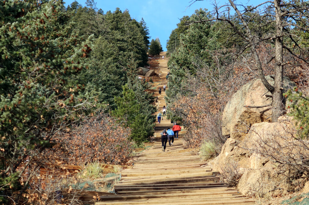
The incline had some sort of turnstile entrance structure / informational building. But this early in the morning, nothing appeared open or staffed. That didn’t mean the incline was empty though. Plenty of sporty locals were ascending and descending its railroad-tie steps.
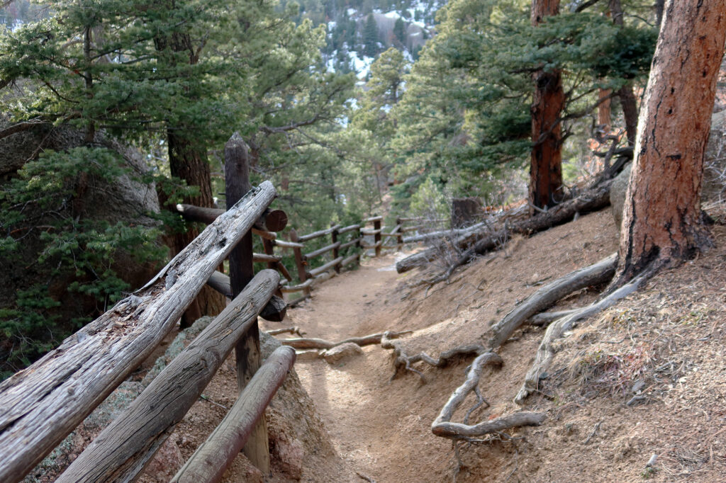
Almost immediately I was struck at how non-monotonous the ascent felt. The “steps” were far from uniform. Some were shorter than average steps. Some much, much larger. The former cable-car line followed a precise compass heading. But the incline undulated from quite shallow to very steep (over 36 degrees at its steepest). At times you couldn’t see very far up it. So it had several helpful hallmarks of an actual hike, as opposed to a uniform, steel staircase.
The Ascent
I trudged higher and higher. This was among the steepest training hikes I had done this season. Up in the high Rockies, where I usually trained, you couldn’t really get onto 30-degree slopes without incurring avalanche risk. But down here at 6000-8000 feet, on the front range, the incline was almost entirely devoid of snow and ice. Despite being super steep, it felt a bit easier than usual, thanks to the extra oxygen.
Among other hikers, there was a very broad range of fitness levels. CrossFit bros and Air Force cadets basically ran up the ties. Families with kids, sat smiling and catching their breath. The official signage strongly advised against descending the stairs. But there were a couple intermediate points where you could bail onto a normal trail if you felt in over your head.
Burdened by an entirely useless amount of iron, I was satisfied to just be somewhat middle of the pack. Eventually a young couple fell into stride with me, and we both sort of set an unspoken goal of not falling behind the other.
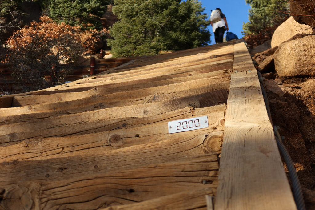
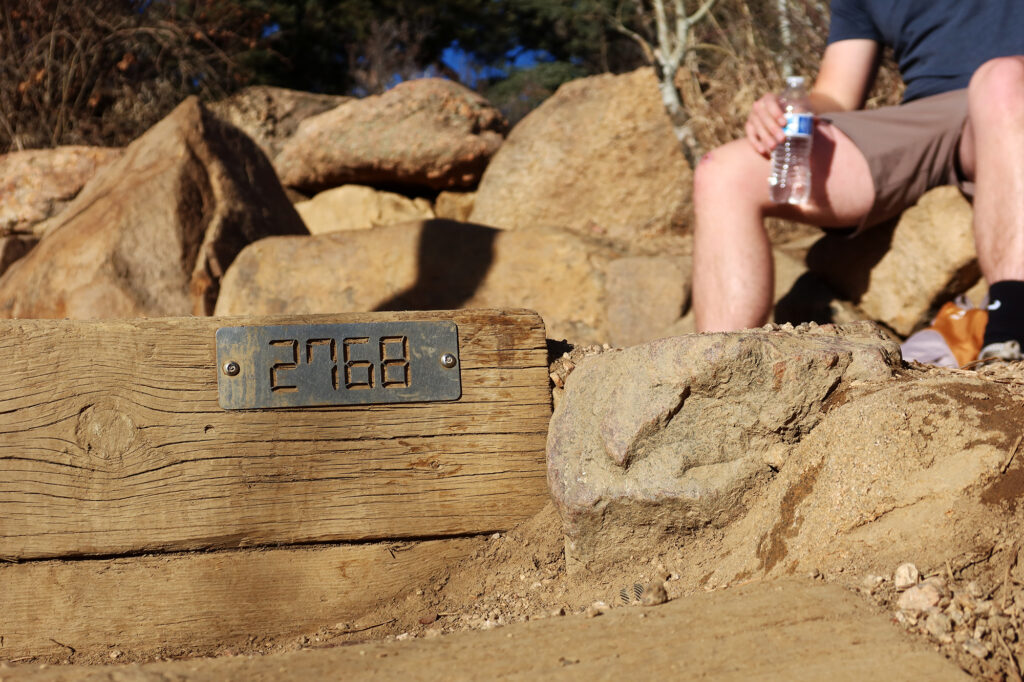
Periodically, cute steel signage nailed into the railroad ties announced some important numerical milestone. 500 steps. 1000 steps. 1500 steps. The views of Colorado Springs and the Front Range grew steadily more expansive.
On a dry, sunny day in early winter, I didn’t end up breaking out microspikes. But I was still glad I brought them. The incline passed in and out of shady sections. And traction would definitely prove critical after a snowstorm or later in the season.
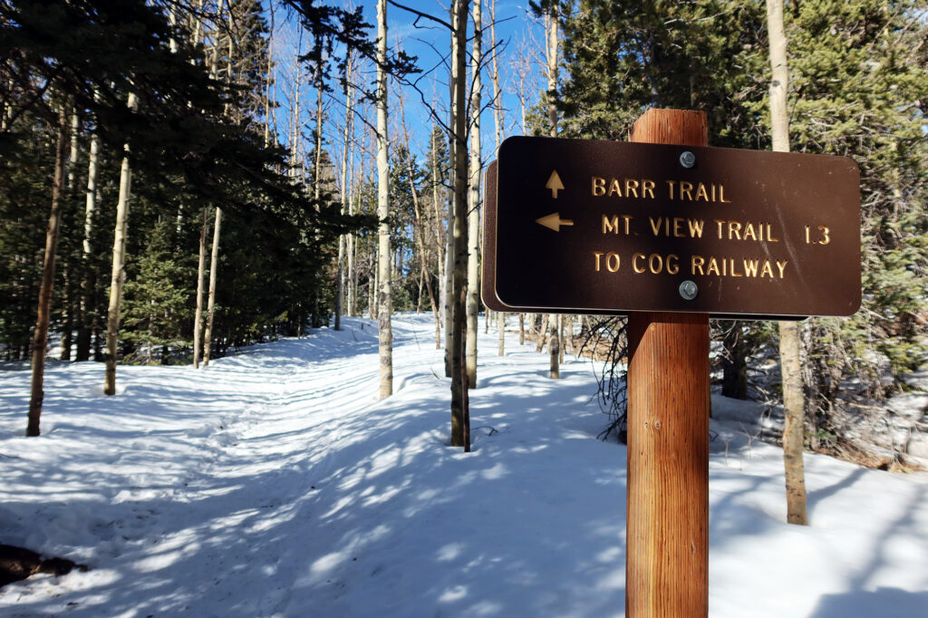
Onwards to the Barr Trail
After 2,768 grueling steps I made it to the top of the incline. A small crowd of incliners were sprawled out amidst the ruined foundations of the old summit house. Most of them began down the switchbacks that dropped towards the lower Barr Trail and back to Manitou Springs.
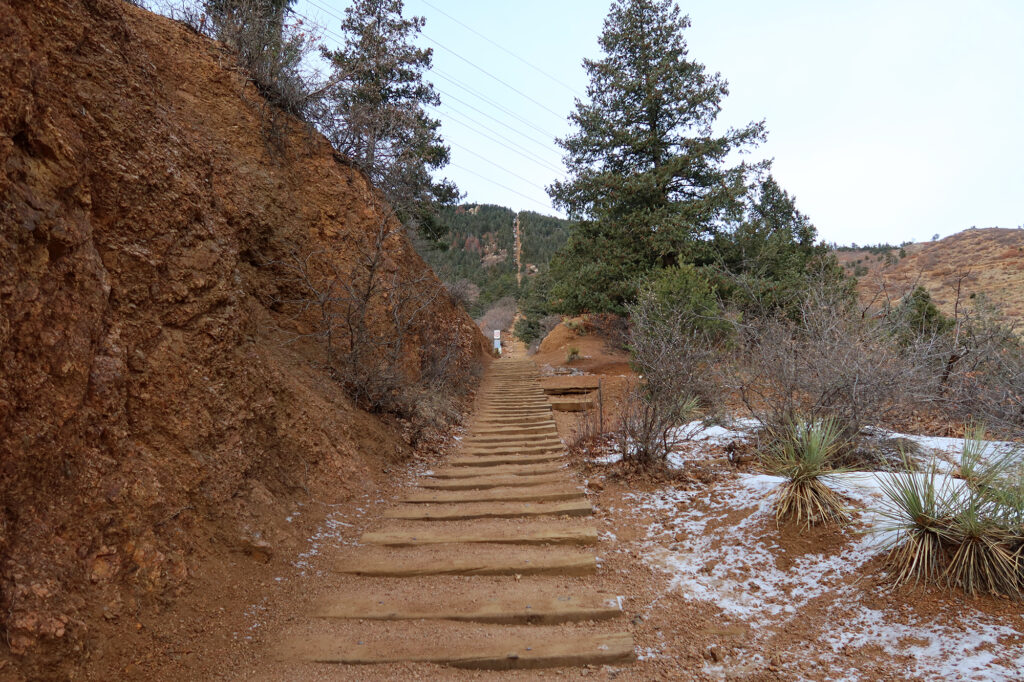
But my ascent was not even halfway over. I’d set a goal of ascending at least 4000 vertical feet that day. The 0.83-mile incline delivered 2000 of those vertical feet. But I’d need to continue higher on the Barr Trail for over five miles to get the second half.
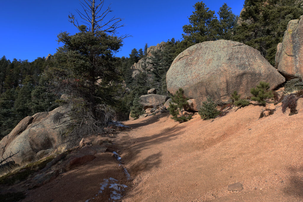
And so I continued on a somewhat flat, lesser-used trail that synced up with the Barr Trail without losing and vertical gain. A mile or two in, the ascent began again, this time much shallower. The Barr Trail ascends from Manitou Springs to the summit of Pikes Peak. At 24 miles, round trip, and 7600 vertical feet of gain, it is the longest and tallest “standard route” ascent of any 14er in Colorado. But with its shallow pitch and excellent maintenance, it’s also among the least technical.
A couple years prior, I had opted to summit Pikes via the far shorter Crags Campground route. 24 miles on the Barr Trail sounded no bueno to me. I was especially unenthused by the idea of sleeping overnight at Barr Camp and dealing with summer crowds and all of their snores and bowl movements.
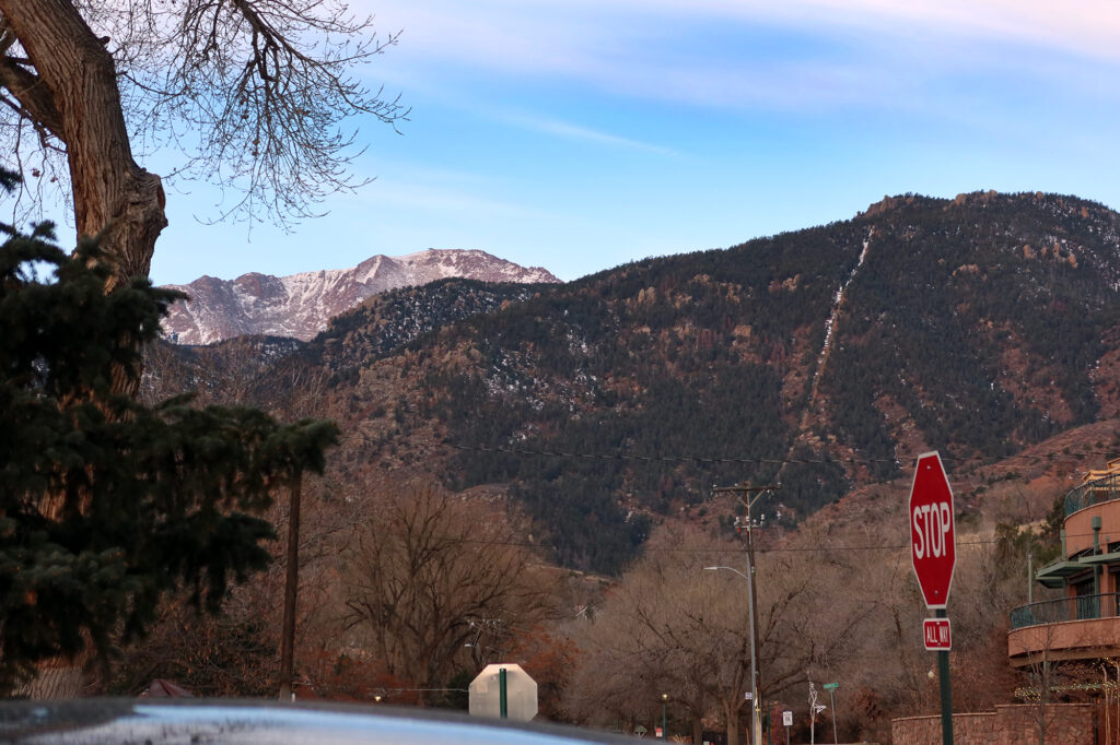
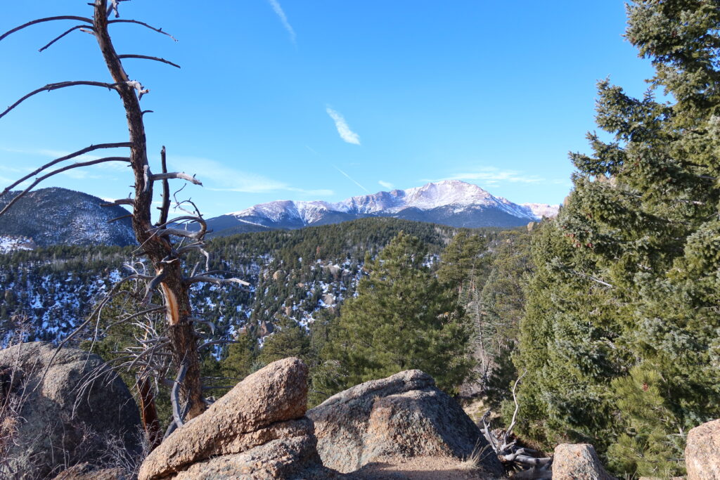
But now here I was, meandering up a sunny and deserted Barr Trail in January. And I thought it was beautiful. The trail bumbled about in the snowy foothills above Manitou Springs. Pikes Peak lorded over the scene, its steep Eastern Face dusted in snow, but with ample rocks still poking out.
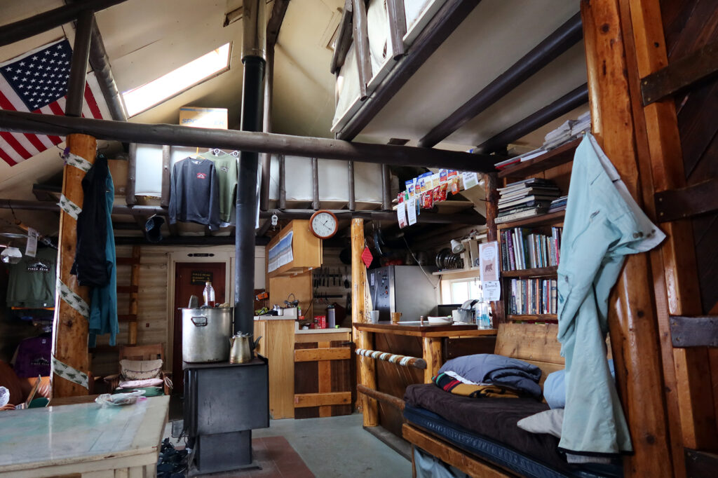
Barr Camp
The snowpack started to pick up a mile or two after the Incline. And so I donned some snowshoes and continued higher. Getting 4000 feet of gain that day meant passing just above “Barr Camp”. The Camp sat about halfway up the trail, roughly 4000′ below the summit, just inside the Pike National Forest boundary. Many folks ascending Pikes Peak will camp overnight here, either in one of the reservable cabins or in a tent.
I continued about 500 vertical feet higher, into thicker pine forest, to reach my vert goal. The trail was well-compacted. Even in mid-winter folks ascend this route. The Cog Railway and summit highway remain open year-round.
Feeling accomplished, I turned around and descended back to Barr Camp. I poked my head inside the main building, where a group of four crunchy friends were hunkered down with some books. It struck me as a funny contrast: the incline was full of fitness bros in shorts and t-shirts and tiny hydration vests. But here at Barr Camp were backpackers with 80-liter packs and creature comforts like chacos and paperback novels.

The descent to Manitou Springs
Then began the long and winding journey back down to Manitou Springs. This time I stayed on the Barr Trail the whole way. The trail was entirely empty until I reached the point where the descent from the Manitou Incline joined up with it.
Then it was quite crowded! It’s amazing how a giant stairwell can draw so many people out and into the mountains, even in January. I didn’t see a single cog railway train run that day. But the abandoned incline they begrudgingly sold off to the public was thronged with happy recreators.