Jan 23, 2025
Arrival in Quito
In January 2025 I joined a guided trip to summit some of the Ecuador’s tallest volcanoes. Typically, getting to a 19,000′ summit involves a lot of time huddled in tents, rehydrating freeze dried dinners, and staring at endless snow and ice. But climbing in Ecuador would not involve any of this “fun.” The benign climate of the equator meant we could acclimate in cities and relaxing haciendas at progressively higher altitudes. And we wouldn’t be dealing with any snow or ice until the “summit days” themselves.
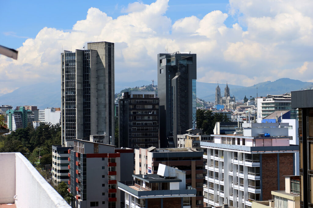
The acclimation process began right in the country’s capital city of Quito. Quito sits at 9,000′ above sea level. It ranks as the second-highest capital in the world behind Bolivia’s La Paz (~12,000′). My first couple days in Quito involved just relaxing and playing tourist, first solo, and then with my new “team” of climbers and guides. Coming from Colorado, I probably could have just jumped right into the acclimation hikes. But most of our group was coming from sea level, and we’d all benefit from just walking around at 9000′ for a day or two.
Ascending the TelefériQo
On day three, we began putting a bit more effort into this process. The standard playbook for easing into higher altitude is to “climb high, sleep low.” Following that strategy, we’d do a relatively short hike that day to Ruku Pichincha, the active volcano that rises above the city to its West.
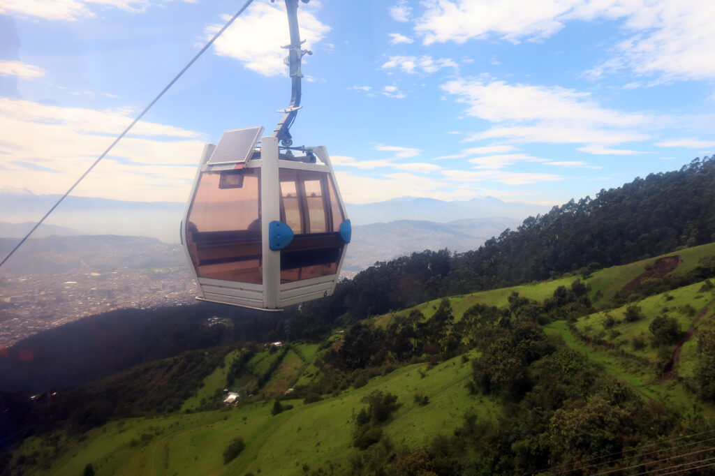
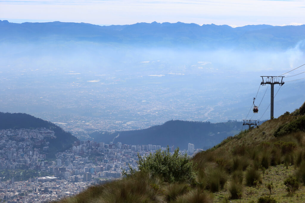
The hike began by ascending a sight-seeing gondola on the edge of the city, the TelefériQo. The name is a slightly clever portmanteau of “teleférico” (the Spanish world for gondola) and Quito. Taking a taxi to the base of the lift and then ascending to its top terminal would save us a solid 3000 vertical feet.
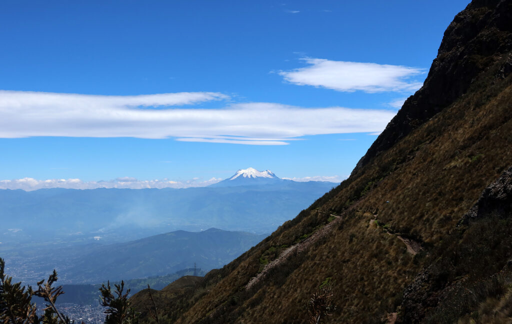
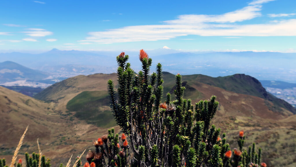
The lift brought us to 12,943′, 103 feet higher than North America’s highest chairlift, in Breckenridge. It was late January, a time when similar altitudes in the United States would be coated in snow and ice. But just 10 miles from the equator, we were instead surrounded by tall grasses and flowers.
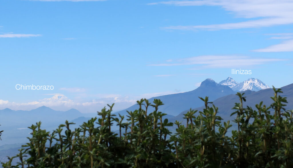
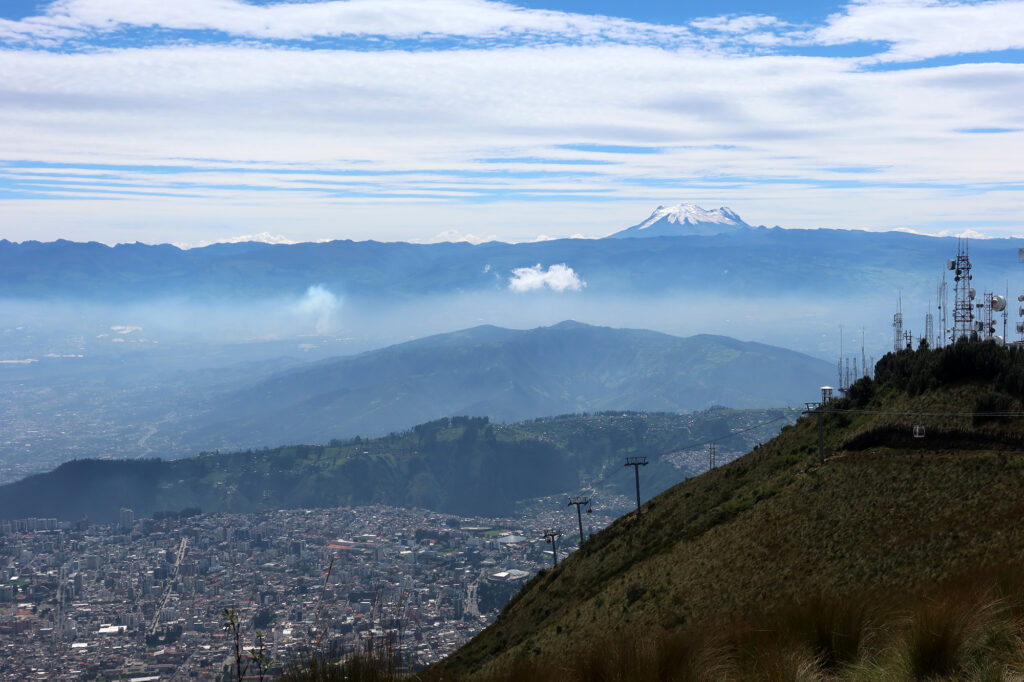
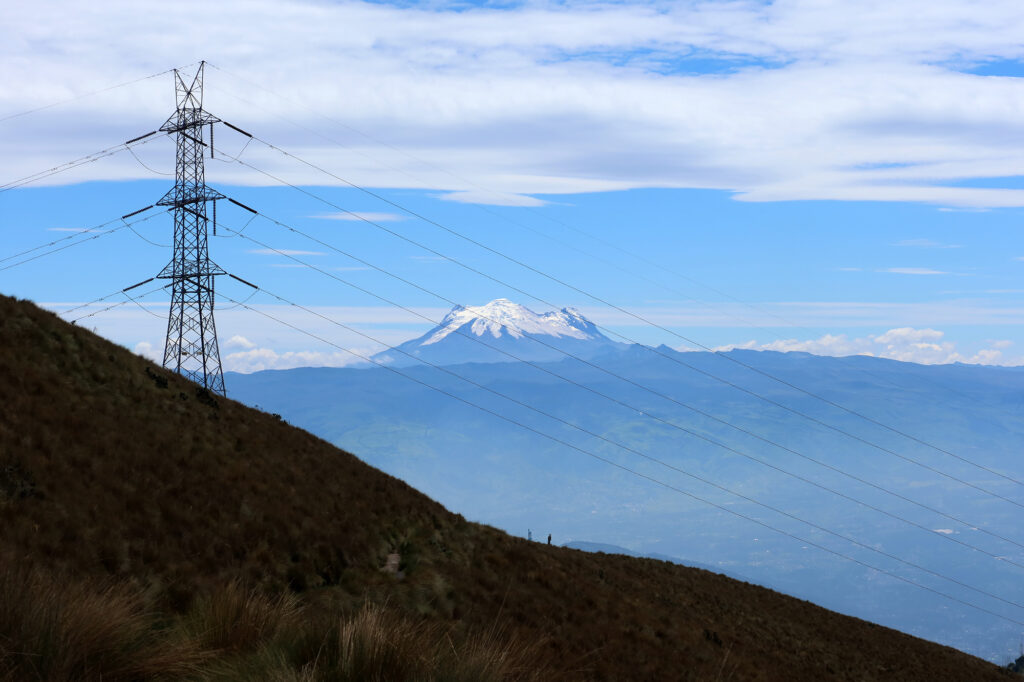
From the start of our hike, we were treated to incredible views of the city and the surrounding peaks of the northern Andes. Several of the country’s tallest volcanoes were on full display that day, including Cayambe, Antisana, Cotopaxi and Chimborazo.
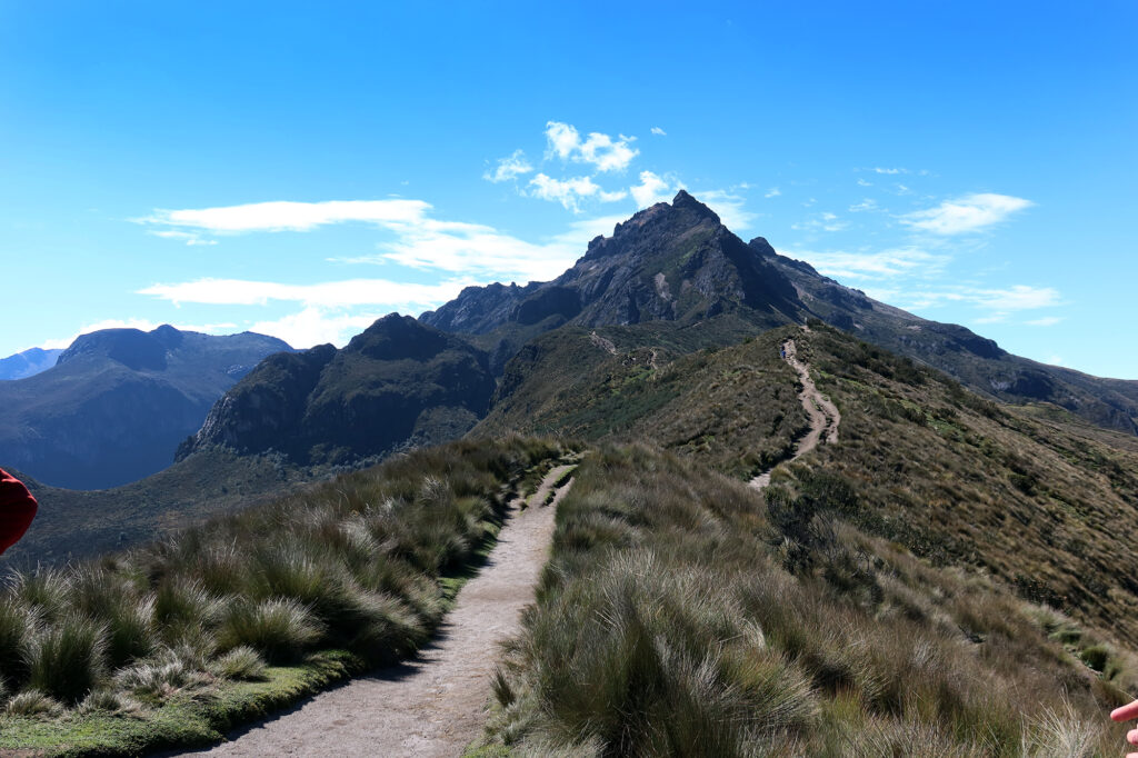
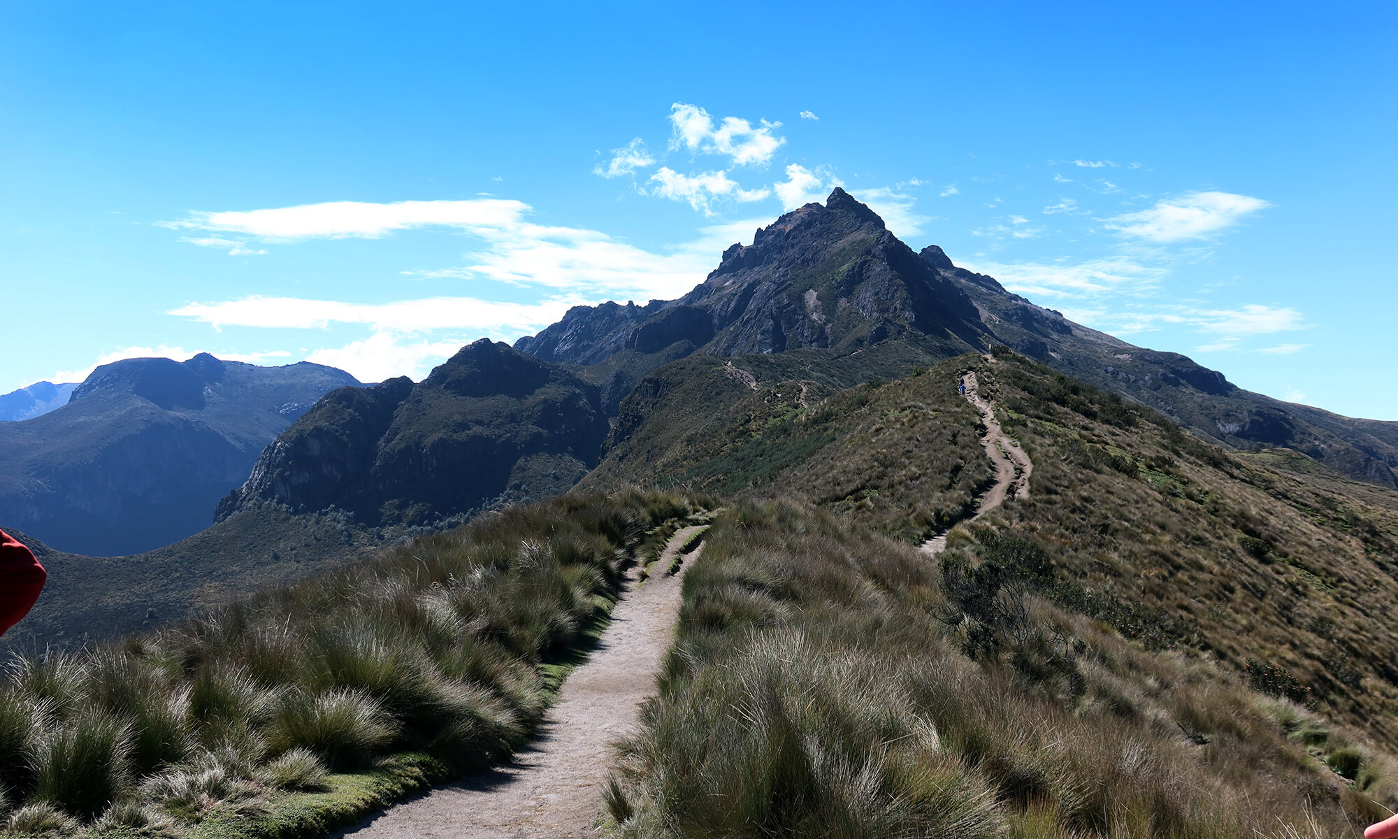
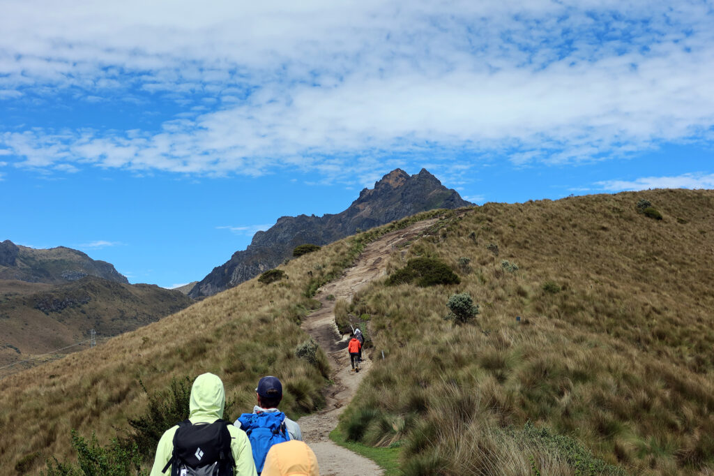
En route to Ruku Pichincha
Finally, after multiple plane rides and taxis and a gondola, the fun part began: hiking! Even though this was just a warmup hike, it would still be a decent effort. We’d ascend 2500 vertical feet to the closer of Pichincha’s two prominent summits, Ruku Pichincha or “Old Pichincha”. And we’d be hiking at an altitude that most of the folks in the group (myself included) had never reached before.
Luckily things began easy. The wide trail ascended at a modest pace, through rolling grassy hills. We chatted and soaked in the views, as the rocky summit loomed ever-closer ahead of us.
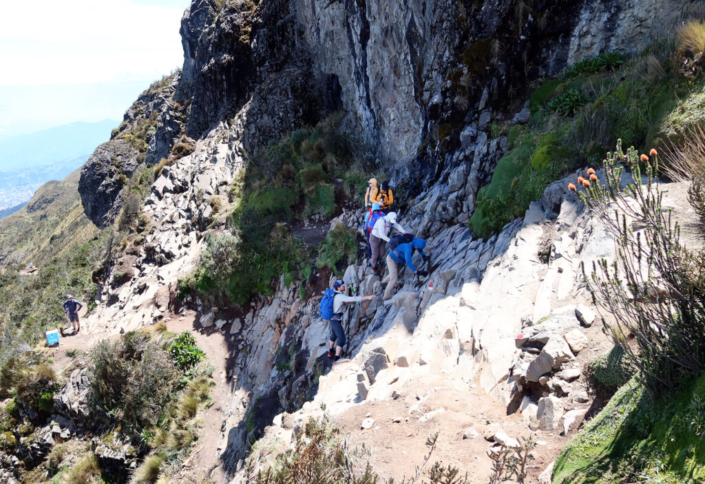
Roughly halfway along, we came to a slightly tricky rock face, that required some mindful traversing. At this point the guides went into guide mode, coaching folks through the footwork. Then we continued higher. Overall I’d describe this as a “non-technical hike” that anyone sure-footed could try, provided they’re OK with a bit of exposure. Call it “easy class III”.
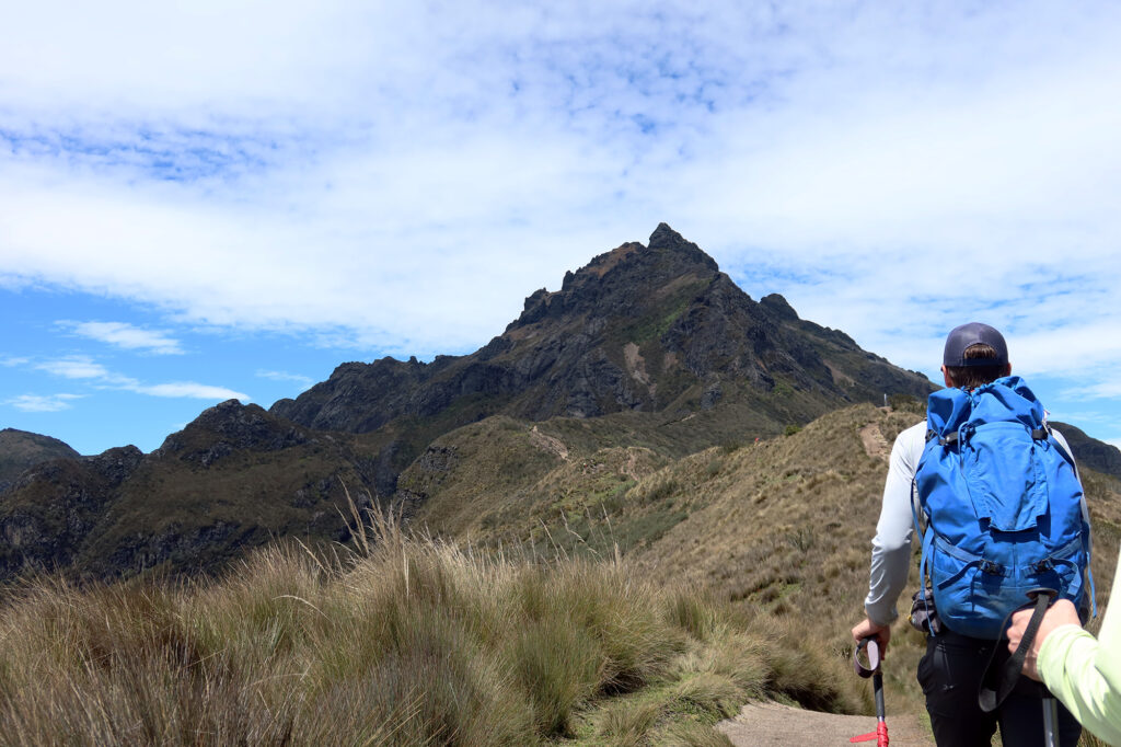
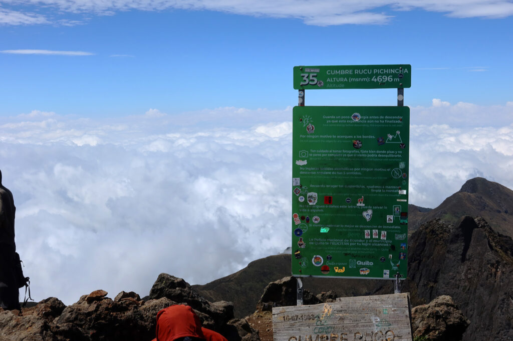
Summiting Ruku Pichincha
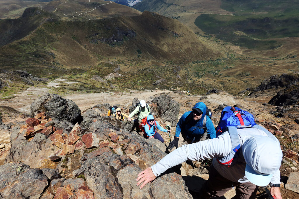
The route traversed beneath the rocky summit onto its northern flank. From there we ascended some slightly loose dirt and rock towards the top. This was where the chatter amongst the group died down as everyone focused on breathing. Ascending this final slope was a bit like ascending the stairs of the Empire State Building, if it was placed on the summit of Mount Whitney.
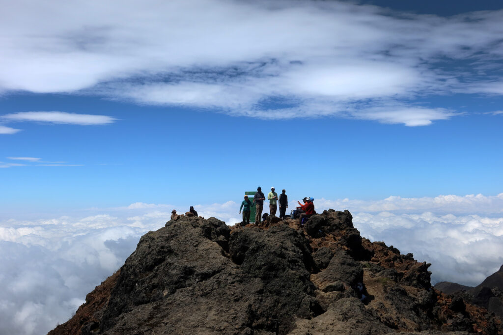
But in short order we reached the summit, a respectable 15,400 feet above sea level. We sat and relaxed for a while, snacking and hydrating.
Gazing to the West, beyond the summit, we saw gorgeous, pillowy clouds below us. These were the western slopes of the Andes, where moist air from the Pacific runs into higher elevations. Beneath the clouds were Ecuador’s famous “cloud forests” home to some of the country’s extraordinary biodiversity.
The return trip
After some time relaxing atop the summit, it was time to do everything again in reverse. We began our descent, many of us feeling proud to have summited our first “15er” … a class of peaks that doesn’t exist in the contiguous US!
Besides being just a really cool, active volcano, Pichincha holds a place of honor in this region of Ecuador. The entire capital region takes its name from the mountain. Quito sprawls out along its eastern base. In fact, many of Ecuador’s “provinces” take their name from prominent mountain summits like Cotopaxi and Chimborazo.
Puffy clouds rose higher around as as the day transitioned towards afternoon. But the route remained sunny for our whole outing. Ecuador’s Andean valleys rarely experience “frontal weather” (systems moving in). Instead, the high alpine sunshine heats the valleys and drives “convective” flows. Thus many afternoons in “winter” feature storms and light rainfall.
About an hour later we were back at the gondola. I treated myself to a frozen banana at the touristy summit building, before we descended back into Quito. Our first hike in Ecuador was a success!