March 9, 2024
Harvey Gap State Park
On a sunny Sunday in March, I decided to drive west to Rifle area and enjoy some snow-free hiking along a curious geological formation called the Grand Hogback. My first adventure took me to the underrated but still regularly-hiked Rifle Arch. But that hike ended in a steep cliff band midway up the hogback.
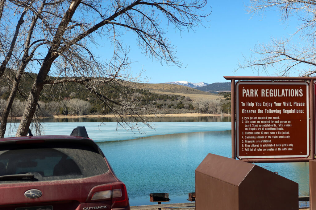
I wanted to get on to the summit of the hogback. To experience the upturned layers of sandstone at their apex (more on the hogback’s geology later). So I headed just east of the arch and town of Rifle to Harvey Gap State Park.
I asked the women working at the visitor center about hikes to the summit of the hogback. They looked a bit confused. Like, people come here for boating, why do you want to walk up a random ridgeline? They had no recommendations.
I left undeterred however. Scouting round on a few mapping softwares, I saw there was a jeep road to a comms tower just to the East of the “gap” in the hogback. A public parking lot sat opposite the road on the Grass Valley Reservoir. I figured I would just give it a go and hope for the best. After all, it has an entry on All Trails.
Ascending the Hogback
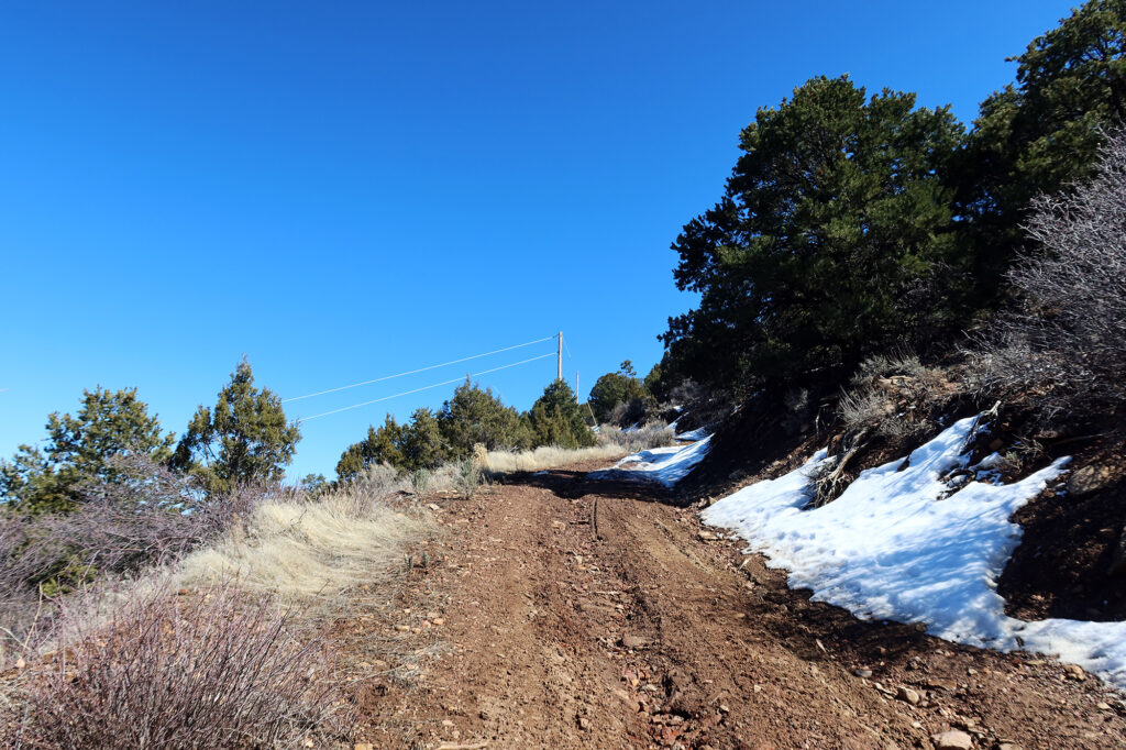
The jeep road looked like a simple enough ascent. It ascended roughly 1000 vertical feet in just over a mile, at a relatively constant grade. But soon I discovered the north/northwestern exposure route had a lot of mud and snow. This didn’t make it impassable … just kind of slow and annoying.
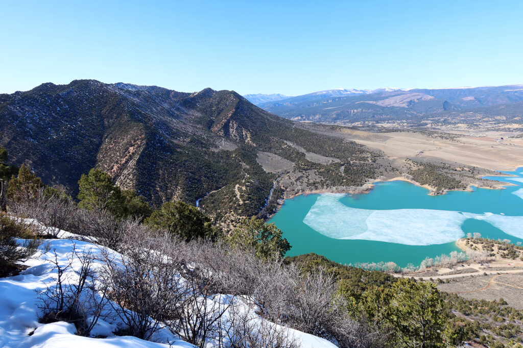
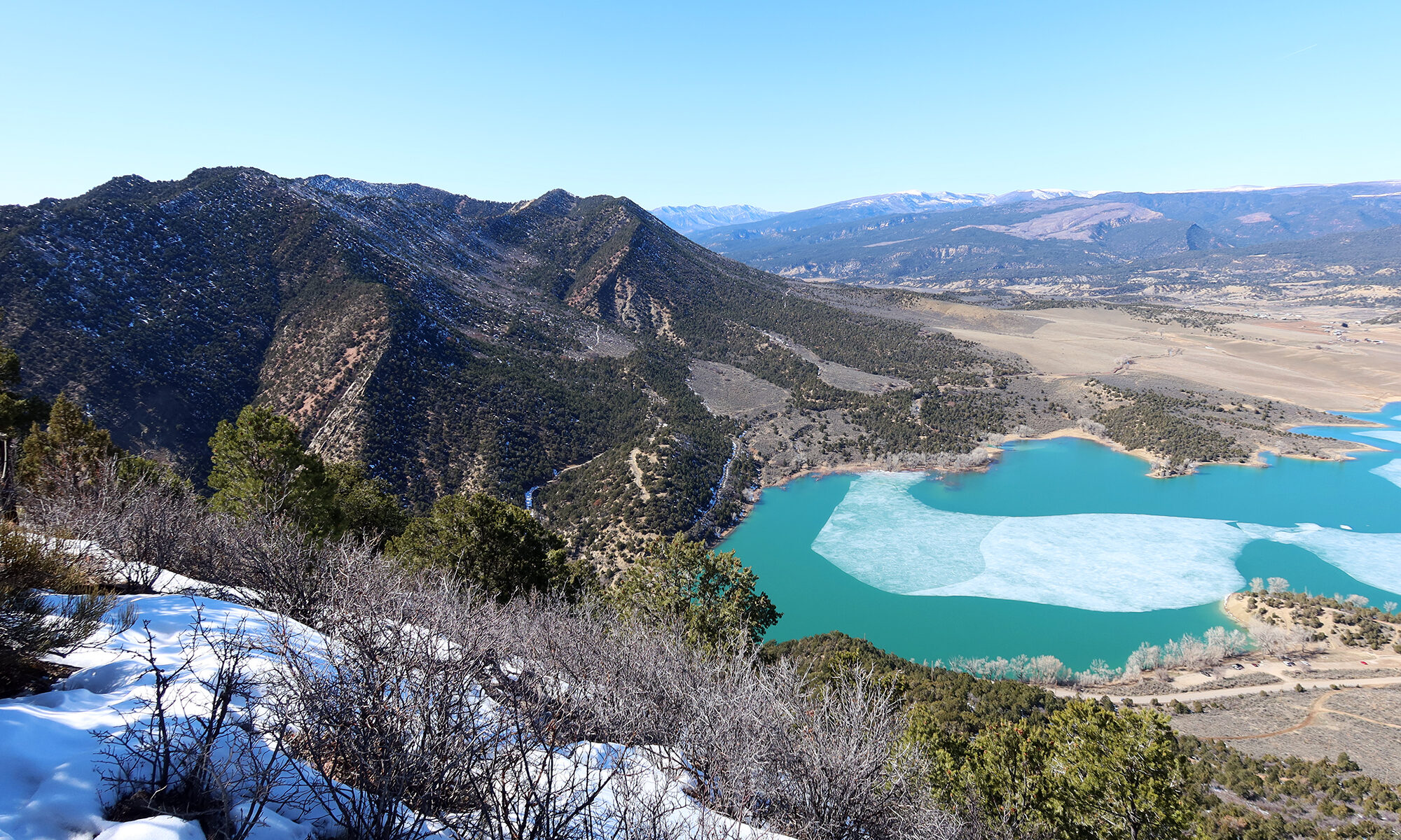
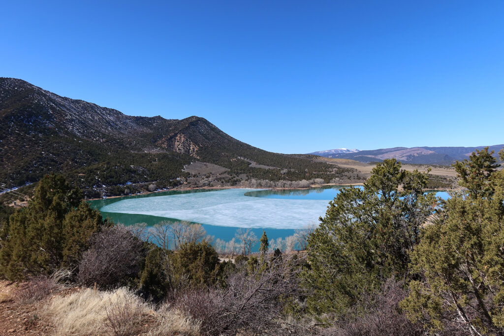
That said, it was hard to complain too much. The views of the reservoir and surrounding valley grew increasingly beautiful.
The Grand Hogback
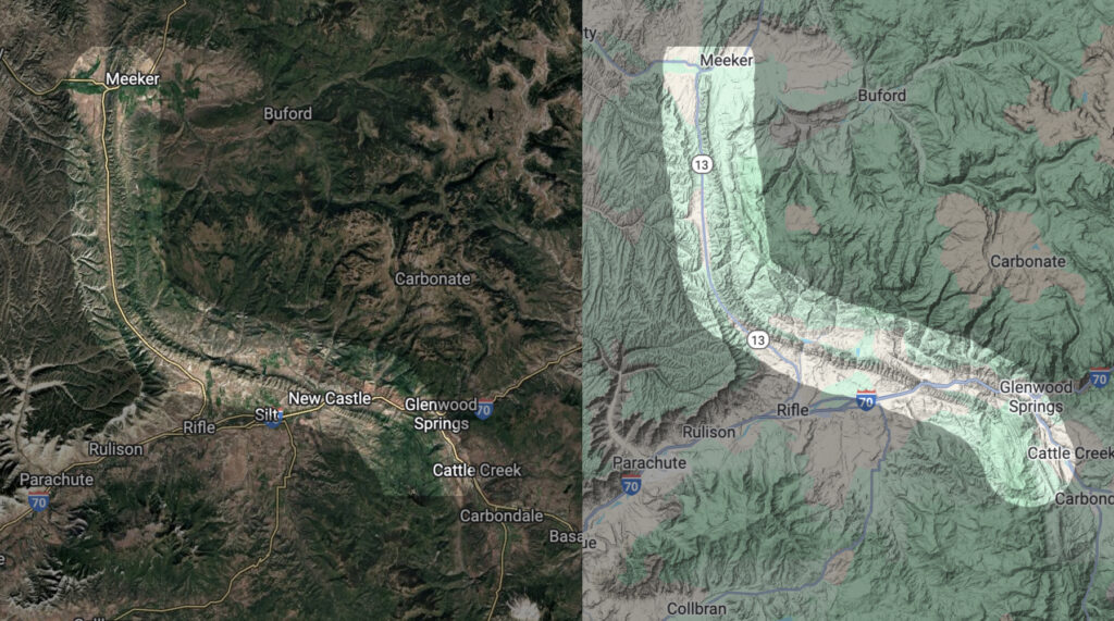
Harvey Gap is one of a handful of “breaks” in the Grand Hogback. Geologists consider the hogback to mark a 70-ish mile stretch of the boundary between the Rocky Mountains, to the East, and the Colorado Plateau, to the West.
During the formation of the Rockies, ~70-50 million years ago, the uplift caused layers/strata of rock along the present day hogback to tilt steeply upward. Millions of years of erosion peeled back weaker rock layers, leaving exposed beautiful striated bands of tougher rock, most notably the resistant sandstones of the Mesaverde Group.
You can see the full extent of the hogback on topo maps, stretching from the northeastern edge of the Roaring Fork Valley, crossing I-70, tacking west, to the north of Rifle, and then turning north towards Meeker and beyond.
The Grand Hogback has an Eastern counterpart of sorts, though it’s composed of different rock layers. Interstate 70 crosses an even longer hogback, known as the Dakota Hogback, on its path from the Denver Metro into the foothills, on the Eastern edge of the Rocky Mountains. The Dakota Hogback stretches (albeit discontinuously) from Northern New Mexico to southern Wyoming.
Topping out on the Hogback at Harvey gap
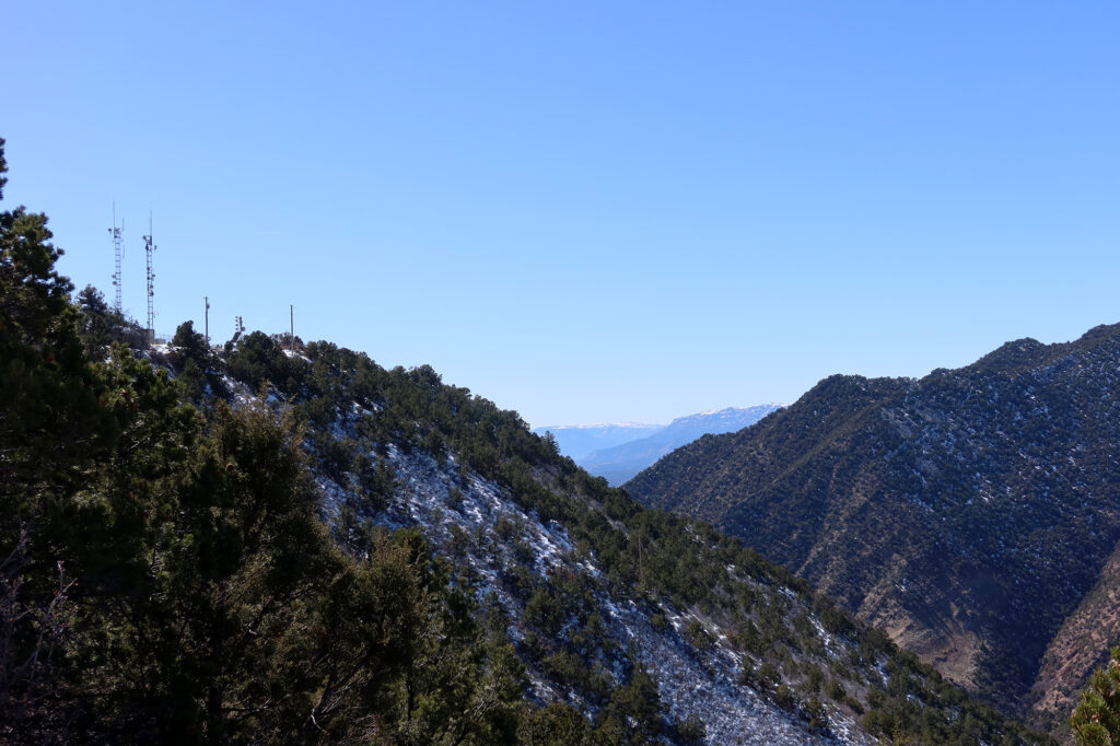
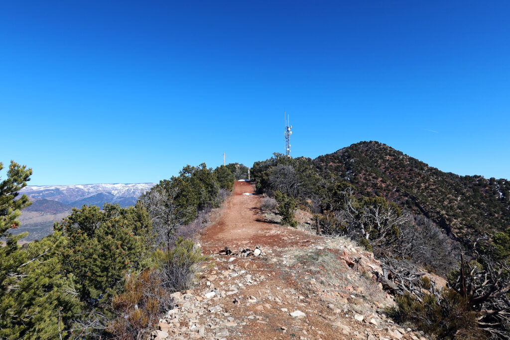
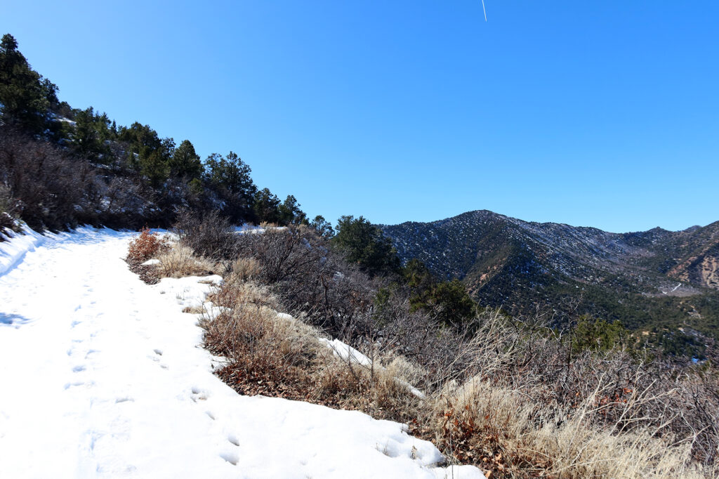
Roughly an hour after starting off, I reached the top of the road. I continued past the comms equipment, and the end of the road. I wanted to try and reach where the hogback “broke” and plunged downward towards the “gap.”
From roughly that vantage point, I had the best views yet of the reservoir constructed just upstream of the gap. Harvey Gap is one of a handful of major breaks in the Hogback. Rifle Gap (en route to Rifle Falls) was another such gap, also home to a large reservoir. I-70 exploits a third at New Castle, carved by the Colorado River over millions of years.
The “summit” area also afforded excellent profile views of the hogback as it continued West, past the gap. I saw clear evidence of the massive, upturned sandstone layers. Here was dramatic evidence of the Rocky Mountains forcing their way up through hundreds of millions of years of ancient rock.