May 3, 2025
Arrival
I drove through the picture-perfect town of Cold Spring, tucked alongside the Hudson River amidst the hills of the Hudson Highlands. This was an auspicious little corner of the Empire State. It was here (and only here) that glaciers managed to carve a broad, navigable river through the ancient Appalachian Mountains. An entire book could be written on how notable this intersection of river and hills would prove for explorers, revolutionaries and industrialists alike. At the very least, it’s home to some spectacular hiking.
I arrived at the nicely renovated trailhead along 9D, just north of town. It had been over a decade since I lived in the area, and I am happy to report that both the trailhead and the path up the mountain (known as the “Washburn Trail”) are in vastly better shape than I remember growing up.
And so I donned my pack, and began the hike.
Ascending past the Quarry
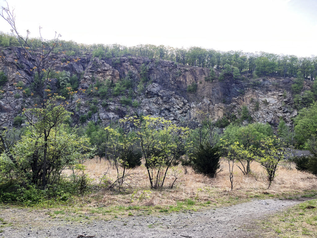
The Washburn Trail begins by ascending a pair of long switchbacks through dense woods. Roughly a half mile and 300 vertical feet later, you reach an impressively large rock quarry dug into the hillside. A few paths meander around the base of the quarry. But the trail itself tacks south, and then up along the quarry’s southern edge.
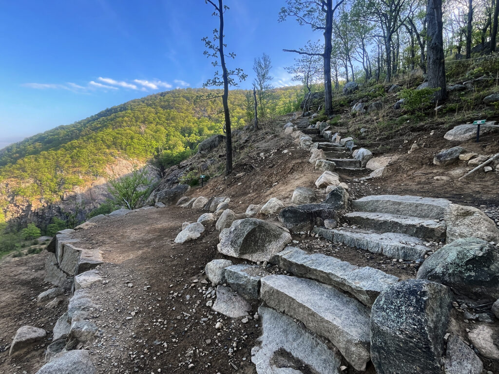
Here recent trailwork was on full display. Various “social trails” trampling through the underbrush had been fenced off. And in their place, a wonderfully constructed series of stone stairways and switchbacks had now been constructed. From my experience, the Hudson Highlands aren’t nearly as prone to erosion and washout as, say, the Catskills or the Adirondacks. But trail hardening is always a welcome site. These hikes see a lot of weekend traffic from New York City.
How Bull Hill Got Its Name
I grew up just north of Bull Hill and Cold Spring, in Poughkeepsie, NY. During summer camp, a counselor named “Hikey Mikey” took us on outings in the Hudson Highlands. Bull Hill was among those outings, and might very well be the first hike I’d ever been on.
Hikey Mikey told us of a crazed bull that rampaged through the sleepy town below. Angry villagers chased the belligerent bovine up into the hills, and off a cliff above the Hudson River. The bull fell, breaking its neck on the rocks below. Thus both Bull Hill and nearby “Breakneck Ridge” got their names.
I assumed this story had about as much truth to it as someone receiving the legal name Hikey Mikey. But googling around now, nearly 30 years later, I am pleased to report this story goes back to at least 1882, described in Joel Cook’s book Brief Summer Rambles Near Philadelphia:
On the western side rises the great Storm King, and on the eastern side Mount Taurus, with Breakneck Mountain beyond it. Mount Taurus is modernized from Bull Hill, so called because a wild bull was once chased by the indignant inhabitants across to the other mountain, where he fell and broke his neck. Thus one adventure named two mountains.
Of course, locals were just as capable of fabricating folklore in the mid-1800s are they are today. But a memorable story of a mountain’s etymology that has survived over 140 years might as well be fact, right?
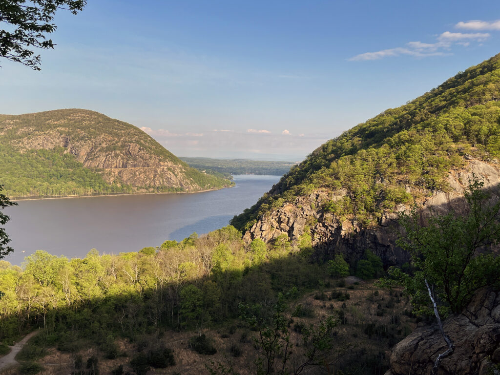
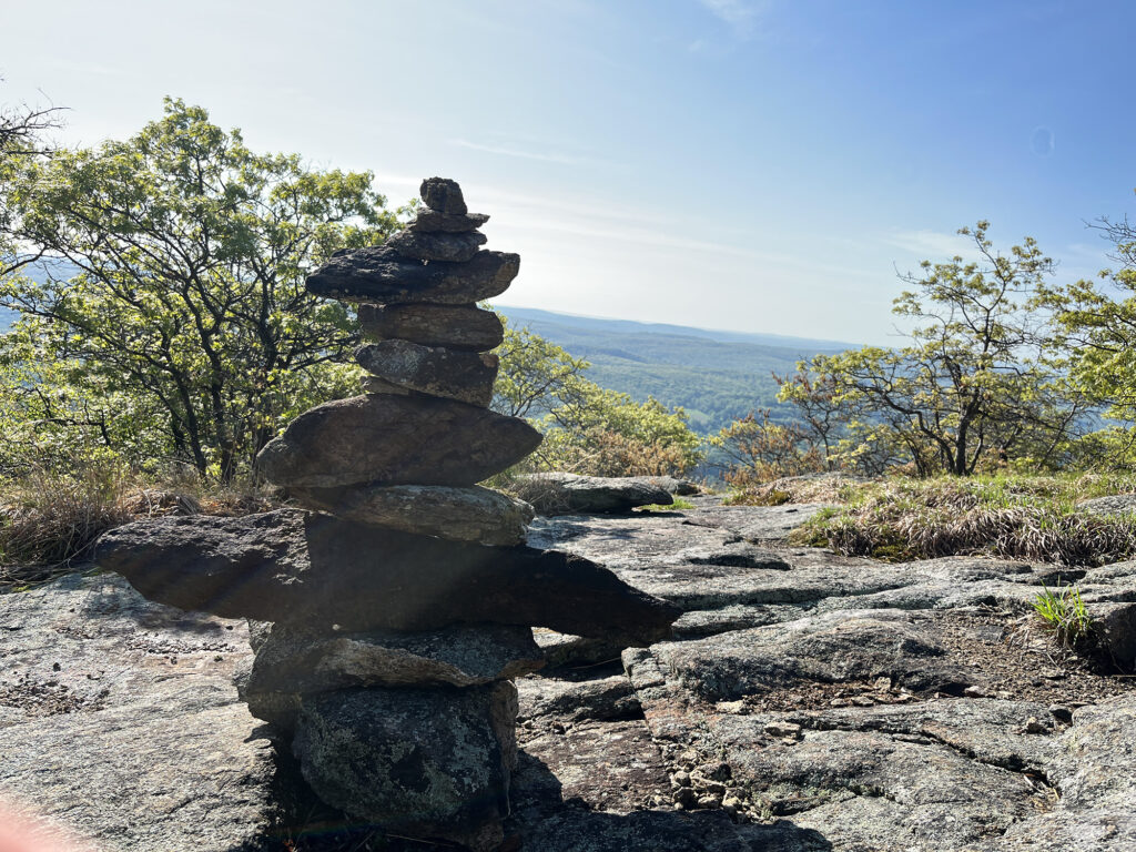
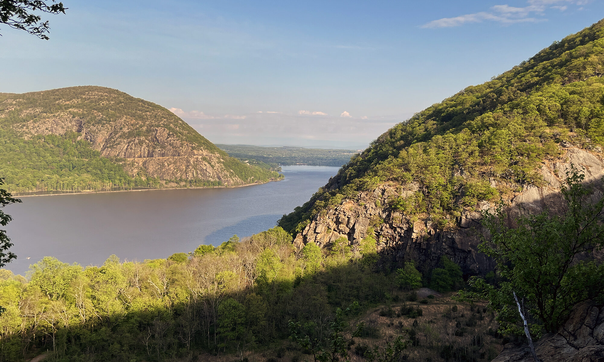
Sweeping Views
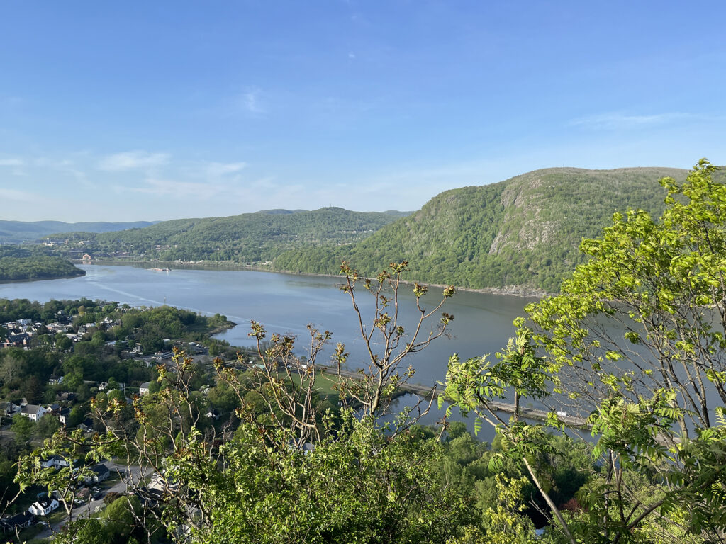
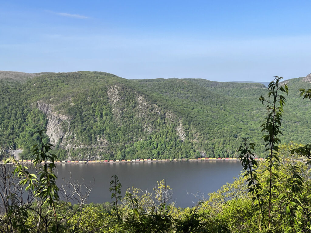
The trail continued higher, to a stunning overlook roughly 500 feet above the trailhead. This is the big “payoff” of the hike, and one I remember well from childhood. The town of Cold Spring sat below, dotted with houses, rail tracks, roads and a baseball diamond. It looked like something straight out of a model train display.
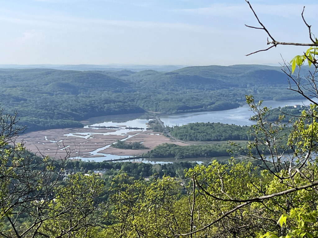
Farther afield, across the river, I could see the buildings at the US Military Academy at West Point. Just south of town, the train tracks continued south through “constitution marsh”, a reedy offshoot of the river.
If you’re just looking to stretch your legs, with perhaps an hour or less to kill, you could just stop here. These are by far the best views on the hike. But more adventure lies ahead if you’re interested in a longer outing with more vert and mileage.
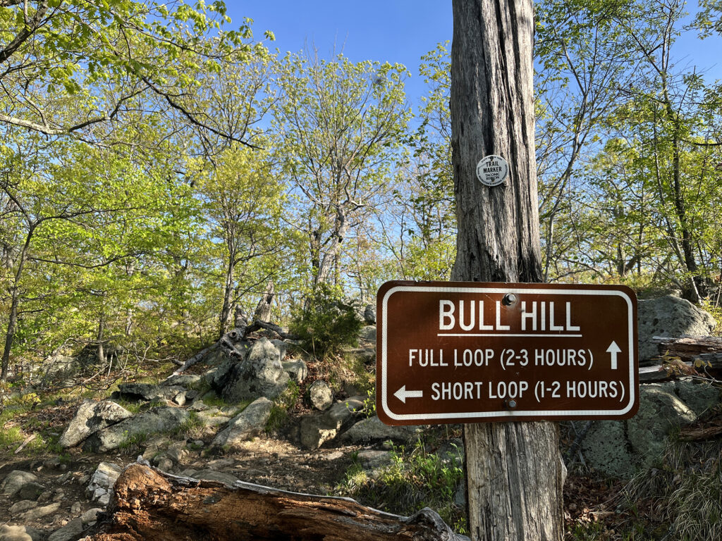
Bull Hill
Believe it or not, the “big views” are less than half way up the mountain. The trail continues another 500 vertical feet to its intersection with the “Undercliff Trail.” Many folks elect to turn off onto this (in either direction really) to make a shorter loop out of things. But the Washburn Trail continues another 300 vertical feet (1300 in total) to the forested summit of Bull Hill.
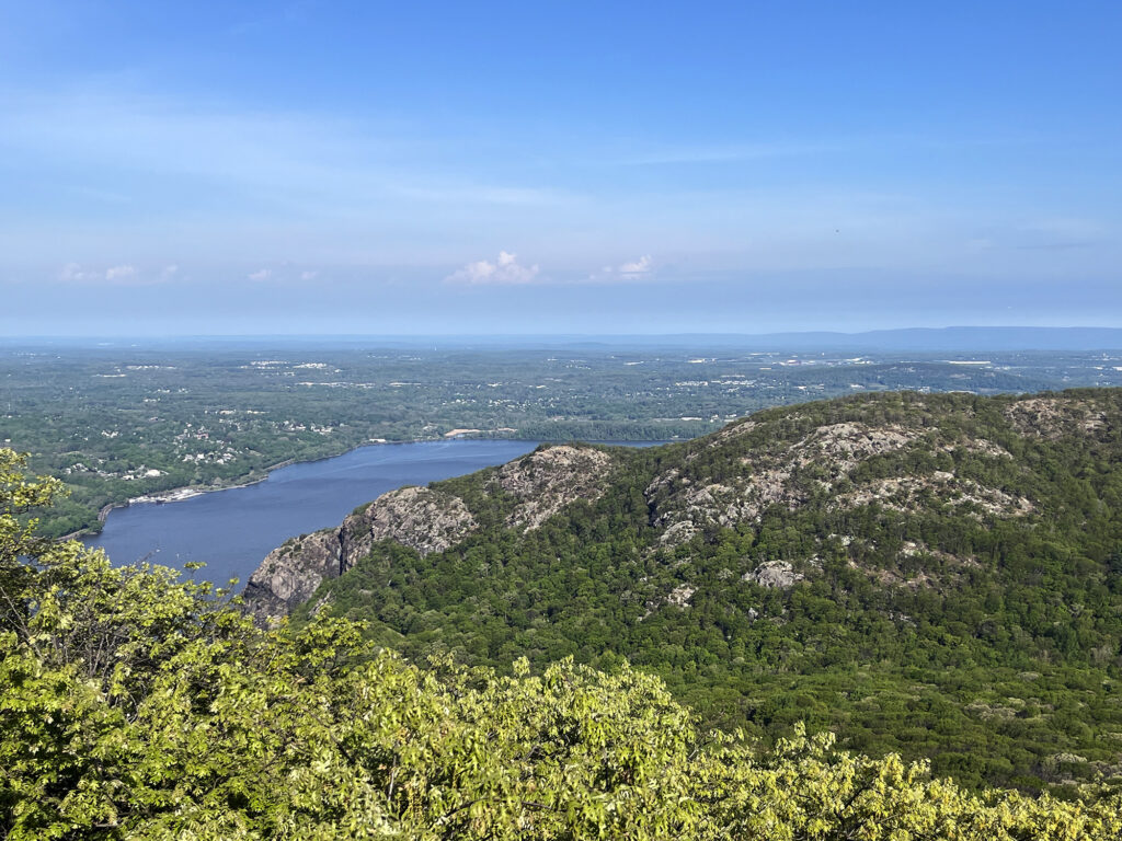
The summit’s views are not particularly impressive, especially compared to some of the earlier sights on this trail. But for folks, like me, looking for a good workout along with some forest bathing, it’s worth a trek.
From there the trail continued down the gentler backside of the mountain, before looping back into a basin between Bull Hill and Breakneck Ridge.
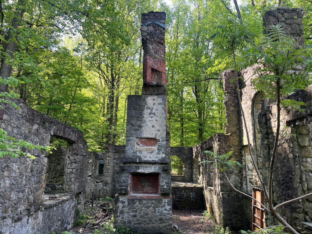
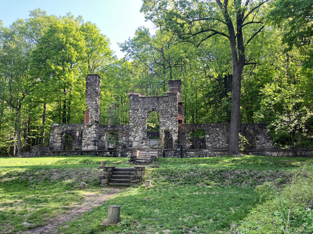
The Cornish Estate
I descended into the basin, and back towards 9D and the trailhead. I was very excited for what came next!
Whether you’re hiking Bull Hill or Breakneck Ridge, hikers commonly come down past the Cornish Estate en route to Cold Spring. Edward Cornish built the impressive stone and wooden mansion back in the early 1900s. The estate fell into disrepair, eventually getting subsumed into the Hudson Highlands State Park. Today its stone and brick ruins are surrounding by forest and overgrown weeds.
In my memory of this hike from decades ago, the estate was a pleasant surprise, off the beaten path. There was no signage or explanations. Just the mystery of some seemingly opulent ruins from a bygone era.
But as of 2025 work seems to be underway to make the site more widely accessible. That day crew were out with weed wackers, clearing out bushes. Volunteers had installed perhaps a dozen interpretive signs, explaining the history of the estate. Obviously this improves and broadens the experience. But some of the serendipity of it felt lost.
Conclusion
The trail continued out and towards town, following the estate’s old driveway. Roughly a mile later, I had reached the trailhead. It was now mid-morning, and bustling with visitors. Overall my adventure was just under 1400 vertical feet and 6.5 miles. The hike was every bit as wonderful as I remembered from childhood!